Wareham Forest Way Walk and Cycle
![]()
![]() This walk follows the Wareham Forest Way from Wareham to Sturminster Marshall. The expansive forest has miles of trails with ponds, viewpoints and heathland to explore.
This walk follows the Wareham Forest Way from Wareham to Sturminster Marshall. The expansive forest has miles of trails with ponds, viewpoints and heathland to explore.
You start on the River Frome in Wareham and head north to Wareham Forest for a lovely wooded section through the heart of the forest. This section takes you through Wareham town, Wareham common and the River Piddle Valley before passing through the conifer plantations of the forest and its abundance of wildlife.
After leaving the forest behind you pass through Old Park and East Morden before coming to the finish point at Sturminster Marshall.
This walk is waymarked with signs along the length of the route.
To extend your walking in the Wareham area you can pick up the The Hardy Way and follow it to Corfe Castle and Kimmeridge Bay.You are also very close to the Hartland Moor and Arne Nature Reserves.
The Sika Trail cycling trail also runs through the forest and is suitable for walkers too.
Please click here for more information
Wareham Forest Way Ordnance Survey Map  - view and print off detailed OS map
Wareham Forest Way Open Street Map  - view and print off detailed map
*New* - Walks and Cycle Routes Near Me Map - Waymarked Routes and Mountain Bike Trails>>
Wareham Forest Way OS Map  - Mobile GPS OS Map with Location tracking
Wareham Forest Way Open Street Map  - Mobile GPS Map with Location tracking
Pubs/Cafes
The Silent Woman is located in a lovely spot in the heart of the forest. The pub has a literary connection it changed its name from 'The Angel' after Thomas Hardy referred to it as ‘the Quiet Lady’ in his novel ‘The Return of the Native’. The inn has a particularly attractive outdoor area with a garden gazebo and picturesque landscaped garden. They serve high quality food and can be found at postcode BH20 7PA for your sat navs.
Dog Walking
The forest trails are ideal for dog walking so you'll probably see other owners on a fine day. The Silent Woman mentioned above is also dog friendly with treats available at the bar.
Further Information and Other Local Ideas
This route is designed for walkers but the forest also includes miles of good mountain bike trails including the popular Sika Trail.
Just to the north east you can pick up the circular Bere Regis Walk and visit Moreton, Bovington Heath and the noteworthy Clouds Hill, the former home of Lawrence of Arabia. Near here there's the Winfrith Newburgh Heath and Tadnoll Nature Reserves. The reserves include miles of peaceful heathland trails with lots of wildlife and a splendid viewpoint.
For more walking ideas in the area see the Dorset Walks page.
Cycle Routes and Walking Routes Nearby
Photos

Woolsbarrow Iron Age Hill Fort Trig point. There's a nice view over the forest from this elevated spot.

Wareham Forest Walk. Top of Gore Hill looking towards Wareham Golf Course far left and the forest to the far right.

Wareham Forest Way. At the point where the footpath leaves the road to skirt Cockett Hill east of East Morden.

Viewpoint and bench.

Wooden bridge over 'Gruffalo Pool'.

Decoy Heath Pond. Decoy Heath looking towards the trees on Gore Heath

Decoy Heath. Parsons Pleaser Memorial looking West

Looking back south from Decoy Heath towards the bottom NW corner of Great Ovens Hill
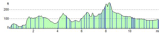
Elevation Profile