Whitby to Sandsend Walk

 A popular coastal walk from Whitby to the nearby village of Sandsend. It's about a 3 mile walk on a fairly flat path with splendid cliff top views and lovely beaches.
The walk starts from the atmospheric ruins of Whitby Abbey. The abbey has a fascinating history stretching back to the 7th century. It overlooks the North Sea in a dramatic location on the East Cliff above Whitby. It's a very photogenic spot with the abbey ruins surrounded by coast, river and countryside.
From the abbey you pick up the Cleveland Way and follow it west, crossing the Swing Bridge over the River Esk on the way.
After crossing the bridge you turn north along Pier Road, passing the Magpie Cafe. The restaurant is well known for its excellent fish and chips which are considered one of the best in the county.
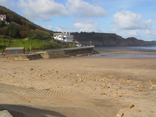
The path then turns west along the promenade, passing the lovely Whitby Sands, the golf club and Upgang Beach before coming to Sandsend. The pretty fishing village includes a nice beach and lots of attractive cottages. The western side of the village is one of the most expensive areas to buy property on the Yorkshire Coast.
On the beach you can explore the little rock pools and go fossil hunting before enjoying refreshments in one of the fine local cafes or pubs.
After exploring Sandsend you can return to Whitby along the beach but please check the tide times before you do this. When the tide is out its a huge beach stretching out to the North Sea so you can walk out quite a bit for great views along the coast and back to the town.
Mulgrave Woods is located right next to Sandsend and is a great place to extend the walk. There's miles of peaceful woodland trails taking you to becks, waterfalls and the interesting ruins of Mulgrave Castle.
You could also continue along the Cleveland Way and visit Runswick Bay. It's another lovely fishing village with a sandy beach, sheltered bay and pretty little cottages.
Whitby to Sandsend Walk Ordnance Survey Map  - view and print off detailed OS map
Whitby to Sandsend Walk Open Street Map  - view and print off detailed map
Whitby to Sandsend Walk OS Map  - Mobile GPS OS Map with Location tracking
Whitby to Sandsend Walk Open Street Map  - Mobile GPS Map with Location tracking
Pubs/Cafes
On the route you could stop off in Sandsend and visit The Hart Inn. This fine pub is located in a excellent location just yards from Sandsend beach. The inn does excellent food including some delicious crab sandwiches. They also have a lovely large garden area for fine weather. You can find them at East Row with a postcode of YO21 3SU for your sat navs.
Further Information and Other Local Ideas
The circular Sandsend Walk starts from the nearby fishing village and heads to Runswick Bay before returning through the countryside and visiting Mulgrave Woods. It's a nice way to explore the coast, countryside and woods of the area.
The Runswick Bay to Kettleness Circular Walk will take you to Kettleness on the cliff top path before returning along an inland dismantled railway line.
For more walking ideas in the area see the North York Moors Walks page.
Cycle Routes and Walking Routes Nearby
Photos
Whitby Abbey. A fine view of the imposing ruins of this iconic ancient structure. The abbey is said to be the inspiration for Bram Stoker’s Dracula.
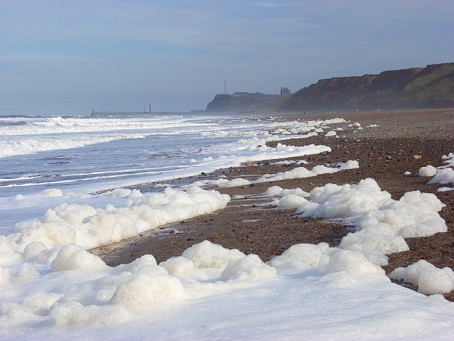
Upgang Beach. The beach is well known for the surf and is very popular for fishing, especially during the summer months.


