GPS Cycle and Walking Routes

Yordas Cave Walk

5 miles (8.7 km)

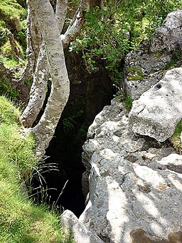
This walk visits Yordas Cave in Kingsdale, North Yorkshire. 
Walkers can explore the cave which includes a large main chamber with a waterfall and a stream running through it. It is damp and dark inside so good waterproof footwear and a torch are required.
After exploring the cave this circular walk visits a series of other nearby pot hole caves. You can follow the Turbary Road south to Jingling Pot and Turbary Pot with some fine views over Kingsdale's splendid limestone landscape on the way.
Just to the west of the cave you could extend the walk by climbing to Gragareth. The hill is notable as the second highest point in Lancashire and includes more caves and a series of cairns known as the Three Men of Gragareth. At the southern end of the walk you will come close to the wonderful Ingleton Falls, one of the major highlights of the area.

Postcode

LA6 3PH - Please note: Postcode may be approximate for some rural locations

Yordas Cave OS Map - Mobile GPS OS Map with Location tracking

Yordas Cave Open Street Map - Mobile GPS Map with Location tracking

Cycle Routes and Walking Routes Nearby

Photos

Yordas Cave - geograph.org.uk - 66192

Yordas Cave. Former show cave, now freely accessible. The low entrance leads straight into a large cavern with a waterfall in a separate chamber (the Chapter House) at the top end. Easily and safely explored with a domestic torch and waterproof footwear.

Dry valley and waterfall in Yordas Wood - geograph.org.uk - 1440837

Dry valley and waterfall in Yordas Wood

Jingling Pot, Kingsdale - geograph.org.uk - 2453161

Jingling Pot, Kingsdale

Gate on the Turbary Road - geograph.org.uk - 4843818

Gate on the Turbary Road

Gateway below Yordas Cave - geograph.org.uk - 2453821

Gateway below Yordas Cave

Kail Pot - geograph.org.uk - 2452200

Kail Pot

Limestone country above Kingsdale - geograph.org.uk - 3339262

Limestone country above Kingsdale

Trig point of Tow Scar and surroundings - geograph.org.uk - 2704899

Trig point of Tow Scar and surroundings

Video

GPS Files

GPX File

Yordas Cave.gpx (On Desktop:Right Click>'Save As. On Ipad/Iphone:Click and hold>Share>Save to Files')