Flatts Lane Country Park
![]()
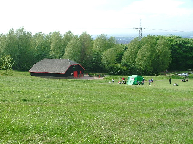
![]() This 100 acre country park in Normanby has super views of the Eston Hills and the North York Moors. There are also a number of peaceful woodland trails and an excellent visitor centre. The Tees Link and Guisborough Forest and Walkway country park are nearby so there is scope for continuing your walk.
This 100 acre country park in Normanby has super views of the Eston Hills and the North York Moors. There are also a number of peaceful woodland trails and an excellent visitor centre. The Tees Link and Guisborough Forest and Walkway country park are nearby so there is scope for continuing your walk.
The climb to Eston Nab also starts from Flatts Lane Country Park. It's a nice climb with splendid views over Middlesbrough, Roseberry Topping, Urra Moor and the Yorkshire coast.
Flatts Lane Country Park Ordnance Survey Map  - view and print off detailed OS map
Flatts Lane Country Park Open Street Map  - view and print off detailed map
Flatts Lane Country Park OS Map  - Mobile GPS OS Map with Location tracking
Flatts Lane Country Park Open Street Map  - Mobile GPS Map with Location tracking
Further Information and Other Local Ideas
The Middlesbrough Walk starts from Middlesbrough Dock on the River Tees and follows the Tees Link to the park. It then visits Ormesby Hall just to the west of the park. The National Trust owned hall is a Grade I listed building, described as a classic Georgian Mansion built in the Palladian style. There's 250 acres of parkland and farmland to explore on a network of footpaths. Near here there's also the noteworthy Stewart Park. There's 120 acres of parkland here with mature woodland, an arboretum and lakes with wildfowl. The park also includes the Captain Cook Birthplace Museum where you can learn about the history of British naval explorer and circumnavigator Captain James Cook. The explorer achieved the first recorded European contact with the eastern coastline of Australia and the Hawaiian Islands, and the first recorded circumnavigation of New Zealand.
The Cleveland Street Walk can be picked up in Guisborough at the historic priory ruins. The photogenic ruins are run by English Heritage and are well worth a visit.
Cycle Routes and Walking Routes Nearby
Photos
Flatts Lane Country Park. The newly erected pylons caused a lot of controversy. A kilometre from here the electric cables go underground for a short distance so that the views of the Cleveland Hills are not obstructed for the residents of Nunthorpe.


