Pontsticill Reservoir
![]()
![]() This circular walk takes you around the beautiful Pontsticill Reservoir in the Brecon Beacons National Park. The reservoir is located a few miles north of Merthyr Tydfil on the Taff Trail. You can catch the splendid Brecon Mountain Railway to Pontsticill station next to the reservoir. The railway runs from Pant near Merthyr Tydfil along the full length of the Pontsticill Reservoir to Torpantau high in the Brecon Beacons.
This circular walk takes you around the beautiful Pontsticill Reservoir in the Brecon Beacons National Park. The reservoir is located a few miles north of Merthyr Tydfil on the Taff Trail. You can catch the splendid Brecon Mountain Railway to Pontsticill station next to the reservoir. The railway runs from Pant near Merthyr Tydfil along the full length of the Pontsticill Reservoir to Torpantau high in the Brecon Beacons.
The walk starts near the Dam and Pontsticill station and heads along the Taff Trail through a woodland area on the western side of the reservoir. You return on the eastern side, climbing towards Cwm Criban for splendid views of Pontsticill and the surrounding countryside. You then descend towards the dam and the finish point. The route runs for just under 7 miles and includes a moderate climb on the way.
You can extend the walk by continuing around Pentwyn Reservoir which lies just to the north.
Postcode
CF48 2UW - Please note: Postcode may be approximate for some rural locationsPontsticill Reservoir Ordnance Survey Map  - view and print off detailed OS map
Pontsticill Reservoir Open Street Map  - view and print off detailed map
Pontsticill Reservoir OS Map  - Mobile GPS OS Map with Location tracking
Pontsticill Reservoir Open Street Map  - Mobile GPS Map with Location tracking
Pubs/Cafes
At the southern end of the water you'll find the conveniently located Red Cow Inn. The limestone pub was traditionally constructed around 1840 and includes a cosy interior with a log fire. Outside there's a lovely beer garden to relax in if the weather is good. You can find the pub at a postcode of CF48 2UN for your sat navs.
Dog Walking
The reservoir and the surrounding woodland are ideal for a nice dog walk. The Red Cow Inn mentioned above is also very dog friendly.
Further Information and Other Local Ideas
The Taf Fechan Forest lies just to the north of the reservoir. There's miles of good cycling and walking trails to be found in the expansive forest. Near here there's also the Neuadd Reservoirs and the Taf Fechan River to enjoy.
You could also try the Merthyr Tydfil Walk which visits the Grade I listed Cyfarthfa Castle and gardens. Llwyn-on Reservoir can be found about 2 miles to the west. There's another nice circular walk, a bird hide and sculpture trails to be found here.
The epic Cambrian Way passes through the area. The long distance waymarked route starts from the city of Cardiff and runs for nearly 300 miles through the Brecon Beacons, the Cambrian Mountains and Snowdonia before finishing on the North Wales coast at Conwy.
Cycle Routes and Walking Routes Nearby
Photos
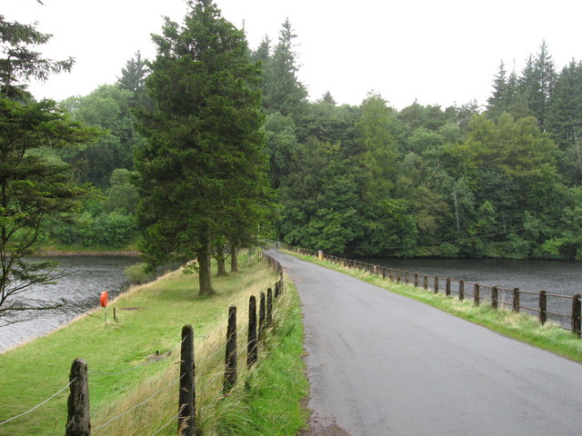
Between the Reservoirs. Road to Dol-y-Gaer (behind), between the Pontsticill (or Taf Fechan) reservoir (left), and Pentwyn (or Dol-y-Gaer) Reservoir (right).


