Bridgwater to Burnham-on-Sea
![]()
![]() Follow National Cycle Route 33 from Bridgwater to Burnham-on-Sea on this pleasant ride through Somerset.
Follow National Cycle Route 33 from Bridgwater to Burnham-on-Sea on this pleasant ride through Somerset.
The ride starts with a lovely traffic free section along the River Parret in Bridgwater before heading into the countryside to Chedzoy. You then join another waterside stretch along King's Sedgemoor Drain to Bawdrip. A short stretch through Cossington Park takes you to Cossington before a series of country lanes lead you to East Huntspill with views of the River Huntspill as you go. You then head through Highbridge to Burnham-on-Sea which sits at the mouth of the River Parrett. The final splendid traffic free section guiding you along the River and past the pier to finish near the tourist information centre.
Access for this ride is fairly good with train stations at Bridgwater and also at Highbridge near Burnham-on-Sea.
Bridgwater to Burnham-on-Sea Ordnance Survey Map  - view and print off detailed OS map
Bridgwater to Burnham-on-Sea Open Street Map  - view and print off detailed map
Bridgwater to Burnham-on-Sea OS Map  - Mobile GPS OS Map with Location tracking
Bridgwater to Burnham-on-Sea Open Street Map  - Mobile GPS Map with Location tracking
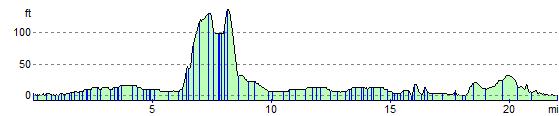
Elevation Profile