Cambridge to St Ives along the Busway
![]()
![]() Enjoy a walk or cycle along this disused railway line which now forms part of National Cycle Network Route 51. It's now a great traffic free tarmac path following the route of the new Cambridgeshire Guided Busway which connects Cambridge, Huntingdon and St Ives. It runs just alongside the busway starting near the Cambridge Science Park just north of the city centre. You then head west passing Histon and the lovely Fen Drayton Lakes.
Enjoy a walk or cycle along this disused railway line which now forms part of National Cycle Network Route 51. It's now a great traffic free tarmac path following the route of the new Cambridgeshire Guided Busway which connects Cambridge, Huntingdon and St Ives. It runs just alongside the busway starting near the Cambridge Science Park just north of the city centre. You then head west passing Histon and the lovely Fen Drayton Lakes.
The reserve has a number of lakes, ponds and lagoons with the River Great Ouse running through it as well. Shortly after you arrive at the market town of St Ives where the route finishes. You have the option of continuing along route 51 to Huntingdon which is just a few miles to the west. It's a nice flat, safe route which is ideal for families or anybody looking for an easy cycle ride or pleasant stroll. Along the way there's great views of the surrounding Cambridgeshire countryside.
Cambridge to St Ives along the Busway Ordnance Survey Map  - view and print off detailed OS map
Cambridge to St Ives along the Busway Open Street Map  - view and print off detailed map
Cambridge to St Ives along the Busway OS Map  - Mobile GPS OS Map with Location tracking
Cambridge to St Ives along the Busway Open Street Map  - Mobile GPS Map with Location tracking
Pubs/Cafes
Near the river in St Ives you'll find the Oliver Cromwell pub for some post walk refreshments. The pub serves a fine Sunday lunch and is also dog friendly. They are located at Wellington St with postcode PE27 5AZ.
Further Information and Other Local Ideas
Head a few miles south of the city and you could visit the nearby village of Haslingfield. Here you'll find pleasant walks along the River Rhee, rows of quaint thatched cottages, a church dating back to the 12th century and a noteworthy Tudor Manor House where Queen Elizabeth I stayed during the 16th century. Near here there's also the new settlement of Cambourne. There's some pleasant walks around this modern village with a lovely local nature reserve to explore. The wildlife rich reserve includes pretty lakes, wildflower meadows and wetland areas. On the walk you can also visit the ancient Bourn Windmill, the oldest surviving windmill in the United Kingdom. Just to the south there's also the stunning gardens at the historic Wimpole Hall.
Cycle Routes and Walking Routes Nearby
Photos
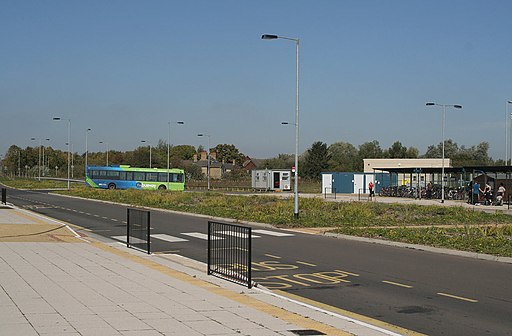
Longstanton Park And Ride. Description: The stop in the foreground is a facility for non-busway bus services to make connections. At present there are no services advertised to do so. In the background a bus is departing on the busway towards St. Ives.


