Dedham Vale Cycle Route
![]()
![]() This circular cycle route explores the Dedham Vale AONB on the Essex-Suffolk border.
This circular cycle route explores the Dedham Vale AONB on the Essex-Suffolk border.
It's a lovely place for a ride with miles of quiet country lanes and a few off road trails as well. Starting from Dedham you'll visit a series of pretty settlements including Manningtree, Cattawade, East Bergholt, Thorington Street, Stoke-by-Nayland, Polstead, Nayland, Little Horkesley and Stratford St Mary.
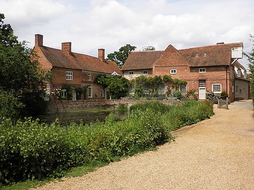
There's some splendid countryside views with highlights including Flatford Mill on the River Stour. This area includes the picturesque 18th century mill and Willy Lott's Cottage, scene of Constable's famous painting 'The Hay Wain'.
The route runs for just over 40 miles, using sections of National Cycle Route 1 and National Cycle Route 13. These signed Sustrans routes are a good way of further exploring the area by bike. The ride could also be started from Manningtree where there is a train station.
Dedham Vale Ordnance Survey Map  - view and print off detailed OS map
Dedham Vale Open Street Map  - view and print off detailed map
Dedham Vale OS Map  - Mobile GPS OS Map with Location tracking
Dedham Vale Open Street Map  - Mobile GPS Map with Location tracking
Cycle Routes and Walking Routes Nearby
Photos
Timber-framed house at Stoke-by-Nayland, Suffolk. This 16th century building was once two houses and known as the Maltings. The tower of the parish church can be seen behind.


