High Woods Country Park
![]()
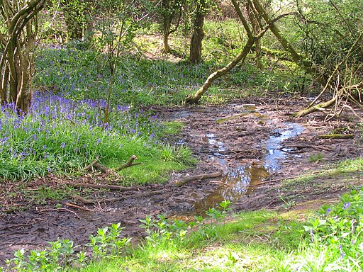
![]() This country park in Colchester includes woodland, open spaces, ponds, a lake and wildflower meadows. The park contains a number of well maintained, waymarked trails suitable for cycling and walking.
This country park in Colchester includes woodland, open spaces, ponds, a lake and wildflower meadows. The park contains a number of well maintained, waymarked trails suitable for cycling and walking.
There are very good facilities including a visitor centre where you can find details of all the walking and cycling trails in the park. Look out for wildlife including deer and various woodland birds.
High Woods is conveniently located just a mile north of Colchester town centre.
You can extend your walking in the town by trying our Colchester Walk. This visits the fascinating castle park with its many historic features. You can also enjoy riverside paths along the River Colne, just to the south of High Woods.
About a mile to the east you will find the pretty Ardleigh Reservoir where there's some nice paths along the northern side of the lake.
Postcode
CO4 5JR - Please note: Postcode may be approximate for some rural locationsPlease click here for more information
High Woods Country Park Ordnance Survey Map  - view and print off detailed OS map
High Woods Country Park Open Street Map  - view and print off detailed map
High Woods Country Park OS Map  - Mobile GPS OS Map with Location tracking
High Woods Country Park Open Street Map  - Mobile GPS Map with Location tracking
Pubs/Cafes
There's a cafe located in the visitor centre where you can enjoy some refreshment after your exercise.
Dog Walking
The woodland and parkland trails are ideal for dog walking. It's a popular place so expect to see other owners on your visit. There are off lead areas and also several waste bins dotted around the park.
Further Information and Other Local Ideas
The Essex Way can be picked up just a mile to the west of the park. The long distance, waymarked trail could be followed west to West Bergholt and then through the lovely Colne Valley.
To the south of Colchester there's the expansive Abberton Reservoir which is another great local wildlife spotting site.
Cycle Routes and Walking Routes Nearby
Photos
Unofficial Path. This path leads out of the park north of Colchester. However it is of little use to the average walker as you are confronted with the back garden gates of Friars Close (behind the photographer) and no way to reach a public road or right of way.


