Land's End to Penzance
15.5 miles (25 km)
![]()
![]() Starting at the most westerly tip of the mainland by the Trevescan cliff follow National Cycle Route 3 to Penzance.
Starting at the most westerly tip of the mainland by the Trevescan cliff follow National Cycle Route 3 to Penzance.
The route starts with a traffic free section near the coast before heading inland on a series of country roads. Shortly after St Buryan you will pass the Merry Maidens Stone Circle (below) before ariving at Mousehole with its stunning harbour. Just to south is the lovely Kemyel Crease wildlife reserve.
You'll then follow an off road track along the coast to Newlyn and then onto the finish point at Penzance.
Land's End to Penzance Ordnance Survey Map  - view and print off detailed OS map
Land's End to Penzance Open Street Map  - view and print off detailed map
Land's End to Penzance OS Map  - Mobile GPS OS Map with Location tracking
Land's End to Penzance Open Street Map  - Mobile GPS Map with Location tracking
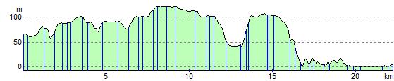
Elevation Profile