Leeds to Barnsley
![]()
![]() Follow the Trans Pennine Trail and National Cycle Route 67 from the city of Leeds to its nearby neighbour Barnsley. You start in the centre of Leeds and follow the River Aire and the Aire and Calder navigation canal to Mickeltown passing Clarence Dock and Woodlesford as you go. You then head west towards Wakefield and Stanley Ferry following the River Calder before turning south towards Barnsley along the navigation canal and more traffic free paths.
Follow the Trans Pennine Trail and National Cycle Route 67 from the city of Leeds to its nearby neighbour Barnsley. You start in the centre of Leeds and follow the River Aire and the Aire and Calder navigation canal to Mickeltown passing Clarence Dock and Woodlesford as you go. You then head west towards Wakefield and Stanley Ferry following the River Calder before turning south towards Barnsley along the navigation canal and more traffic free paths.
This section takes you through Walton and Haw parks with their attractive woodland and lakes. You finish crossing the River Dearne in Barnsley before finishing at the train station.
Leeds to Barnsley Ordnance Survey Map  - view and print off detailed OS map
Leeds to Barnsley Open Street Map  - view and print off detailed map
Leeds to Barnsley OS Map  - Mobile GPS OS Map with Location tracking
Leeds to Barnsley Open Street Map  - Mobile GPS Map with Location tracking
Further Information and Other Local Ideas
The Castleford Greenway will take you from Wakefield to Castleford along the old railway line. The surfaced path makes for a safe, easy cycle or walk in the area.
Cycle Routes and Walking Routes Nearby
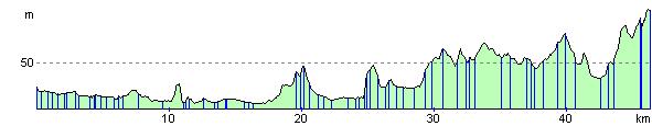
Elevation Profile