Walks near Wakefield
![]()
![]() This Yorkshire town is a great base for walkers with numerous local parks, canalside trails, several nearby reservoirs and riverside paths along the Calder.
This Yorkshire town is a great base for walkers with numerous local parks, canalside trails, several nearby reservoirs and riverside paths along the Calder.
This walk explores Clarence Park, Holmfield Park and Thornes Park in the town centre. The three parks are all located on the south western side of the town and run alongside each other. In the parks you'll find easy surfaced footpaths taking you to rose gardens, a conservatory, a lake and an aviary. After exploring the parks you could head a short distance south to visit the canalside walk at Horbury and the lovely Pugneys Country Park where there's two large lakes and a nature reserve.
Please scroll down for the full list of walks near and around Wakefield. The detailed maps below also show a range of footpaths, bridleways and cycle paths in the area.
Wakefield Ordnance Survey Map  - view and print off detailed OS map
Wakefield Open Street Map  - view and print off detailed map
*New* - Walks and Cycle Routes Near Me Map - Waymarked Routes and Mountain Bike Trails>>
Wakefield OS Map  - Mobile GPS OS Map with Location tracking
Wakefield Open Street Map  - Mobile GPS Map with Location tracking
Walks near Wakefield
- Pugneys Country Park - This 250 acre park contains two lakes with pleasant waterside footpaths
- Newmillerdam Country Park - Enjoy cycling and walking paths in this popular country park in Wakefield
- Wintersett Reservoir - This pretty reservoir near Wakefield has a nice walking trail running along the western side of the water
- Anglers Country Park - Enjoy a peaceful walk or cycle around this pretty country park in Wakefield
- Nostell Priory - Explore 300 acres of parkland and gardens surrounding this 18th-century treasure house near Wakefield
- Wakefield Canal - Follow the Wakefield Branch of the Aire and Calder Navigation Canal from Wakefield to Castleford on this waterside walk in West Yorkshire
- Barnsley Canal - Enjoy a waterside walk or cycle along the Barnsley Canal on this easy route near Royston
- Ardsley Reservoir - This circular walk takes you around Ardsley Reservoir in East Ardsley, near Tingley in Leeds
- Fitzwilliam Country Park - Enjoy a short circular walk or cycle along the network of way-marked paths in this pretty country park in the Wakefield area of Yorkshire
- Hemsworth Water Park - Enjoy a short stroll along the lakes in this lovely park near Wakefield
- Ryburn Reservoir and Baitings Reservoir - This walk visits these two pretty reservoirs near Rishworth in West Yorkshire
- Walton Hall Park - A walk around the pretty parkland surrounding Walton Hall in Wakefield
- Ossett - This West Yorkshire market town is located in the Wakefield area of the county
- Morley - This West Yorkshire town is located close to Leeds and Wakefield
- Allerton Bywater - This village near Leeds has a series of pleasant waterside footpaths to try
- Castleford Greenway - This route follows the Castleford Greenway and the Trans Pennine Trail from Castleford to Wakefield in Yorkshire.
- Horbury - This village near Wakefield has some pleasant waterside walks along the canal and the River Calder.
Pubs/Cafes
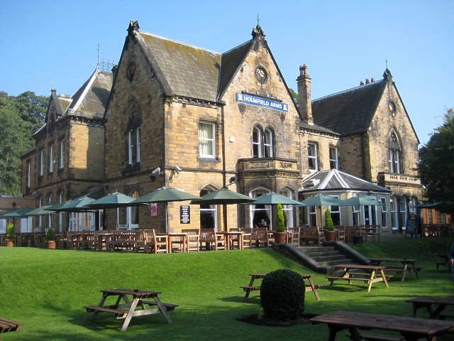
The Holmefield Arms is located in Holmefield Park. It's a fine place for some post walk refreshments with outdoor seating overlooking the park. You can find them at Denby Dale Rd, WF2 8DY.
Dog Walking
The parks are a fine place for a dog walk so you're bound to see other owners on your visit. The Holmefield Arms mentioned above is also dog friendly.
Photos
Lowe Hill, Clarence Park. Lowe Hill in Clarence park contains a medieval motte with two baileys to the north east. Excavations in 1953 indicated that the motte is probably an unfinished 12th century adulterine castle.
Holmfield House. Another view of this fine building, now a pub/restaurant. Originally the house was called Holme Field, now shortened to Holmfield.
Trees in Clarence Park. Looking towards Lawefield Lane with the spire of Wakefield Cathedral in the distance.


