GPS Cycle and Walking Routes

National Cycle Route 85

9 miles (14.6 km)

This route follows Sustrans National Cyle Route 85 from Trevor to Llantysilio along the Llangollen Canal.
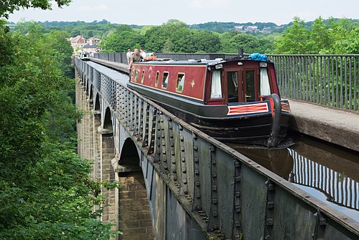
On the way you will pass the impressive Pontcysyllte Aqueduct, the River Dee, the Horseshoe Falls and the town of Llangollen. It's nearly all traffic free so a nice safe route for families.
The complete route will eventually run from Chester to Wrexham, Llangollen, Corwen, Bala and Dolgallau where it will link up with the popular Mawddach Trail.

National Cycle Route 85 OS Map - Mobile GPS OS Map with Location tracking

National Cycle Route 85 Open Street Map - Mobile GPS Map with Location tracking

Photos

Pontcysyllte Aqueduct from the south end

Pontcysyllte Aqueduct from the south end

River Dee at Trevor - geograph.org.uk - 923586

River Dee at Trevor. Looking downriver from the Dee Bridge towards the Aqueduct.

Footbridge on the Llangollen Canal near Trevor - geograph.org.uk - 2287009

Footbridge on the Llangollen Canal near Trevor

Heading towards Llangollen - geograph.org.uk - 3194384

Heading towards Llangollen

Llangollen Canal - geograph.org.uk - 1145800

Llangollen Canal

Canalside houses, Llangollen - geograph.org.uk - 2363668

Canalside houses, Llangollen

Video

GPS Files

GPX File

National Cyle Route 85.gpx (On Desktop:Right Click>'Save As. On Ipad/Iphone:Click and hold>Share>Save to Files')