Pembroke to Haverfordwest
![]()
![]() This cycle ride follows National Cycle Route 4 between these two Pembrokeshire towns.
This cycle ride follows National Cycle Route 4 between these two Pembrokeshire towns.
The ride starts with a lovely traffic free section through Pembroke that takes you around the castle, over the Pembroke river and through the town centre to the Cleddau Bridge. Here you cross the River Cleddau enjoying fantastic views of Milford Haven before joining another long traffic free path that takes you all the way to Haverfordwest, finishing at the train station.
Most of this ride is off road making for a pleasant and relaxing ride through some beautiful scenery.
Pembroke to Haverfordwest Ordnance Survey Map  - view and print off detailed OS map
Pembroke to Haverfordwest Open Street Map  - view and print off detailed map
Pembroke to Haverfordwest OS Map  - Mobile GPS OS Map with Location tracking
Pembroke to Haverfordwest Open Street Map  - Mobile GPS Map with Location tracking
Further Information and Other Local Ideas
In Pembroke you could take some time to explore the historic Pembroke Castle. The medieval castle dates to the 12th century and is Grade I listed. You can stroll around the pleasant castle grounds and enjoy some fine views of the millpond and the River Pembroke in the attractive town.
The Brunel Trail can be picked up in Harverfordwest. The popular route runs south along an old railway line to Johnston and Neyland Marina.
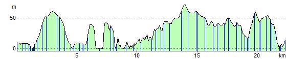
Elevation Profile