Putney to Greenwich
14.3 miles (23 km)
![]()
![]() This route follows National Cycle Route 4 and the River Thames from Putney to Greenwich. The ride starts on Putney Bridge and heads through Battersea to Westminster passing the Tate Gallery and the Houses of Parliament on the way. You then continue along the Thames to Bermondsey and Rotherhithe before finishing at the iconic Cutty Sark near Greenwich.
This route follows National Cycle Route 4 and the River Thames from Putney to Greenwich. The ride starts on Putney Bridge and heads through Battersea to Westminster passing the Tate Gallery and the Houses of Parliament on the way. You then continue along the Thames to Bermondsey and Rotherhithe before finishing at the iconic Cutty Sark near Greenwich.
Putney to Greenwich Ordnance Survey Map  - view and print off detailed OS map
Putney to Greenwich Open Street Map  - view and print off detailed map
Putney to Greenwich OS Map  - Mobile GPS OS Map with Location tracking
Putney to Greenwich Open Street Map  - Mobile GPS Map with Location tracking
Cycle Routes and Walking Routes Nearby
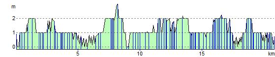
Elevation Profile