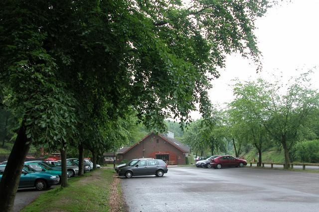
Queen Elizabeth Country Park
![]()
![]() Explore 2000 acres of open access woodland and downland in the South Downs on this circular walk or cycle in Hampshire. Queen Elizabeth Country Park is Hampshire's biggest country park with 20 miles of trails for walkers, cyclists & horse riders. Highlights in the park include Butser Hill - the highest point on the South Downs with views to the Isle of Wight. There is also a Visitors Centre where you can sign up for a guided walk.
Explore 2000 acres of open access woodland and downland in the South Downs on this circular walk or cycle in Hampshire. Queen Elizabeth Country Park is Hampshire's biggest country park with 20 miles of trails for walkers, cyclists & horse riders. Highlights in the park include Butser Hill - the highest point on the South Downs with views to the Isle of Wight. There is also a Visitors Centre where you can sign up for a guided walk.
The park is very popular with mountain bikers with several off road trails running through the park. See the video below for example of what you can expect.
Several long distance trails run through the park so there is great scope for extending your walk. You can pick up the Hangers Way, Staunton Way and the The South Downs Way National Trail within the park boundaries.
The Shipwrights Way also passes through the park. This super cycling and walking trail runs all the way to Portsmouth via Havant and Hayling Island.
Postcode
PO8 0QE - Please note: Postcode may be approximate for some rural locationsPlease click here for more information
Queen Elizabeth Country Park Ordnance Survey Map  - view and print off detailed OS map
Queen Elizabeth Country Park Open Street Map  - view and print off detailed map
Queen Elizabeth Country Park OS Map  - Mobile GPS OS Map with Location tracking
Queen Elizabeth Country Park Open Street Map  - Mobile GPS Map with Location tracking
Explore the Area with Google Street View 
Pubs/Cafes
There's a nice on site cafe where you can enjoy refreshments after your exercise. You could also head to the The Old Drum on Chapel St in nearby Petersfield. The contemporary country pub is located in the centre of the town and has a lovely beer garden. Built in the 18th Century, it is the oldest in the area and has been beautifully restored to keep its character and charm. You can find it at postcode GU32 3DP.
Dog Walking
With miles of wonderful woodland trails the expansive park is ideal for a dog walk. The Five Bells pub in Buriton is also dog friendly.
Further Information and Other Local Ideas
On the north eastern fringes of the park you'll find the idyllic village of Buriton. It's a delighfully picturesque place with a pretty duck pond and an old church. The St Mary's church is worth investigating as it contains some ancient pieces including medieval Sedilia (seats), Norman arches, a 13th century mural, a Norman font and Pillars bearing carvings of water Lilies, Foliage and Scallops. It's a lovely place to relax after your climb and has a nice pub for refreshments too. The Five Bells is a traditional country pub with a lovely rustic outside seating area at the front of the pub and a selection of cosy nooks and crannies to choose from inside. You can find it north of the pond, on the High Street with a postcode of GU31 5RX for your sat navs. The Buriton Circular Walk starts from the village and visits the park and Butser Hill.


Buriton Pond and church - a worthy place to visit close to the hill.
Head east along the South Downs Way and you could visit another splendid viewpoint at Harting Down. There's also the nearby village of South Harting where you could pay a visit to the National Trust's Uppark. Here you'll find a fine 17th century Georgian House surrounded by lovely gardens with views of the English Channel. The author H.G Wells stayed in the house during the late 19th century. The class divisions he observed here inspired his socialist views which later manifested themselves in work such as 'The Time Machine'. You can find the house at postcode GU31 5QR.
Just to the south you can pick up the Clanfield Walk and visit Butser Ancient Farm and Windmill Hill. The farm is one of the area highlights and includes an archaeological open-air museum with reconstructions of Neolithic dwellings, Iron Age roundhouses, a Romano-British villa and an early Saxon house.
For cyclists National Cycle Route 22 runs through the forest. The signed Sustrans trail runs from Banstead through Surrey, Hampshire and the North Downs to Portsmouth on the south coast.
For more walking ideas in the area see the Hampshire Walks and the South Downs Walks pages.


