Selby to Hessle
![]()
![]() This lovely route starts in Selby and follows National Cycle Route 65 and the Trans Pennine Trail to Hessle. You begin by the River Ouse in Selby and head towards Heminbrough along the river. The route continues on country roads through the pretty village of Barmby on the Marsh on the River Derwent and then onto Howden before rejoining the riverside track at Faxfleet. More quiet roads then take you through Brantingham and Elloughton before a pleasant run along the River Humber takes you into Hessle where you will pass the iconic Humber Bridge near Hull and Barton Upon Humber.
This lovely route starts in Selby and follows National Cycle Route 65 and the Trans Pennine Trail to Hessle. You begin by the River Ouse in Selby and head towards Heminbrough along the river. The route continues on country roads through the pretty village of Barmby on the Marsh on the River Derwent and then onto Howden before rejoining the riverside track at Faxfleet. More quiet roads then take you through Brantingham and Elloughton before a pleasant run along the River Humber takes you into Hessle where you will pass the iconic Humber Bridge near Hull and Barton Upon Humber.
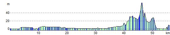
This is a fairly flat ride with some lovely waterside stretches.
For more information on this route please click here.
In Selby you can continue your exercise at the Selby Canal. Some of the canal is available to cyclists or you can walk the whole length if you prefer.
Selby to Hessle Ordnance Survey Map  - view and print off detailed OS map
Selby to Hessle Open Street Map  - view and print off detailed map
Selby to Hessle OS Map  - Mobile GPS OS Map with Location tracking
Selby to Hessle Open Street Map  - Mobile GPS Map with Location tracking
Cycle Routes and Walking Routes Nearby
Elevation Profile