Shrewsbury to Whitchurch
31 miles (50 km)

 This route starts in Shrewsbury by the Kingsland Bridge on the River Severn, first following National Cycle Route 81 and then National Cycle Route 45 to Whitchurch in North Shropshire.
Aside from the start which follows the River Severn along the Shropshire Way the route is mainly on quiet country roads. The iconic Wrekin hill makes a splendid backdrop for much of the ride.
Highlights on the route include the remains of Haughmond Abbey and Moreton Corbet castle. There are also distant views of the Wrekin Hill to enjoy for most of the ride and the beautiful Hawkstone Park which is slightly off the route near Hodnet.
Shrewsbury to Whitchurch Ordnance Survey Map  - view and print off detailed OS map
Shrewsbury to Whitchurch Open Street Map  - view and print off detailed map
Shrewsbury to Whitchurch OS Map  - Mobile GPS OS Map with Location tracking
Shrewsbury to Whitchurch Open Street Map  - Mobile GPS Map with Location tracking
Cycle Routes and Walking Routes Nearby
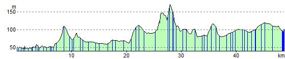
Elevation Profile