Siblyback Lake
![]()
![]() Enjoy a walk or cycle on the new waterside path around this beautiful lake and country park in Cornwall. The track runs around the perimeter of the lake and is great for families or anyone looking for a nice easy ride. There are also lovely views of Bodmin Moor and the surrounding Cornish countryside. A cafe overlooking the lake is perfect for rest and refreshment after your exercise. The circular trail runs for a distance of about 3 miles so should take around an hour to complete on foot.
Enjoy a walk or cycle on the new waterside path around this beautiful lake and country park in Cornwall. The track runs around the perimeter of the lake and is great for families or anyone looking for a nice easy ride. There are also lovely views of Bodmin Moor and the surrounding Cornish countryside. A cafe overlooking the lake is perfect for rest and refreshment after your exercise. The circular trail runs for a distance of about 3 miles so should take around an hour to complete on foot.
Siblyback Lake is located just a few miles north of Liskeard.
If you would like to continue your walking in the area then you could visit the splendid Golitha Falls where you will find spectacular waterfalls in a woodland gorge.
Postcode
PL14 6ER - Please note: Postcode may be approximate for some rural locationsSiblyback Lake Ordnance Survey Map  - view and print off detailed OS map
Siblyback Lake Open Street Map  - view and print off detailed map
Siblyback Lake OS Map  - Mobile GPS OS Map with Location tracking
Siblyback Lake Open Street Map  - Mobile GPS Map with Location tracking
Dog Walking
The lake is a lovely place for a dog walk so you'll probably see other owners on a fine day. You are requested to please keep them on leads.
Further Information and Other Local Ideas
Just to the east you can visit the highest village in Cornwall at Minions. There's also the circular walk to the Cheesewring and Hurlers Stone Circle to try from here. The distinctive granite tor sits atop Stowe's Hill and is a popular destination for walkers and photographers.
The larger Colliford Lake sits a few miles to the west. The mysterious Dozmary Pool is also located in this area.
Head east to nearby Callington and you could enjoy climbs to the ancient hill fort at Cadson Bury and the country park at Kit Hill.
For more walking ideas in the area see the Bodmin Moor Walks page.
Cycle Routes and Walking Routes Nearby
Photos
Angling, either from a boat or the shore, is just one of the water sports catered for on this reservoir.
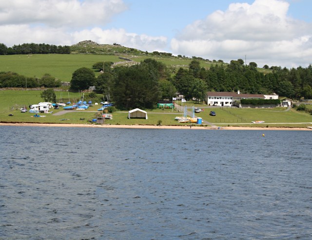
Watersports Centre. A view of the water sports centre from the opposite side of the reservoir. Tregarrick Tor is visible on the horizon.


