Worcester to Droitwich Spa
9 miles (14 km)

 This lovely short route follows National Cycle Route 45 from Worcester to Droitwich Spa. The route follows the towpath of the Worcester and Birmingham Canal for the first half before heading into Droitwich Spa on quiet country roads.
Worcester to Droitwich Spa Ordnance Survey Map  - view and print off detailed OS map
Worcester to Droitwich Spa Open Street Map  - view and print off detailed map
Worcester to Droitwich Spa OS Map  - Mobile GPS OS Map with Location tracking
Worcester to Droitwich Spa Open Street Map  - Mobile GPS Map with Location tracking
Further Information and Other Local Ideas
In Worcester the trail links with the Cotswold Line Cycle Route which runs through the AONB from Worcester to Long Hanborough, just outside Oxford. The trail visits several of the delightful towns and villages of the region with some glorious Cotswolds scenery to enjoy on the way.
Cycle Routes and Walking Routes Nearby
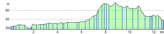
Elevation Profile