Aldworth Walks

 This rural village in Berkshire sits just to the west of Streatley, near the border with Oxfordshire.
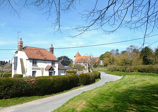
Aldworth is a very pretty with its historic 13th century church and noteworthy Bell Inn Pub. It's a nice place to start a walk with lots of good footpaths to explore the surrounding Berkshire Downs countryside.
This walk from the village heads north to pick up The Ridgeway National Trail. You'll then climb to Lowbury Hill where there's some fine views and the site of an ancient Roman Temple.
The route then follows The Ridgeway east to visit neighbouring Streatley where you can enjoy a nice riverside walk along the River Thames on the Thames Path.
Postcode
RG8 9SE - Please note: Postcode may be approximate for some rural locationsAldworth Ordnance Survey Map  - view and print off detailed OS map
Aldworth Open Street Map  - view and print off detailed map
Aldworth OS Map  - Mobile GPS OS Map with Location tracking
Aldworth Open Street Map  - Mobile GPS Map with Location tracking
Walks near Aldworth
- Streatley - A circular walk from Streatley, climbing onto the Ridgeway Hills to the west of the town before looping round across Cholsey Downs and returning via the River Thames
- Goring - This riverside village in South Oxfordshire is ideally located for walking with two National Trails passing through the area
- Woodcote - This South Oxfordshire based village is a nice place to start a woodland and countryside walk
- Wallingford Circular Walk - This circular walk explores the countryside surrounding the riverside Oxfordshire town of Wallingford
- Pangbourne Circular Walk - This nice 3 mile circular walk around the Berkshire village of Pangbourne includes waterside stretches along the River Thames and the River Pang.
Start the walk from Panbourne train station and then head east along the Thames Path to Pangbourne Meadow - Mapledurham House - The Mapledurham estate is a wonderful place for a relaxing afternoon walk
- Blewbury - This walk from the Oxfordshire village of Blewbury visits the Iron Age Hillfort at Blewburton Hill
- Pangbourne to Goring Walk - This walk follows a section of the Thames Path National Trail from Pangbourne in Berkshire to Goring in South Oxfordshire
- Wittenham Clumps - This circular walk climbs to these two distinctive hills near Dorchester
- Moulsford - This South Oxfordshire based village is located on the River Thames near Streatley and Wallingford.
Pubs/Cafes
The Bell Inn is a pub of some note, dating back to at least the 15th century. The Grade II listed inn has a charming interior with a large panelled tap room, an inglenook fireplace, a quarry-tiled floor, and a smaller 'L' shaped room. The pub is well known for its delicious filled rolls and its lovely garden area for warmer days. You can find them at postcode RG8 9SE for your sat navs.
Further Information and Other Local Ideas
Head east to Moulsford and you could visit the riverside Beetle and Wedge Inn. This particularly lovely stretch of the Thames has strong literary connections, featuring in The Wind in the Willows and Jerome K Jerome's Three Men in a Boat.
Photos
The Bell at Aldworth. Besides its listing and awards, the pub is also notable for having been owned and run by the same family continuously since the 18th century.
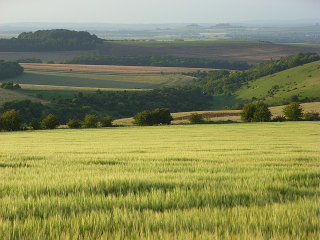
Barley, Lowbury Hill. Looking down across the Aston Upthorpe Downs with their steep dry valley. In the distance are the twin wooded hilltops of Wittenham Clumps.
River Thames at Streatley. On the Berkshire side of the river, the Swan at Streatley forms the waterfront in front of the weir (below the photographer. The lock is further to the east (right) on the Oxfordshire side of the river. The Oxford barge (blue vessel in the middle) is a permanently moored feature and is available for hire for conferences, receptions and civil weddings.
