Woodcote Walks
![]()
![]() This South Oxfordshire based village is a nice place to start a woodland and countryside walk.
This South Oxfordshire based village is a nice place to start a woodland and countryside walk.
The village is located near Wallingford and Streatley in the Chiltern Hills AONB so there's plenty of local options for stretching your legs.
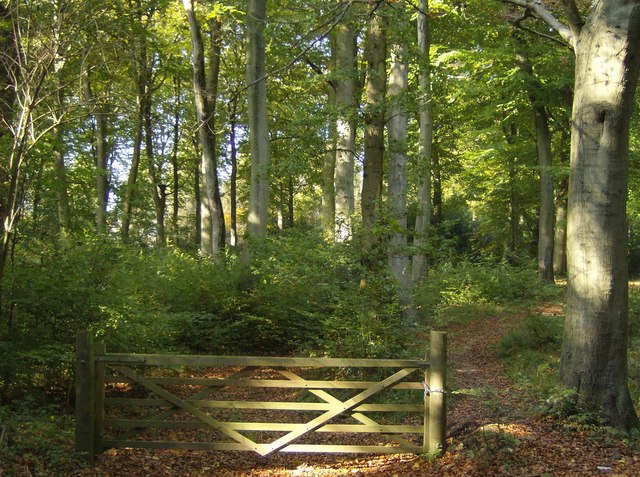
This circular walk explores the expansive area of Chiltern beech woodland located just south of the village. There's miles of peaceful trails here ideal for leisure or dog walking. Look out for a wide variety of woodland birds as you make your way along the network of footpaths and bridle tracks.
To continue your walking in the area head south west to visit the River Thames and the wonderful Basildon Park.
Scroll down for a list of further walks near and around Woodcote.
Postcode
RG8 0SD - Please note: Postcode may be approximate for some rural locationsWoodcote Ordnance Survey Map  - view and print off detailed OS map
Woodcote Open Street Map  - view and print off detailed map
Woodcote OS Map  - Mobile GPS OS Map with Location tracking
Woodcote Open Street Map  - Mobile GPS Map with Location tracking
Walks near Woodcote
- Streatley - A circular walk from Streatley, climbing onto the Ridgeway Hills to the west of the town before looping round across Cholsey Downs and returning via the River Thames
- Wallingford Circular Walk - This circular walk explores the countryside surrounding the riverside Oxfordshire town of Wallingford
- Stoke Row - This walk takes you around the pretty Oxfordshire village of Stoke Row
- Greys Court - This walk explores the area around the National Trust's Greys Court in Henley-on-Thames, Oxfordshire.
- Henley-on-Thames - The popular market town of Henley-on-Thames has a number of excellent waymarked trails to try
- Henley via Stonor Circular Walk - A circular walk from Henley visiting Stonor, Middle Assendon and the National Trust's Greys Court
- Nettlebed - This Oxfordshire village is surrounded by several large areas of woodland and some lovely Chilterns countryside
- Warburg Nature Reserve - This delightful nature reserve near Henley-on-Thames has some lovely woodland trails to try
- Oxfordshire Way - Take a trip through Oxfordshire and enjoy rivers, canals, pretty villages and beautiful countryside on this lovely trail
- Chiltern Way - This is the original 125 mile circuit of the Chilterns AONB taking you through Hemel Hempstead, Chalfont St Giles, Marlow, Hambleden, Turville, Fingest, Bix Bottom, Ewelme, the Ridgeway, Stokenchurch, Great Hampden, Aldbury, the Dunstable Downs Country Park, Sharpenhoe Clappers and Harpenden
- Turville - This circular walk explores the countryside surrounding the Chilterns village of Turville
- Thames Path - Starting at the Source of the Thames at Thames Head in Gloucestershire, follow the iconic river through beautiful countryside and historic towns to the city of London.
- Fingest - This pretty little Buckinghamshire village is located in the Chilterns near Henley on Thames
- Ibstone - This Buckinghamshire based village is located in a pleasant rural spot in the Chiltern Hills, on the border with Oxfordshire
- Basildon Park - A walk around the beautiful Basildon Park near Reading
- Aldworth - This rural village in Berkshire sits just to the west of Streatley, near the border with Oxfordshire.
Pubs/Cafes
The Red Lion is located in a pleasant spot next to the village green. The pub dates back to 1845 and includes a nice outdoor seating area for warmer weather. You can find them on Goring Road at postcode RG8 0SD for your sat navs.
Dog Walking
The woodland trails are ideal for dog walking and the Red Lion mentioned above is also dog friendly.
Photos
Entering Birchen Copse. One is immediately faced with a choice of three routes, a bridleway to the left and two footpaths. In practice there are plenty of other paths through the woodland where access is not discouraged. The public paths are all clearly signed with white arrows on trees.
Bridleway through Bensgrove Wood. Looking south east, this is a very clear bridleway through typical Chiltern beech woodland.


