Bleaklow Walk
![]()
![]() This challenging walk takes you to Bleaklow Head and Bleaklow Stones near Glossop, in the Peak District National Park. The elevated largely peat covered, gritstone moorland, is popular with walkers.
This challenging walk takes you to Bleaklow Head and Bleaklow Stones near Glossop, in the Peak District National Park. The elevated largely peat covered, gritstone moorland, is popular with walkers.
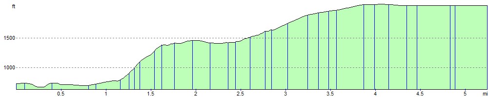
The walk starts from the car park at Torside Reservoir and follows the Longdendale Trail along the water before picking up the Pennine Way to Torside Clough. The climb continues past Sykes Moor to the 633 m (2,077 ft) summit of Bleaklow Head. Here you will find a huge cairn of stones and wonderful views across Greater Manchester, Lancashire, Cheshire and the Hope Valley.
Holme Moss transmitter, Emley Moor and the Yorkshire Dales are also visible. Footpaths continue east to the interesting geological formations at Bleaklow Stones.An alternative route is to go via Wildboar Clough and its lovely waterfalls although this does require some scrambling. This is shown in the video below.
Just to the south of the hill you will find the crash site of the USAF Boeing RB-29A Superfortress at Higher Shelf Stones. Much of the wreckage and a memorial to those who lost their lives can be visited on the B29 Crash Site Walk from Snake Pass.
Bleaklow Ordnance Survey Map  - view and print off detailed OS map
Bleaklow Open Street Map  - view and print off detailed map
*New* - Walks and Cycle Routes Near Me Map - Waymarked Routes and Mountain Bike Trails>>
Bleaklow OS Map  - Mobile GPS OS Map with Location tracking
Bleaklow Open Street Map  - Mobile GPS Map with Location tracking
Further Information and Other Local Ideas
Just east of Torside Reservoir you'll also find Woodhead Reservoir. At the eastern end of the reservoir there's a car park where you can start the Middle Black Clough Waterfall Walk. The area is a bit of a hidden gem with walks along the River Etherow to some beautiful waterfalls and wonderful rock formations. It's located just a few miles north east of the hill and well worth a visit.
For more walking ideas in the area see the Peak District Walks page.
Cycle Routes and Walking Routes Nearby
Photos

Bleaklow Head from the cairn. Looking SW along the Pennine Way.

Bleaklow Hill

Bleaklow Head Cairn. This is a desolate barren plateau, of gritstone and bare peat, but a welcome sight to anyone walking the Pennine Way.

Descending eroded peat gully on east flank of Bleaklow. This image demonstrates the depth of peat on Bleaklow, as well as recent efforts at gullly-blocking and damming to re-wet and restore the moorland habitat. Picture taken whilst walking the Derwent Watershed Route.

Torside Clough. The Pennine Way passing along Torside Clough just south of the reservoir.

Stones on Torside Clough. The path leading up to Bleaklow includes interesting rock formations.

The beginnings of Near Black Clough

The greening of Bleaklow. This photo shows the results of a peat restoration project by the Moors for the Future Partnership, who have been sowing grass and heather seed by helicopter. The idea is to stabilise areas of friable bare peat and thus allow natural recolonisation by heather, bilberry and other natural flora.
Elevation Profile