Blockley Circular Walk

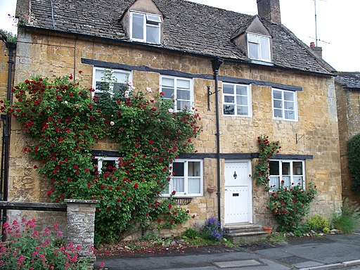
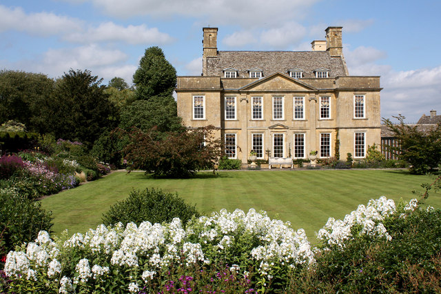
 This walk explores the Cotswolds countryside to the south of the pretty village of Blockley. It uses the North Cotswold Diamond Way and Heart of England Way long distance trails to create a circular walk from the village. On the way you'll visit two of the highlights of the area at Batsford Arboretum and Sezincote House. There's also some nice woodland trails and a visit to the villages of Condicote and Bourton on the Hill.
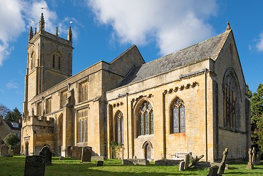
Start the walk from Blockley village which has an interesting late Norman Church built in about 1180. In the village you can pick up the waymarked Diamond Way and follow the footpath south west to Far Upton Wold Farm. You continue south from here to the village of Condicote where you turn east toward Donnington.
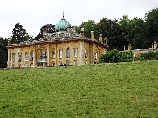
The route then turns north to Longborough where you follow the Heart of England Way a short distance to Sezincote. Here you'll find a Mogul Indian palace surrounded by beautiful gardens which include a curving orangery, spring-fed pools, canals and a large lake.
From the house you continue north to Bourton-on-the-Hill and Batsford Aboretum. Here you'll find 56 acres to explore on a series of good footpaths with woodland consisting of Japanese maples, magnolias and pines.
The final section follows the Monarch's Way north west, back into Blockley.
Blockley Ordnance Survey Map  - view and print off detailed OS map
Blockley Open Street Map  - view and print off detailed map
Blockley OS Map  - Mobile GPS OS Map with Location tracking
Blockley Open Street Map  - Mobile GPS Map with Location tracking
Walks near Blockley
- North Cotswold Diamond Way - This diamond shaped walk was created by the RA's North Cotswold Group to celebrate the 60th Jubilee in 1995
- Heart of England Way - Follow the Heart of England Way through the Midlands of England
- Batsford Arboretum - This beautiful arboretum and botanical garden near Moreton-in-Marsh is perfect for a peaceful afternoon stroll
- Sezincote House - This walk takes you to the extraordinary Mogul Indian palace of Sezincote House near Moreton-in-Marsh in the Cotswolds
- Moreton-in-Marsh Circular Walk - This circular walk from Moreton-in-Marsh makes use of the Monarch's Way and the Heart of England Way to explore the countryside, villages and woodland surrounding the popular Cotswolds town
- Monarch's Way - This incredible 615-mile walk approximates the escape route taken by King Charles II in 1651 after being defeated in the Battle of Worcester
- Bourton on the Hill - This small Cotswolds village is located near Moreton-in-Marsh and Blockley in Gloucestershire
Further Information and Other Local Ideas
The Donnington Way - Cotswolds Pub Walk passes through the village. The long circular walk visits 15 fine old Donnington Brewery pubs in the Cotswolds.
Photos
The church of St Peter and St Paul in Blockley, Gloucestershire. This church, parts of which date back to the 12th century, is a Grade II* Listed Building in England.


