Bourton on the Hill Walks

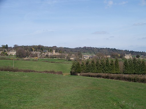
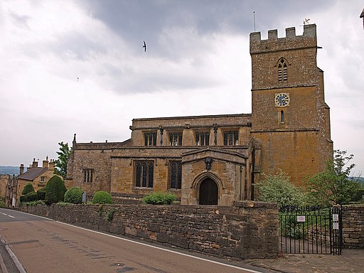
 This small Cotswolds village is located near Moreton-in-Marsh and Blockley in Gloucestershire. The hillside village includes several historic buildings including a 17th century cottage and a noteworthy church dating back to the 12th century.
The village lies on the Heart of England Way providing an opportunity to explore the area on a good waymarked footpath.
This circular walk from the village uses the trail and a section of the Monarch's Way to visit Sezincote House, Longborough, Moreton-in-Marsh and Batsford Arboretum.
Sezincote is located just south of the village and is a major highlight of the area. Here you will find a splendid Mogul Indian palace surrounded by stunning gardens with a curving orangery, spring-fed pools, canals and a large lake. At Batsford just north of the settlement, you will find a glorious arboretum and botanical garden with Japanese maples, magnolias and pines.
Postcode
GL56 9AQ - Please note: Postcode may be approximate for some rural locationsBourton on the Hill Ordnance Survey Map  - view and print off detailed OS map
Bourton on the Hill Open Street Map  - view and print off detailed map
Bourton on the Hill OS Map  - Mobile GPS OS Map with Location tracking
Bourton on the Hill Open Street Map  - Mobile GPS Map with Location tracking
Walks near Bourton on the Hill
- Sezincote House - This walk takes you to the extraordinary Mogul Indian palace of Sezincote House near Moreton-in-Marsh in the Cotswolds
- Moreton-in-Marsh Circular Walk - This circular walk from Moreton-in-Marsh makes use of the Monarch's Way and the Heart of England Way to explore the countryside, villages and woodland surrounding the popular Cotswolds town
- Blockley - This walk explores the Cotswolds countryside to the south of the pretty village of Blockley
- Batsford Arboretum - This beautiful arboretum and botanical garden near Moreton-in-Marsh is perfect for a peaceful afternoon stroll
- Walk from Moreton in Marsh to Stow on the Wold - A point to point walk from Moreton in Marsh to Stow on the Wold using a section of the Monarch's Way long distance trail
- The Slaughters - This short walk between these two delightful Cotswolds villages is a favourite for visitors to the region
- Stow on the Wold to Bourton on the Water Walk - This linear walk joins these two picturesque Cotswolds village using a series of waymarked footpaths
- Daylesford - This little village in the Cotswolds has some nice footpaths to follow around its fine old country house
- Chipping Campden to Dover's Hill - This walk climbs to Dover's Hill from the lovely market town of Chipping Campden in the Cotswolds
- Cotswold Way Circular Walk - Chipping Campden - This splendid circular walk uses the Cotswold Way and the Donnington Way to explore the countryside and landmarks surrounding the Cotswold villages of Chipping Campden and Broadway
Pubs/Cafes
The Horse & Groom is located in the village at postcode GL56 9AQ. The pub is a Georgian stone inn with a Grade II listing. Modern cuisine is served in a lovely dining room. An open fire has been tastefully added to the spacious, light-filled bar. The pub has five en-suite rooms that are perfect for trips to nearby Moreton-in-Marsh and the Batsford Arboretum. A lovely, protected garden with lots of seating and breathtaking views of the Cotswolds is available. There is car parking and the pub is also dog friendly.


