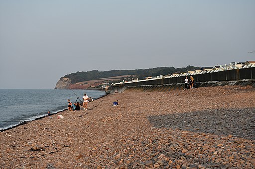
Blue Anchor To Dunster Beach Walk

 This walk takes you along Blue Anchor Bay on the Somerset coast. The long sandy beach is a popular place for a walk with rocky cliffs and alabaster rocks which are great for fossil hunting. There are also some great views towards Minehead and Watchet.
You can start the walk from Blue Anchor train station on the West Somerset Heritage Railway. The station is right next to the beach where you can head north west to the Dunster Beaches Estate Nature Reserve. Here you'll find woods, a large lake, rare flowers and lots of coastal birds.
At the end of the route there's also the Hawn, a large freshwater lake with a pleasant nature trail along the water.
To extend the walk head inland to visit the historic Dunster Castle where there's some lovely grounds to explore. You could also continue along the West Somerset Coast Path towards Minehead or Watchet.
Blue Anchor To Dunster Beach Walk Ordnance Survey Map  - view and print off detailed OS map
Blue Anchor To Dunster Beach Walk Open Street Map  - view and print off detailed map
Blue Anchor To Dunster Beach Walk OS Map  - Mobile GPS OS Map with Location tracking
Blue Anchor To Dunster Beach Walk Open Street Map  - Mobile GPS Map with Location tracking
Further Information and Other Local Ideas
The Steam Coast Trail runs alongside the beach. This shared cycling and walking path runs along a surfaced path ideal for a safe cycle or walk.


