Bollington Canal Circular Walk
![]()
![]() This circular walk explores the area surrounding the Cheshire town of Bollington. On the way you'll visit two of the highlights of the area with a climb to the unusual folly at White Nancy, before an easy stroll along the towpath of the Macclesfield Canal.
This circular walk explores the area surrounding the Cheshire town of Bollington. On the way you'll visit two of the highlights of the area with a climb to the unusual folly at White Nancy, before an easy stroll along the towpath of the Macclesfield Canal.
The route starts just below White Nancy on the eastern side of the town. From here you can follow footpaths south up onto the hill where you will find the structure. The folly is in the shape of a small domed sugar loaf and thought to have been built in 1817 by Colonel Gaskell as a monument to the Battle of Waterloo. From the elevated position of the folly there are fine, wide reaching views over the Cheshire Plain.
The walk then heads south along the Saddle of Kerridge to Kerridge Hill where there is a standing stone and more fine views.
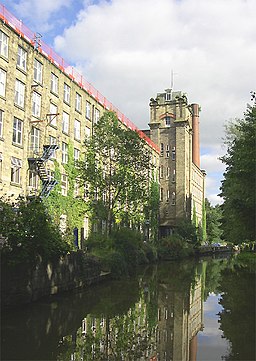
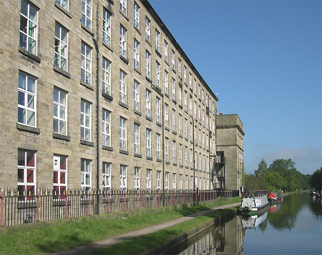
The route then descends the hill and heads west to join an interesting section of the Macclesfield canal. On the canal you will pass some historic sites at Clarence Mill and Adelphi Mill where cotton and silk was spun in the 19th century.
You then follow the towpath north back into Bollington where the route finishes.
Bollington Ordnance Survey Map  - view and print off detailed OS map
Bollington Open Street Map  - view and print off detailed map
*New* - Walks and Cycle Routes Near Me Map - Waymarked Routes and Mountain Bike Trails>>
Bollington OS Map  - Mobile GPS OS Map with Location tracking
Bollington Open Street Map  - Mobile GPS Map with Location tracking
Pubs/Cafes
Near White Nancy you will find the Bulls Head in the hamlet of Kerridge. It's a decent pub to stop off at and located just off the route. The pub dates from the 17th century and has a lovely cosy interior to relax in after your exercise. It's nice outside too with a patio area and a garden both with great views. In the paddocks attached to the pub you will usually find pigs and sheep looked after by the landlord. It's a friendly place with a good menu and selection of ales. You'll probably see plenty of other walkers in there too on a fine day. You can find the pub at the foot of the hill on 2 Oak Lane with a postcode of SK10 5BD for your sat navs.
Further Information and Other Local Ideas
There's lots of other good walking options in the area. You could head to Tegg's Nose Country Park or the splendid Lyme Park where there are miles of good cycling and walking trails. The long distance Gritstone Trail and the Middlewood Way shared cycling and walking trail also pass through the area.
Just to the west the worthy village of Prestbury is well worth a visit.
The village includes several listed timber framed buildings, a 17th century pub, a picturesque churchyard and views of the River Bollin. Look out for famous faces too as it is one of the most desirable places to live in the north with many celebrities and footballers purchasing expensive properties in the area. Just north of the village you'll also find the Grade II listed Mottram Hall. The estate includes 270 acres of beautiful landscaped gardens surrounding a fine 18th century hall which now operates as a hotel.
The circular Macclesfield Walk starts from the neighbouring town and visits Bollington and several of the other local highlights.
To the east there's the highest point in Cheshire to visit on the Shining Tor and Cats Tor Walk. In this area you'll also find some easy waterside walking around Lamaload Reservoir, Errwood Reservoir and Fernilee Reservoir.
To the north is the circular Pott Shrigley Walk which will take you around the old Shrigley Hall to the surrounding moors.
For more walking ideas in the area see the Cheshire Walks page.
Cycle Routes and Walking Routes Nearby
Photos
Adelphi Mill and Macclesfield Canal at Bollington, Cheshire. This was built in 1868 for the spinning of cotton, and later silk. During the Second World War, spinning ceased and the production of parachutes took over. At the end of the sixties the Mill was bought by Britax for the production of webbing for motorcar seatbelts until the late eighties. The Mill was then sold and converted to offices and workshop uses.
Kerridge Hill near Bollington. This trig point at 313 metres sits on the highest point of a splendid knife-sharp ridge affording views of Macclesfield to the west and Rainow to the east.


