Cheshire Walks

Use the filter to show walks of a certain type such as woods, reservoirs, hills, long distance, country parks, canals and rivers.
In the spring walkers flock to the beautiful bluebell woods in the Cheshire area. Click the 'Woodland' button below to see these.
Use the links to view full route information including elevation profiles, interactive maps and GPS downloads.
You can also view an overview map of all the routes in the using the Cheshire Walk Map>>
*New* - Walks and Cycle Routes Near Me Map - Waymarked Routes and Mountain Bike Trails>>
| Filter: |
| Route Name | Photo | Distance | Description |
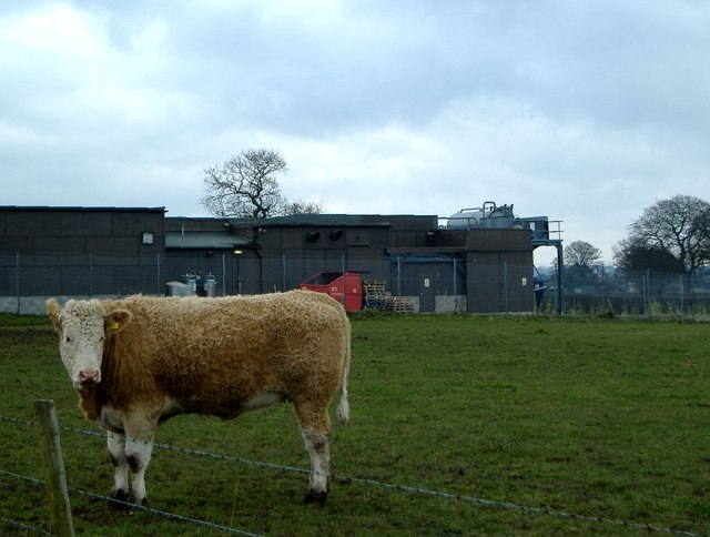
| Alderley Edge | 4.3 miles (7 km) | This lovely circular walk explores the beautiful National Trust owned area of Alderley Edge. Starting at Alderley Edge train station you climb to a sandstone escarpment, where there are fabulous over the Cheshire Plain to the Peak District. You return through a delightful wooded area, passing a waterfall, before arriving back at Alderley Edge train station. The National Trust have also devised a number of other walking trails which you can pick up from the Wizard Tea-Room. These include the Miners Ramble which explores the age-old mining history of the Edge. The Wizard Trail also starts from the edge and will take you to the the Wizard's well, the 15th century Alderley mill and National Trust owned Hare Hill. You can follow a permissive path south to Hare Hill to extend the walk. View Full Details>> | |
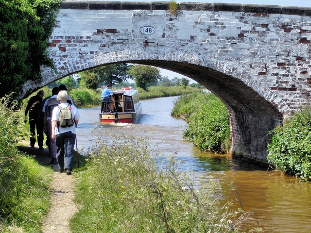
| Along the River Dee from Chester to Connah's Quay | 6.2 miles (10 km) | Follow the River Dee from England into Wales on this easy waterside walk or cycle. The route starts on the England and Wales border at Chester and follows a good riverside path to Connah's Quay in Wales. You'll pass Saltney Bridge and Queensferry Bridge before finishing at Hawarden Bridge at Connah's Quay. It's a good surfaced path which is great for cyclists looking for a safe, traffic free ride. It runs along National Cycle Route 568 with nice views of the surrounding countryside. Near the end of the route you'll find the delightful Wepre Park. You could extend your exercise by exploring the 160 acre country park with its river, waterfall and the 12th century ruins of Ewloe Castle. Also nearby is the fascinating ruins of Flint Castle with views over the Dee Estuary. In Chester you can explore the city on the Chester Walls Walk. There's much to enjoy with more views of the River Dee and a visit to a number of interesting historical sites. View Full Details>> | |
| Astbury Mere Country Park | 1 mile (1.6 km) | Enjoy a waterside walk around the peaceful Astbury Mere in Congleton, Cheshire. There are wildflower meadows and views across the mere towards Congleton Edge and Mow Cop. View Full Details>> | |
| Baker Way | 11.2 miles (18 km) | Take a stroll along the Baker Way from Chester to Delamere Forest on this pleasant, varied walk. The walk starts at Chester railway station and heads east along the Shropshire Union Canal to Rowton. View Full Details>> | |
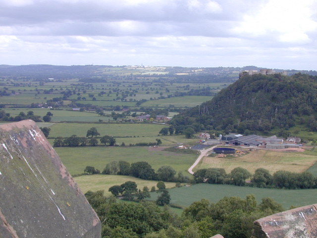
| Beeston Castle | 0.6 miles (1 km) | Climb to the ruins of this 13th century castle and enjoy wonderful views over the Cheshire Plain on this short circular walk in the Peckforton Hills. The site is a significant historical structure and is one of the more popular walks in the area. You can park at the car park on Chapel Road and then follow the nice walking trail up to the castle ruins. From here you can enjoy one of the most spectacular views of any castle in England. You can see across eight counties from the Pennines in the east to the Welsh mountains in the west. There's also an exhibition detailing 4000 years of the castle's history and 40 acres of woodland trails. The Sandstone Trail runs past the castle so you can pick this up to extend your walk. If you head south you will soon come to Peckforton Castle and the Peckforton Hills where you can enjoy some nice woodland trails. You can virtually explore some of the castle grounds on the google street view link below. View Full Details>> | |
| Bickerton Hill and Maiden Castle | 2.2 miles (3.5 km) | This walk uses part of the Sandstone Trail to visit Maiden Castle Iron Age hill fort and Bickerton Hill. It's a lovely area with the hills covered in pretty heather, bilberry bushes and yellow gorse. You'll reach a height of over 700ft with wonderful views over the Cheshire countryside to enjoy. The area is managed by the National Trust so there are good footpaths and conveniently located car parks. You can start your walk from the car park off the Old Coach Road near the village of Duckington. From here pick up the Sandstone Trail and climb through woodland to Larkton Hill and Maiden Castle. The hill fort dates from 600 BC commanding a fine view over the Cheshire Plain. From the fort you continue east to Gallantry Bank before turning north to climb to Raw Head, the highest point on the Bickerton Hills. Raw Head stands at a height of 227 m (745 ft) with more great views to enjoy from here. The area is well known for its varied flora and fauna. The attractive woodland areas consist of silver birch, aspen, holly, rowan, sessile oak and wild cherry trees. Look out for a wide variety of butterflies such as gatekeeper, red admiral, speckled wood and tortoiseshell. Interesting bird sightings include buzzard, kestrel, jay, long-tailed tit, magpie, nuthatch, raven, treecreeper and green woodpeckers. To extend your walk you can continue east along the Sandstone Trail to Bulkeley Hill and then explore the Peckforton Hills. View Full Details>> | |
| Bishop Bennet Way | 32.3 miles (52 km) | The Bishop Bennet Way is a shared walking and cycling path running from Beeston in Cheshire to Wirswall on the Shropshire borders.
The route starts at the 13th century Beeston Castle and proceeds through Milton Green, Churton and Shocklach where you will pass the Grade I listed Norman church. View Full Details>> | |
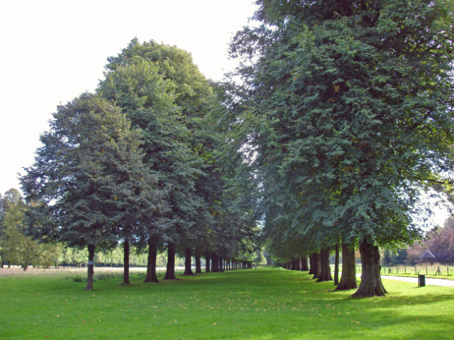
| Bollin Valley Way | 24.9 miles (40 km) | Follow the River Bollin from Macclesfield to Partington on this delightful waterside walk through Greater Manchester and Cheshire. The walk starts at the Macclesfield Riverside Park and follows the river through Prestbury, Wilmslow, Hale and Bowdon to Partington on the Manchester Ship Canal. On the route you will pass the 18th century Grade II listed Mottram Hall and National Trust owned Dunham Massey. This Georgian House is set in a magnificent 121-hectare (300-acre) deer park and boasts Britain's largest winter garden. View Full Details>> | |
| Bosley Cloud | 2.2 miles (3.5 km) | This short circular walk visits the Bosley Cloud hill, near Congleton, on the edge of the Peak District. The hill stands at 343 m (1,125 ft) and offers wonderful views over Congleton, Greater Manchester and the surrounding Peak District hills and countryside. You start at the parking area at Timbersbrook and follow the Gritstone Trail to the Cloud summit. You can descend the same way or take an alternative path to the south of the peak. The route follows good waymarked footpaths and includes woodland sections followed by a steep ascent to the craggy sandstone summit. Here you will find a toposcope which details the landmarks you can see from the viewpoint. These include the Dane Valley, the Pennine Hills and the Potteries. If you would like to extend your walk you could continue along the Gritstone Trail or pick up the Maccelsfield Canal on the Cheshire Ring Canal Walk just to the north. You could also head to the nearby Bosley Reservoir and pick up the waterside path. View Full Details>> | |
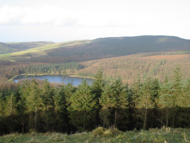
| Bosley Reservoir | 3.4 miles (5.5 km) | This reservoir in the Cheshire village of Bosley has a nice waterside walking trail running along it's southern and eastern shore. The village has a church dating from the early 15th century with a delightful wildlife garden. It's a short walk from the village to the reservoir with splendid views of the beautiful countryside and rolling hills of the Cheshire Plain. The reservoir also includes a grade II listed horseshoe arch bridge and a valve house built in 1831. You can start the walk from the little village and head south on the pavement of the A523. You pass Chaff Hall before picking up the footpath to take you across farmland to the reservoir. Alternatively there is roadside parking on Smithy Lane at the southern end of the water so you could drive straight there. You can see this on the google street view link below. You can extend your walk by climbing north east towards Sutton Common and Croker Hill for fabulous views back down to the reservoir. These paths head north east from the northern point of the water. To extend your walking in the area you could head half a mile west from Bosley and pick up the Cheshire Ring Canal Walk. This will take you along the towpath of the Macclesfield Canal to the splendid Bosley Locks which are well worth a visit. A couple of miles to the south west you can enjoy a climb to the Bosley Cloud and enjoy fabulous views over the area. View Full Details>> | |
| Brereton Heath Country Park | 1.2 miles (2 km) | Explore 50 acres of silver birch and oak woodland in this country park and nature reserve in Davenport. The park also includes a 15 acre lake, heathland, a wildflower meadow and wetland areas. Look out for woodpeckers, nuthatch, treecreepers, kingfisher, heron, great crested grebe and goldfinch as you make your way through the park. View Full Details>> | |
| Bridgewater Canal Way | 37.9 miles (61 km) | A walk along the Bridgewater canal, through Cheshire, Greater Manchester and on into Lancashire. The route passes Salford, Trafford, Altrincham, Manchester, Warrington and Halton. Along the way you'll pass a series of nice parks including Dunham Massey, Worsley Woods and Sale Water Park. View Full Details>> | |
| Bulkeley Hill | 1.6 miles (2.5 km) | Enjoy a walk through these peaceful woods to the Bulkeley Hill viewpoint on this walk in Cheshire. The woods are run by the National Trust and include 12 acres (5 hectares) of semi-natural ancient woodland. You can start the walk from the little village of Bulkeley, following public footpaths to Bulkeley Woods and the Sandstone Trail to the hill top viewpoint. From here there are splendid views over the Cheshire Plain. You can further explore the area by trying the Peckforton Castle and Peckforton Hills Walk which runs past the site. You could also head west along the Sandstone Trail and visit Bickerton Hill and Maiden Castle. View Full Details>> | |
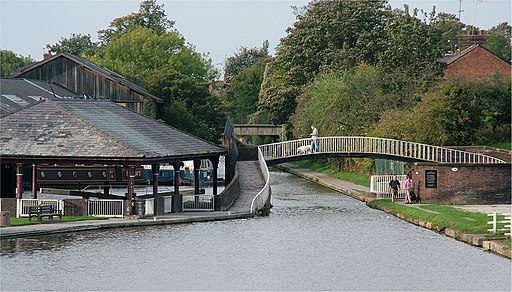
| Cheshire Ring Canal Walk | 98.2 miles (158 km) | This nice easy walk follows six historic canals through Cheshire, Greater Manchester and Staffordshire. The canal towpaths you will follow include:
The videos below show the sections along the Rochdale Canal in Manchester and along the Peak Forest Canal at Marple. View Full Details>> | |
| Chester Canal Walk | 19.9 miles (32 km) | Follow the route of the old Chester Canal on this waterside walk in Cheshire. The canal route runs for about 20 miles from Chester to Nantwich, passing Waverton, Beeston Castle, Tiverton and Barbridge. Along the way there are lots of pretty locks, nice villages, historic old mills and great views of the countryside of the Cheshire Plain. The walk starts at the Chester Canal basin, on the Wirral Line of the Ellesmere Canal, at Raymond Street, near the junction with the River Dee. The basin is located just to the north west of the city centre. You follow the canal east along the city walls, passing the Grade I listed Northgate and Phoenix Tower before coming to Great Boughton. The next stage takes you through Christleton, where there is a large grade II listed mill building, which was once steam powered and includes bays in the right gable from which boats were loaded. The canal then meanders through the villages of Waverton and Tiverton. Just before you arrive at Tiverton there's the option of taking a short detour south along the Sandstone Trail to Beeston Castle. You can climb up to the ruins of the 13th century castle and enjoy wonderful views over the Cheshire Plain. View Full Details>> | |
| Chester City Circular Walk | 3.1 miles (5 km) | This varied circular walk takes you to some of the highlights of this attractive Cheshire city. You'll pass along the Shropshire Union Canal, visit the City Walls, stroll through Grosvenor Park and enjoy more waterside paths along the River Dee. It's about a 3 mile walk on flat paths so suitable for all abilities. The walk starts in the city centre on Northgate Street, just to the west of the splendid cathedral. Follow the road north to the canal and then head west to visit the canal basin and the Water Tower Gardens. The basin is an attractive area where the canal and the River Dee meet. After exploring the basin the walk then follows the canal towpath east along the city walls, passing the Grade I listed Northgate and Phoenix Tower. At Russell Street, turn south and head to Grosvenor Park. The lovely park is regarded as one of the finest and most complete examples of Victorian parks in the country. In it you will find ornamental flower beds, grassed areas, trees, footpaths, three medieval arches and river views. After exploring the park you cross Queens Park Bridge and follow a path heading west along the River Dee. You then cross Old Dee Bridge where you can visit Chester Castle, overlooking the River Dee, just to the west of the bridge. The castle was originally built in 1070 by Hugh d'Avranches, the first Earl of Chester. You can explore the medieval remains of the castle and learn about its history in the museum. After visiting the castle head back towards Old Dee Bridge and walk up Lower Bridge Street to return to the cathedral. To extend your walking in the city you could try the Chester Walls Walk. The ancient raised walkway visits a series of interesting historical sites and Grade I listed buildings. You could also extend your waterside walking and continue along the Chester Canal towards Nantwich. View Full Details>> | |
| Chester Walls | 1.9 miles (3 km) | This fine circular walk follows the city walls of the attractive city of Chester. The raised walkway visits a series of interesting historical sites and includes good views over the River Dee and the Shropshire Union Canal. Chester's city walls are the oldest, longest and most complete in Britain. They're history stretches back 2000 years when the Romans began construction. The walk starts on Eastgate Street and heads north past Chester Cathedral and Addleshaw Bell Tower. The cathedral dates from the 11th century with all the major styles of English medieval architecture, from Norman to Perpendicular, represented in the present building. You continue north, passing Kaleyard Gate, a Grade I listed postern gate, used by the monks of St Werburgh's Abbey in the 13th century. Soon after you come to Phoenix Tower at the northeast corner of the city walls. Also known as King Charles' Tower, the structure dates from the 13th century and is also Grade I listed. At the tower you turn west along the canal to Northgate which carries the city walls footpath over Northgate Street. This northern section also passes Morgan's Mount, constructed in 1645 during the Civil War as an observation platform and gun emplacement. At the north western corner you will find the medieval Bonewaldesthorne's Tower leading to the 14th century Water Tower. The tower was constructed in the time of Edward II (1322-25) at a cost of one hundred Pounds. It now includes a musuem and the adjacent Water Tower Gardens. At the Water Tower you turn south to pass along the western section of the walls. This section passes the Georgian Sedan House and the 18th century Watergate, which spans the A548 road between Watergate Street and New Crane Street. To the west of the walls you can also enjoy views over Chester Racecourse. At the south western corner you will come to Chester Castle, overlooking the River Dee. The castle was originally built in 1070 by Hugh d'Avranches, the first Earl of Chester. You can explore the medieval remains of the castle and learn about its history in the museum. The southern section of the walls passes the 18th century Bridegate and the notable Bear and Billet pub. The building has been described as the 'finest 17th-century timber-framed townhouse in Chester and 'one of the last of the great timber-framed town houses in England'. At the south eastern corner you will find Barnaby's Tower. The tower probably dates from the 13th century, and was damaged in 1644–46 during the Civil War. From here you head north to Northgate and the Nine Houses though there are now just six almhouses remaining. The final section of the walk takes you past Thimbleby's Tower to Eastgate where you can admire the fine Eastgate Clock. It is a prominent landmark in the city of Chester and is said to be the most photographed clock in England after Big Ben. View Full Details>> | |
| Comber Mere | 0.6 miles (1 km) | Comber Mere Abbey is surrounded by some beautiful parkland, woodland, lakes and gardens. The historic abbey was founded in the 1130s by Hugh Malbank, Baron of Nantwich. The expansive estate includes a 5 acre walled garden and a number of Grade II listed structures including a sandstone sundial which is thought to date from the 12th century. View Full Details>> | |
| Crewe and Nantwich Circular Walk | 28 miles (45 km) | This circular walk takes you through the countryside and villages surrounding Crewe and Nantwich. You start off at Coppenshall just north of Crewe and first head to Weston. This section takes you past Sandbach Flashes wetlands (good for bird watching) and also the tudor house at Haslington. From Weston you head towards Acton passing Hough Common, Wybunbury and Austerson. Highlights on this section include Shrewbridge Lake and Dorfold Hall Jacobean mansion. You will also cross the River Weaver and the Shropshire Union Canal. View Full Details>> | |
| Dane Valley Way | 41 miles (66 km) | Follow the River Dane through Derbyshire and Cheshire on this fabulous walk from Buxton to Middlewich. Highlights on the route include the wonderful Three Shires Head where the counties of Cheshire, Derbyshire and Staffordshire meet. Here you will find pretty waterfalls, pools and an old packhorse bridge. Near here you will pass the fascinating deep mossy chasm of Lud's Church. The route also passes through the attractive town of Buxton and the delightful Buxton Country Park. View Full Details>> | |
| Delamere Forest | 3.1 miles (5 km) | Enjoy miles of walking and cycling trails in this 2,400 acre forest on the Cheshire Plain, near Frodsham. For walkers there's several easy waymarked trails to try. Cyclists can enjoy challenging mountain bike trails or easy family trails. The trails are well marked and cycle hire is available from TRACS (UK) situated just the left-handside of the forest centre car park. You can see details of all the trails on the open street map link below. This circular walk starts from the Linmere car park and takes you around Blakemere Moss Lake. Look out for wildlife including greater spotted woodpecker, black headed gulls, dragonfly and various butterflies. View Full Details>> | |
| Delamere Way | 21.1 miles (34 km) | Take a walk along the Delamere Way and visit Delamere Forest Park and the Trent and Mersey Canal. The path starts in Frodsham and heads south to Delamere Forest with its 2,400 acres of mixed deciduous and evergreen woodland and Blakemere Moss - a lake around 1 km in length. The smaller Hatchmere Lake can also be found in this area. There's a nice waterside pub to visit here. You then turn north towards Acton Bridge before crossing the River Weaver at Dutton Lock and then the Trent & Mersey Canal shorty after. The final section takes you through Hatton and past Appleton Reservoir before finishing at Stockton Heath in Warrington. View Full Details>> | |
| Eddisbury Way | 16.8 miles (27 km) | Follow the Eddisbury way from Frodsham to Burwardsley on this walk through Cheshire. You start by the River Weaver at Frodsham and head south to Kelshall, passing through Manley Common and skirting the edge of Delamere Forest. You then head to Duddon before crossing the Shropshire Union Canal and finishing at Burwardsley next to Peckforton Castle and Peckforton Hills. View Full Details>> | |
| Errwood Reservoir and Fernilee Reservoir | 3.7 miles (6 km) | Enjoy some lovely waterside walking along these two reservoirs in the Goyt Valley area of the Peak District. The walk starts from the Erwood Hall Car Park at the southern end of Erwood Reservoir but you could also start the walk at Buxton and follow the Midshires Way to the reservoirs. The route follows good footpaths along the western side of the two reservoirs before following the River Goyt to Fernilee. You can return the same way or follow the Midshires Way through the woodland above the reservoirs. It's a beautiful area with the water surrounded by attractive woodland and the river feeding into Fernilee Reservoir at the northern end. If you would like to continue your walking in the area then you could explore the Errwood Estate with its old ruined hall and peaceful woodland with azaleas and rhododendrons. The Shining Tor and Cats Tor Walk starts from the same location so you could climb these hills to extend your walking. They offer wonderful views of the Cheshire Plain, Winter Hill, the city of Manchester and Jodrell Bank. View Full Details>> | |
| Etherow Goyt Valley Way | 13.7 miles (22 km) | The Goyt Valley is an excellent place for walks with fine riverside trails along the Rivers Goyt and Etherow. There's also a number of pretty reservoirs and splendid views of the Peak District hills. This walk takes you through the beautiful valley from Stockport to Hadfield along the waymarked Etherow Goyt Valley Way. If you'd like to explore the Upper Goyt Valley then see the Errwood Reservoir and Fernilee Reservoir Walk. This will take you along two lovely reservoirs near Whaley Bridge. This path starts in Vernon and Woodbank Park on the River Goyt in Stockport and follows the river to Etherow Country Park near Marple. This is a lovely section with a reservoir, woodland and a variety of wildlife to enjoy. The walk then joins the River Etherow following it to Broadbottom and then onto Bottoms Reservoir in Hadfield. There is a challenging climb near Broadbottom on this route but with fantastic views over the surrounding area. View Full Details>> | |
| Frodsham Hill | 3.1 miles (5 km) | Climb to this prominent hill on the Mid-Cheshire Ridge on this lovely walk in Cheshire. Frodsham or Overton Hill stands at a height of 500 feet (152 metres) offering fabulous views over the Cheshire Plain and the Mersey estuary. The walk also visits Woodhouses Iron Age Hillfort which is protected as a Scheduled Ancient Monument. The walk starts at the Frodsham Hill car park just to the south of the hill on Bellemonte Road. From here you can pick up the North Cheshire Way to the Frodsham War Memorial. The sandstone obelisk is dedicated to the memory of the fallen in World Wars I and II and sits on Frodsham Hill. From here you pick up the Sandstone Trail and head south west along the ridge to Woodhouse Iron Age Hillfort. You then turn around and follow woodland trails back to the start point. To extend your walking in the area you could head to the nearby Helsby Hill where there's another Iron Age Hillfort, more great views and nice woodland trails. The Delamere Way also passes the hill. You can follow it south east to visit Delamere Forest and Blakemere Moss Lake near Kelsall. View Full Details>> | |
| Gritstone Trail | 34.8 miles (56 km) | This beautiful, challenging walk runs through the Peak District from Disley to Kidsgrove. The walk begins at the train station at Disley and soon comes to the wonderful Lyme Park (video below) with its mansion house and Medieval deer park. You continue south passing the town of Bollington before climbing to the unusual structure of White Nancy and crossing the Saddle of Kerridge. From the elevated position above Bollington you can enjoy splendid views across the Cheshire Plain, the mountains of North Wales to the west, the hills of Shropshire to the south and the Pennines to the north and east. The route continues to the lovely Tegg's Nose Country Park via Tower Hill. The views are truly dramatic from this former quarry site, including Shutlingsloe, the second highest point in Cheshire. View Full Details>> | |
| Hale Lighthouse | 2.5 miles (4 km) | This circular walk visits the Hale Lighthouse on the River Mersey in Cheshire. The lighthouse is a popular place for a walk with some splendid coastal scenery to enjoy. View Full Details>> | |
| Hare Hill | 4 miles (6.5 km) | This walk visits the National Trust's lovely Hare Hill Gardens before heading to the nearby Alderley Edge for fine views over the Cheshire Plain. The walk starts from the Hare Hill car park which is located between Macclesfield and Alderley Edge. The National Trust owned site has some lovely gardens with flower beds, woodland and a pretty pond with a wooden footbridge. In the park you can see 70 varieties of rhododendron, azaleas, hollies, and hostas. The centrepiece is a walled garden containing a pergola and wire sculptures. After exploring the gardens you can then follow a permissive footpath north to Alderley Edge where there are some nice woodland trails, interesting old mines and nice viewpoints from the elevated position of the edge. It's about a 1.5 mile walk from the gardens to the edge where you can try the Miners Ramble and the Wizard Trail to further explore the area. View Full Details>> | |
| Helsby Hill | 1.2 miles (2 km) | Enjoy a climb to Helsby Hill Fort on this short circular walk in Cheshire. The hill is one of the notable landmarks of the area, standing over 450ft above the village of Helsby below. From the summit there are splendid views over the Mersey Estuary, the city of Liverpool and into Wales. You can start your walk from the Helsby Quarry car park off Alvanley Road, about 1 mile to the south of the hill summit. Then head north, crossing the road before picking up the woodland trails towards the hill top. Here you pick up a section of the North Cheshire Way to take you to the edge of the woodland, before turning around and picking up the Middle Walk trail to take you back down the hill. Several long distance trails pass Helsby Hill so you can pick any of these up to extend your walk. For example you could follow the Longster Trail south to Harmer's Wood and then on to the pretty Manly Mere where there is an adventure trail to try. The Sandstone Trail runs just to the east of Helsby. On this trail you can climb to the nearby Woodhouses Hill Fort and then on to Frodsham Hill near Overton. Here you can also link up with the Delamere Way and follow it south east to the expansive Delamere Forest near Kelsall. The Longster Trail starts on Helsby Hill so this is another good option. The long distance path runs from Helsby to Chester via the villages of Great Barrow and Guilden Sutton. View Full Details>> | |
| Jodrell Bank Arboretum | 0.6 miles (1 km) | The Jodrell Bank telescope is an iconic structure located near Holmes Chapel in Cheshire. As well as a fascinating discovery centre there is also a pretty 35 acre arboretum with lovely walking trails. Trees include crab apple and the mountain ash Sorbus species. There is also a small-scale model of the solar system and great views of the famous Lovell telescope. In the discovery centre you can find out about the solar system with fascinating interactive displays and games. There is also good facilities with a car park and cafe. If you would like to continue your walking in the area then you could pick up the Dane Valley Way which runs through Holmes Chapel. View Full Details>> | |
| Knutsford | 10.6 miles (17 km) | The Cheshire town of Knutsford has some lovely country walks to try. Highlights close to the town include the famous Tatton Park, the wildlife haven of Rostherne Mere and the North Cheshire Way long distance trail which passes through the town. This walk takes you from the town through Tatton Park to Rostherne Mere where there are lots of bird watching opportunites. The walk starts from Knutsford train station and heads north to first visit Knutsford Moor. The Moor is a pretty park which forms the extreme southern tip of Tatton Mere. There's waterside paths, reed beds, wildlife and wildflowers to see here during the summer months. The route then proceeds into the expansive Tatton Park. One of Cheshire's highlights the lovely park includes miles of footpaths taking you to two pretty meres, open parkland and attractive woodland. After passing through the northern end of the park you will come to Rostherne Mere. The lovely mere is a great place to look out for birdlife with several water loving birds visiting the area. After enjoying the mere the route then returns to the town centre and the train station on the same paths. View Full Details>> | |
| Ladybrook Valley Interest Trail | 9.9 miles (16 km) | This walk follows various brooks from Cheadle to Disley via Hazel Grove. You start off at Abney Hall Park in Cheadle. The park has lovely grounds and the interesting Abney Hall built in 1847 and makes for a fine start point. From here you follow the Micker Brook to the grand Brammall Hall. Bramall Hall is one of Cheshire's grandest black and white timber-framed Tudor manor houses and also has 70 acres of beautiful parkland. The trail then joins the Lady Brook, following it to Poynton Park in Hazel Grove where you will walk alongside the attractive Poynton Lake. The final section takes you along Norbury Brook to Middlewood, before crossing the Macclesfield Canal and finishing at Disley. View Full Details>> | |
| Little Budworth Country Park | 3.7 miles (6 km) | Explore woodland, lowland heath, ponds and boggy mires in this country park near Winsford. View Full Details>> | |
| Llangollen Canal | 49.1 miles (79 km) | Enjoy a waterside walk or cycle along the Llangollen Canal. The canal runs from Llangollen in Wales to Hurleston Reservoir near Nantwich in Cheshire. You can walk along the canal towpath from start to finish, while cyclists can enjoy the section from Llangollen to Chirk using National Cycle Network routes 85 and 84. This first section starts at the wonderful Horseshoe Falls just to the west of Llangollen. You then head through Llangollen to the wonderful Pontcysyllte Aqueduct where the canal is carried over the valley of the River Dee. The magnificent structure is the longest and highest aqueduct in Britain and a World Heritage Site. There are wonderful views of the Dee Valley and up to the medieval Castell Dinas Bran from this major highlight on the route. You can explore the Aqueduct by clicking on the google street view link below. You continue to Chirk where you will pass the National Trust owned Chirk Castle. The castle has award-winning gardens and a 460 acre estate to explore so is well worth the small detour from the canal. The next section runs to Ellesmere passing Hindford and the pretty Frankton Locks on the way. At Frankton Junction you can pick up the Montgomery Canal which runs to Newton. When you reach Ellesmere you will pass close to the lovely Ellesmere Lake where you can enjoy lakeside and woodland walks. You continue east to Whitchurch passing the delightful Colemere Country Park, the Ellesmere Canal and Bettisfield on the way. View Full Details>> | |
| Longster Trail | 9.3 miles (15 km) | The Longster trail runs from Helsby to Chester via the villages of Great Barrow and Guilden Sutton. The path starts on Helsby Hill with great views of the Cathedrals in Liverpool, Beeston Castle and the mountains of North Wales. You then head south west passing Manley Mere, Great Barrow and Guilden Sutton village. The path is named after Frank Longster, a local man who served as chairman of the Mid-Cheshire Footpath Society during the 1970s. View Full Details>> | |
| Lud's Church | 3.1 miles (5 km) | This walk visits the fascinating deep chasm of Lud's Church on the edge of the Staffordshire Peak District. It's a lovely place for a walk with nice views of the Dane Valley and woodland trails through Forest Wood and Gradbach Wood near the chasm. You can start the walk from the car park off Gradbach Mill Lane, about a mile to the east of the cave. From here you can pick up the Dane Valley Way and follow the River Dane to the chasm. The Millstone Grit geological formation is covered in moss and has an unusual atmospheric feel to it. It's 100 metres (328ft) long and 18 metres (59 ft) deep so you can walk along for quite a way between the tall mossy rocks. After exploring Lud's church you can explore the surrounding woodland before crossing Black Brook and returning to the car park along the riverside path. This area of the White Peak is great for walkers so there's lots of options for extending your walk. You could continue west along the Dane Valley Way and visit nearby Danebridge. From the same car park you can visit Three Shires Head. The beautiful area is where the counties of Cheshire, Derbyshire and Staffordshire meet. There's lots of pretty waterfalls and a wonderful grade II listed packhorse bridge over the River Dane. Just to the south of Lud's Church you will find The Roaches. The elevated rocky ridge, includes fascinating rock formations and wonderful views of the surrounding countrsyide. View Full Details>> | |
| Lyme Park | 5.3 miles (8.5 km) | This is a circular walk through the splendid Lyme Park in Disley, Cheshire. Here you can explore the 1,300 acre estate with its resident deer and enjoy fabulous views of the Peak District. There are also tranquil lakes, peaceful woodland walks and an Edwardian rose garden to enjoy. The park may look familiar as it was used for the BBC production of 'Pride and Prejudice'. The walk begins at the park gate near Disley train station, before exploring the most attractive areas of the park and returning to the start point. The Gritstone Trail long distance path passes through the park so you could pick this up to extend your walk. Heading south will take you towards Bollington via Sponds Hill. Additionally the North Cheshire Way passes through Lyme Park, so you could pick this up and head west towards the village of Adlington, passing the Macclesfield Canal on the way. View Full Details>> | |
| Lymm Dam | 0.9 miles (1.5 km) | Enjoy an easy waterside walk around this pretty lake in the Cheshire village of Lymm. The beautiful still waters of the lake are surrounded by attractive woodland with well maintained paths to follow. There is usually plenty of roadside parking around the dam and an ice cream van for refreshments. Start the walk by the Dingle near the canal and then head south to follow the 1 mile path around the water. You could also continue south along the woodland trails along the Bradley Brook to extend the walk. View Full Details>> | |
| Macclesfield | 12.4 miles (20 km) | This market town in Cheshire has an abundance of local options for walkers. There's canalside trails, an expansive forest, several pretty reservoirs and hill climbs with fabulous views over the Cheshire Plain. View Full Details>> | |
| Macclesfield Canal | 26.1 miles (42 km) | Follow the towpath of the Macclesfield Canal from Marple to Kidsgrove on this waterside walk in Cheshire. Along the way there's lots of interesting lock structures, old bridges, pretty villages, nice pubs and great views of the surrounding Cheshire countryside. The 27 mile canal runs from Marple in Greater Manchester to Kidsgrove in Staffordshire, where it links with the Trent and Mersey Canal. You start of at Marple Canal Locks near to Marple train station. It's a wonderful start to the walk with the fascinating flight of sixteen locks a truly impressive sight. The canal then heads south through the town before branching off to the south west while the adjacent Peak Forest Canal branches off to the south east towards Disley. The canal continues south towards Middlewood and Bollington, before entering Macclesfield itself. After passing through the eastern edge of the town you head out into the countryside again, passing Bosley Locks before coming to Congleton. The Bosley locks are one of the highlights of the route with an impressive flight of twelve canal locks. The final section runs from Congleton to Kidsgrove where the canal links with the Trent and Mersey Canal. The canal is one section of the Cheshire Ring Canal Walk which follows six historic canals through Cheshire, Greater Manchester and Staffordshire. Along the route of the canal there's plenty of opportunities to make short detours and visit some of the area's attractions. For example, around Congleton you can visit the lovely Astbury Mere Country Park and enjoy a waterside walk around the pretty lake. Around Bosley you will find Bosley Reservoir and the climb to Bosley Cloud. Also of interest is the Middlewood Way. View Full Details>> | |
| Macclesfield Forest and Trentabank Reservoir | 2.8 miles (4.5 km) | This circular walk explores Macclesfield Forest and also pays a visit to the pretty Trentabank Reservoir on the western edge of the Peak District. The walk starts at the Standing Stone car park on the eastern edge of the forest. You then head west on good woodland footpaths through the conifer forest, passing along the Bollin Brook before arriving at Trentabank Reservoir. The area is great for wildlife spotting with a large heronry and other water loving birds such as common sandpiper, green sandpiper and little ringed plover. You may also see red deer in the woodland area. The area also include grassland with a variety of pretty plants and flowers including bluebell, tormentil, pignut, birdsfoot trefoil, foxglove and lesser knapweed. From the reservoir the route heads south back into the woodland towards Nessit Hill before returning to the car park. It's easy to extend your walking in this lovely area. You could head west past Ridegate Reservoir and pick up the Gritstone Trail and follow it to the excellent Tegg's Nose Country Park. View Full Details>> | |
| Macclesfield to Marple - Middlewood Way | 11.2 miles (18 km) | Follow the Middlewood Way - a lovely off road cycle and walking path running from Macclesfield to Marple and passing by the Macclesfield Canal. View Full Details>> | |
| Maelor Way | 23.6 miles (38 km) | This splendid walk takes you from the Shropshire/Cheshire border into Wales. The path starts at Grindley Brook near Whitchurch and heads west to Penley in Wales, passing around the pretty Hanmer Mere on the way. You continue to Overton and then Erbistock where you join the River Dee and then the River Ceiriog to Chirk before the final waterside section leads to the finish point at Bronygarth. This is a beautiful walk through some fabulous English and Welsh countryside. It also has several waterside streches along the two rivers with a stroll along the Llangollen Canal near Chirk to enjoy also. View Full Details>> | |
| Marbury Country Park | 1.9 miles (3 km) | This splendid country park is in a beautiful location in Northwich, Cheshire. The park contains magnificent Lime avenues, an Arboretum and the delightful Budworth Mere. The Trent and Mersey Canal also runs through the park so there is scope for continuing your walk or cycle here. Marbury is also very close to Dairy House Meadows Park, Anderton Nature Park and the splendid Anderton Boat Lift. This remarkable feat of engineering is located on the canal and is one of the highlights of the area. The park is located just to the north of Northwich town centre and forms part of the wider Northwich Community Woodlands, an area of countryside with 11km (7 miles) of cycling and walking paths. View Full Details>> | |
| Mersey Valley Timberland Trail | 21.7 miles (35 km) | This walk runs from Lymm to Runcorn, following the Bridgewater canal for much of the route. View Full Details>> | |
| Mersey Way | 21.7 miles (35 km) | Follow the River Mersey from Warrington to Liverpool on this waterside walk through Cheshire and Merseyside. The trail is often walked in two stages with the first section running from Warrington to Widnes, passing Paddington Meadows Nature Reserve, Spike Island and Victoria Park on the way. The second stage runs from Widnes to Liverpool, passing the Runcorn-Widnes Bridge and John Lennon airport, before finishing at Garston. Here you will find the lovely Speke Hall and Garston Nature Reserve. There are fine views across the Mersey Estuary and lots of wading birds to look out for here. View Full Details>> | |
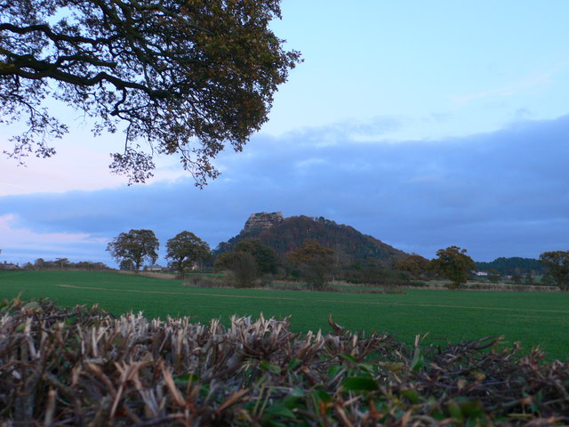
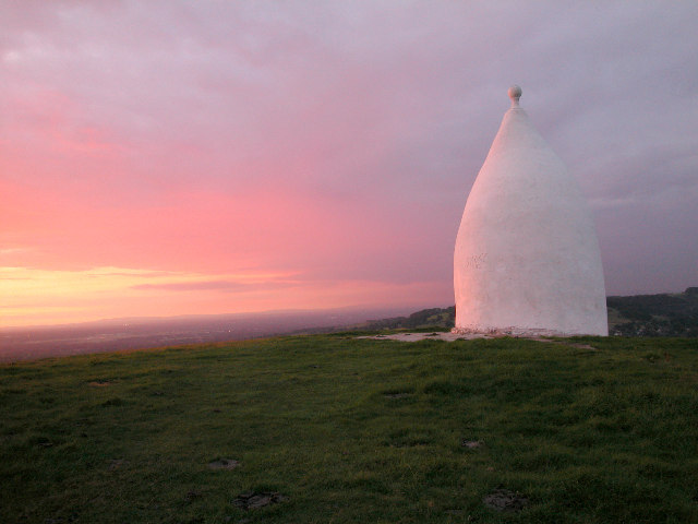
| Mow Cop | 0.9 miles (1.5 km) | Visit Mow Cop Castle and the Old Man of Mow on this short circular walk on the Cheshire–Staffordshire border. The castle sits in an elevated position above the village with wonderful views over the surrounding Staffordshire countryside and the Cheshire Plain. The 18th century folly is a well know landmark positioned 355m above sea level and visible for miles around. The walk also visits the Old Man of Mow - an interesting 65ft rock formation just to the north of the castle. Near here is a triangulation pillar and more great views to enjoy. Mow Cop is on the Gritstone Trail so you can extend your walk by continuing along this long distance trail. View Full Details>> | |
| Nantwich Riverside Loop | 3.1 miles (5 km) | This waterside route in Nantwich uses sections of the River Weaver and the Shropshire Union Canal to create a circular walk through the western part of the town. View Full Details>> | |
| North Cheshire Way | 70.2 miles (113 km) | Starting at Hooton Station, near Ellesmere Port, follow the North Cheshire Way through Frodsham, Northwich, Knutsford and Wilmslow to the finish point at Disley. Highlights on the walk include:
| |
| Northwich | 5 miles (8 km) | A lovely circular walk around Northwich, taking in the River Weaver, the Trent and Mersey Canal and several parks including the splendid Marbury Country Park. The route explores the Northwich Community Woodlands, an area of countryside with 11km (7 miles) of cycling and walking paths. The walk starts in Carey Park just to the north of the town centre where car parking is available. Follow the paths along the river into Anderton Nature Park. There's a nice wildflower trail with orchids and lots of wildlife to look out for here. Near here there's also the splendid Anderton Boat Lift. This remarkable feat of engineering is located on the canal and is one of the highlights of the area. The route then picks up the canal towpath following it east into Marbury Park. Here you will find magnificent Lime avenues, an Arboretum and the delightful Budworth Mere in Great Budworth. View Full Details>> | |
| Parkgate Circular Walk | 3.1 miles (5 km) | This fine circular walk explores the village of Parkgate on the River Dee estuary. It's a splendid place for a stroll with great views across the marshes and a wide variety of birdlife to look out for. This includes huge numbers of wildfowl and waders. Keep your eyes peeled for grey herons, egrets, peregrine falcon, merlin, hen harrier and short eared owl. The route heads along the Parkgate Parade and then follows a section of the Wirral Way cycling and walking trail. It's a flat, easy walk with great views of the village parade on the coastal section and lots of wild flowers and butterflies along the disused railway line. To extend your walk you can head north along the Wirral Way to Wirral Country Park for more great views across the estuary. View Full Details>> | |
| Peckforton Castle and Peckforton Hills | 5.3 miles (8.5 km) | Explore the Peckforton Castle Estate and the Peckforton Hills on this walk in Cheshire. The walk makes use of the Sandstone Trail to take you along woodland trails with great views of the surrounding Cheshire countryside from the elevated Sandstone Ridge. If you head north along the ridge you could also visit the ruins of the 13th century Beeston Castle. It's a short climb with fabulous views over the beautiful countryside of the Cheshire Plain. If you were to head south along the trail you would soon come to Bickerton Hill and Maiden Castle where there are more great views and the Iron Age hill fort of Maiden Castle. View Full Details>> | |
| Rivacre Valley Country Park | 1.6 miles (2.5 km) | Enjoy woodland walking trails and beautiful meadows in this country park and nature reserve in Ellesmere Port. In the spring there are carpets of bluebells and bright yellow celandines to enjoy. You can also stroll along the Rivacre Brook and look out for a variety of wildlife and wooden sculptures. There is parking on site and Overpool rail station is not far too. If you would like to continue your walking in the area then you could pick up the Wirral Way and head to the nearby Wirral Country Park. View Full Details>> | |
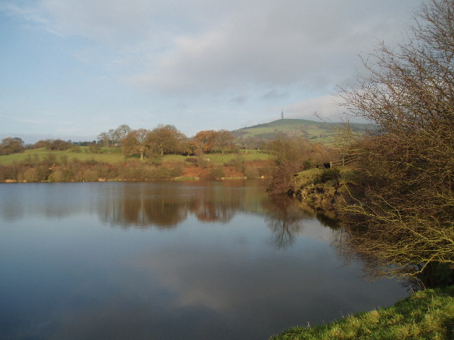
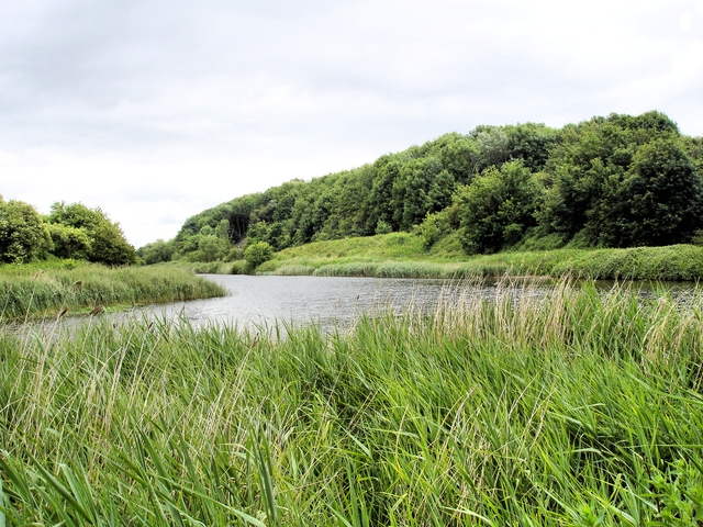
| Rostherne Mere | 0.6 miles (1 km) | Visit this pretty natural lake in the village of Rostherne, Cheshire. The area is a designated nature reserve where you can look out for a variety of wildfowl on the water. The reserve has no public access but there is a public footpath and viewpoint to the west of the mere. This is on Rostherne Lane and is shown on the google street view link below. It's an attractive area with the peaceful mere surrounded by woodland and countryside. Bring your binoculars and look out for cormorants, great crested grebe, tufted duck, pochard, goldeneye, teal and wigeon. The drone video below shows St Mary's Church in the village of Rostherne and a bird's eye view of the mere and surrounding countryside. For cyclists Regional Cycle Route 70 runs through the village of Rostherne just to the south of the mere. You can then follow country lanes around the water. View Full Details>> | |
| Sandstone Trail | 31.7 miles (51 km) | This is a popular walk that runs through Cheshire and Shropshire from Frodsham to Whitchurch. The path starts in Frodsham and heads south to Frodsham Hill with lovely views over the Cheshire Plain and the Mersey Estuary. You continue to Delamere Forest with its 2,400 acres of mixed deciduous and evergreen woodland and Blakemere Moss, a lake around 1 km in length. From Delamere you continue south towards Beeston Castle in Tarporley. With an exhibition detailing 4000 years of the castle's history and 40 acres of woodland trails, Beeston is a major attraction on the walk. Soon after you will come to Peckforton Castle, which is actually a country house built in the style of a medieval castle. It is now used as a luxury hotel. The path then heads through the lovely Peckforton Hills, passing the Bickerton Hills and Hampton Green before joining the towpath of the Shropshire Union Canal to Grindley Brook and then onto the finish point at Whitchurch. To extend your walking on the trail you could try our circular walk from Frodsham which uses the Delamere Way to create a loop around the town. View Full Details>> | |
| Sankey Valley Park | 2.5 miles (4 km) | Enjoy a super, waterside cycle or walk in this country park in Warrington. The valley follows the course of Sankey Brook and the now disused Sankey Canal. The park also contains children's play areas, a maze and a lawned area for families. There is also a meadow, mature woodland and a wetland nature reserve with a variety of birdlife. View Full Details>> | |
| Shining Tor and Cats Tor | 6.2 miles (10 km) | Climb to the highest point in Cheshire on this wonderful walk in the Goyt Valley. The walk starts from the Erwood Hall Car Park at the southern end of Erwood Reservoir. The route then ascends to Shining Tor, passing the Errwood Estate with its old ruined hall and attractive woodland. The hall was built in the 1830s by Samuel Grimshawe with a 2000 acre estate consisting of farmland and woodland with azaleas and rhododendrons. You can see the Grimshawe's family cemetery and an attractive Spanish Shrine to the governess of the children at Errwood Hall. The estate is a popular start point for walks in the Goyt Valley. At the 559 m (1,834 ft) summit of Shining Tor you can enjoy great views of the Cheshire Plain, Winter Hill, the city of Manchester and Jodrell Bank. On a clear day you can also see as far as Snowdonia. The route then heads north along the ridge to Cats Tor and then on to Pym Chair. It's a lovely stretch of the walk with a good path leading along the ridge with views of Cats Tor and the surrounding Peak District hills and moorland. Pym Chair is another popular viewpoint with a car park. You could also start the walk from here if you prefer. From Pym chair you descend back to Errwood Reservoir along a nice country lane before a final waterside section leads you back to the Errwood Hall car park. If you would like to continue your walking in the area then you could pick up the Midshires Way which runs past the reservoir. You could actually start the walk from nearby Buxton and follow the Midshires Way to Shining Tor from there. The Errwood Reservoir and Fernilee Reservoir Walk also starts from the same location. If you head north from Pym Chair then you would soon come to Windgather Rocks, a popular place for rock climbers. View Full Details>> | |
| Shropshire Union Canal | 65.9 miles (106 km) | Travel from the ourskirts of Wolverhampton to Ellesmere Port on this long distance waterside walk along the Shropshire Union Canal. The route starts at Autherley Junction in the Oxley area of Wolverhampton. You follow the canal north into the countryside, passing Pendeford Mill Nature Reserve where there are good bird watching opportunities. You continue north to Brewood and Wheaton Aston before passing Belvide Reservoir. The canal enters Shropshire, passing Market Drayton before entering Cheshire where you pass Audlem with views of the River Weaver. The route then passes through Nantwich and Chester before finishing at Ellesmere Port where you join with the Manchester Ship Canal and the River Mersey. The canal also links with the Llangollen Canal and the Montgomery Canal which run into Wales. View Full Details>> | |
| Shutlingsloe | 3.1 miles (5 km) | Enjoy fabulous views over Cheshire on this climb to Shutlingsloe Hill in the Peak District. The distinctive hill is also known as the Cheshire Matterhorn due to its shape from certain directions. The walk starts from the Trentabank Reservoir car park and follows a footpath through Macclesfield Forest to Shutlingsloe, passing Nessit Hill on the way. There is quite a steep path to the 506 m (1,660 ft) summit but you will be rewarded with splendid views of the surrounding Peak District scenery. At the summit you will find a toposcope detailing all the landmarks visible from the viewpoint. This includes Shining Tor and the famous large dish of the radio telescope at Joddrell Bank. You can return on the same path or descend to Wildboarclough and return on country lanes to make it a circular walk. Highlights on the walk include nice woodland trails through the conifer forest and views over Trentabank Reservoir with its heronry and interesting plantlife. It's easy to extend your walking in this lovely area. You could head west from the car park to Ridegate Reservoir and pick up the Gritstone Trail and follow it to the excellent Tegg's Nose Country Park. View Full Details>> | |
| South Cheshire Way | 34.2 miles (55 km) | This is a splendid walk along canals and through wonderful Shropshire and Cheshire countryside from Grindley Brook, near Whitchurch, to Mow Cop near Congleton. The walk starts on the Shropshire Union Canal at Grindley Brook and heads to Marbury. View Full Details>> | |
| Staffordshire Way | 95.1 miles (153 km) | Travel through Staffordshire, Cheshire, Derbyshire, Worcestershire and enjoy canals, lakes, country parks and a series of pretty towns and villages. Highlights on the walk include lovely views of the popular Blithfield Reservoir and the Caldon Canal. View Full Details>> | |
| Stanney Woods | 1.2 miles (2 km) | Enjoy a series of woodland trails in this country park and nature reserve in Ellesmere Port. In the park you'll find ancient woodland of oak and silver birch and a wide variety of birdlife. View Full Details>> | |
| Styal Country Park | 5.3 miles (8.5 km) | Explore the extensive, National Trust owned Styal Estate on this walk in Wilmslow, Cheshire. You can stroll along the River Bollin, through the peaceful woodland to the pretty Styal village. The cottages and barns of the village were built in the 1820s for the workers at Quarry Bank Mill. The cotton mill was built in 1784, and powered by Europe's most powerful working waterwheel on the banks of the River Bollin. Experts at the mill will provide you with an excellent history of the cotton industry and workings and machinery of the mill. You can also enjoy a stroll through the beautiful Quarry Bank gardens with caves, cliffs, trees, rhododendrons, a glasshouse and views across the river to the mill. View Full Details>> | |
| Tatton Park | 5.3 miles (8.5 km) | Explore the wonderful 1000 acre deer park on this walk or cycle in Knutsford, Cheshire. View Full Details>> | |
| Tegg's Nose Country Park | 2.5 miles (4 km) | This lovely country park in Macclesfield has splendid views of the Peak District National Park and the Cheshire plain. You can also see Macclesfield Forest, the summit of Shutlingsloe (the second highest point in Cheshire), the Telecoms Tower on Sutton Common and the Macclesfield Canal. This circular walk starts at the car park at the northern end of the park and heads south to the viewpoints. At the southern end you'll descend to Teggsnose Wood, Tegg's Nose Reservoir and Bottoms Reservoir. There's some nice waterside trails to try here before returning to the car park on other footpaths on the eastern side of the park. The landscape includes meadow, moorland and woodland while there is also a waterside section aroung Tegg's Nose Reservoir. The park has a very good Visitors Centre where you can find out details of the cycle and walking routes in the park. Click here to see the Tegg's Nose to Parkgate cycle route details. The Gritstone Trail walking route also runs through the park so there is scope for continuing your walk. Macclesfield Forest and Trentabank Reservoir lie just to the east where you will find more good walking trails. View Full Details>> | |
| Three Shires Head | 3.7 miles (6 km) | Explore this beautiful section of the Dane Valley and enjoy rivers, old stone bridges and waterfalls on this lovely walk in the Peak District. Three Shires Head is a point on Axe Edge Moor where the counties of Cheshire, Derbyshire and Staffordshire meet. Here you will find a Grade II-listed packhorse bridge over the River Dane. The bridge is thought to have been constructed in the 18th century. It's a delightful area with a number of small waterfalls and the surrounding Peak District scenery to enjoy. The walk begins from a parking area in Gradbach a couple of miles south of Three Shires Head. You then follow the Dane Valley Way and other footpaths to the bridge and the river. Here you will also find Panniers Pool, a popular place for a paddle or swim in the summer months. An alternative route would be to come from Buxton and follow the Dane Valley Way across Axe Edge Moor to the bridge. This is a much longer walk but does pass through the pretty Buxton Country Park on the way. To extend your walking in the area you could visit the fascinating Lud's Church. The deep chasm is located just to the west of the start point of this walk. Just to the south you can climb to The Roaches. View Full Details>> | |
| Trans Pennine Trail | 215 miles (346 km) | This terrific walking and cycling trail runs from coast to coast across northern England entirely on surfaced paths. It starts on the Yorkshire coast at Hornsea and passes through Yorkshire, Derbyshire and Greater Manchester before finishing on the Merseyside coast at Southport. View Full Details>> | |
| Trent and Mersey Canal | 95.1 miles (153 km) | Follow the Trent and Mersey Canal through Derbyshire, Staffordshire and Cheshire on this long distance waterside walk. The route starts at Shardlow near Long Eaton in Derbyshire and heads through Weston-on-Trent and Willington to Burton Upon Trent where you will pass Mercia Marina and the lovely Branston Water Park with its woodland, wetland and meadow. You continue to Alrewas where you will pass the National Memorial Arboretum. The Arboretum contains over 50,000 trees with nearly 300 memorials for the armed forces, civilian organisations and voluntary bodies who have played a part in serving the country. The next stage takes you through Handsacre to Rugeley where you will pass the wonderful Cannock Chase Country Park. It's worth taking a short detour to explore the Cannock Chase AONB with miles of woodland walking and cycling trails, lakes, ponds and wildlife including deer and various birds to look out for. You continue through the beautiful Trent Valley passing the National Trust Owned Shugborough Park at Great Haywood. It is worth a visit with a grand hall, museum, kitchen garden, model farm and extensive parkland with follies, woodland and a Chinese House with two Chinese-style bridges. The route continues through Weston to Stone before coming to the outskirts of Stoke-on-Trent where you will pass the splendid Trentham Gardens. Also in Stoke you will pass Westport Lake which is worth a small detour. You continue north to Kidsgrove where you will find the Grade II* listed Rode Hall, surrounded by parkland and formal gardens. The hall and gardens are open to the public from April to September and are well worth a small detour from the canal. The canal continues through Cheshire to Sandbach where you will pass close to the Watch Lane Flash Nature Reserve. Onward to Middlewhich and Northwhich where you will pass Marbury Country Park. View Full Details>> | |
| Two Saints Way | 92 miles (148 km) | Travel through Cheshire and Staffordshire on this wonderful long distance walking trail. The 92 mile pilgrimage route runs from Chester to Lichfield, passing through Nantwich, Stoke-on-Trent and Stafford. It is named after the saints St Werburgh and St Chad, Saxon saints who brought Christianity from Northumbria to the ancient kingdom of Mercia in the seventh century. It runs between St Werburgh's shrine at Chester to St Chad's shrine at Lichfield. The route is typically completed in the following four sections: Chester to Nantwich The route starts at Chester Cathedral and heads through the town, passing the Roman amphitheatre and the pilgrim church of St John's. You then pick up the Shropshire Union Canal passing along the towpath on the Baker Way. You'll pass Waverton, Beeston Castle, Bunbury, the River Gowy, Barbridge and Hurleston Reservoir before arriving at St Mary's Church in the market town of Nantwich. Nantwich to Stoke-on-Trent You leave Nantwich, heading south along the River Weaver, before turning east towards the village of Wynbunbury and the Wynbunbury Moss Nature Reserve. You continue through Weston, Barthomley and Newcastle-under-Lyme where you skirt the edge of the pretty Apedale Country Park. The last section takes you through Stoke-on-Trent, passing Westport Lake before coming to the halfway point of the trail at Stoke Minster, with its Saxon preaching cross. Stoke-on-Trent to Stafford You leave Stoke, heading south towards the beautiful Trentham Gardens with a section along the Trent and Mersey Canal. You continue through the lovely Trent Valley passing Tittensor Chase, Stone and Hopton before coming into Stafford. There's some nice sections along the River Trent on this leg of the journey. You finish at St Chad's, the oldest church in the county town of Stafford. Stafford to Lichfield The route then follows the River Sow out of Stafford, joining the Heart of England Way at Milford where you pass Shugborough Park and cross the Cannock Chase AONB. It's a lovely section, passing through Cannock Chase Country Park where you will visit the Katyn Memorial and Castle Ring hill fort. View Full Details>> | |
| Warrington | 9.3 miles (15 km) | This circular walk around Warrington includes nice waterside stretches along the River Mersey, the Woolston Cut Canal and the Manchester Ship Canal. There's also a visit to some pretty local parks and nature reserves. The walk starts next to Warrington Bridge where you pick up the start of the Mersey Way long distance footpath. View Full Details>> | |
| Weaver Way | 39.8 miles (64 km) | Follow the Weaver Way through Cheshire from Audlem to Frodsham on this delightful 40 mile walk. This route is ideal if you enjoy waterside walking, with long stretches along the Trent and Mersey Canal and Shropshire Union Canal as well as along the River Weaver Navigation. Watch out for a variety of wildlife along the way including March hares, Canada Geese and Kingfishers. View Full Details>> | |
| White Nancy | 2.2 miles (3.5 km) | This walk climbs to unusual structure of White Nancy overlooking the town of Bollington in Cheshire. The folly is in the shape of a small domed sugar loaf and thought to have been built in 1817 by Colonel Gaskell as a monument to the Battle of Waterloo. This circular walk makes use of the Gritstone Trail to take you from Bollington to the 280.5 metres (920 ft) high White Nancy before crossing the Saddle of Kerrridge to Kerridge Hill. From the elevated position above the town you can enjoy splendid views across the Cheshire Plain, the mountains of North Wales to the west, the hills of Shropshire to the south and the Pennines to the north and east. It's easy to extend your walk by continuing along the Gritstone Trail to the nearby Tegg's Nose Country Park. View Full Details>> | |
| Whitegate Way | 6.2 miles (10 km) | A lovely, short cycle or walk on a disused railway line, running from Cuddington to Winsford through the Cheshire countryside. View Full Details>> | |
| Windgather Rocks | 6.2 miles (10 km) | This walk visits this interesting gritstone crag which is popular with rock climbers. There are fascinating geological rock formations and wonderful views over the Peak District to enjoy. The walk starts from Whaley Bridge, near the train train station in the town. You then follow footpaths around the pretty Toddbrook Reservoir before climbing to Taxal Moor. From here you can enjoy super views back towards Whaley Bridge and the reservoir. The final section takes you along Taxal Edge to the rocks where you can enjoy splendid views over the surrounding countryside. The walk can be extended by continuing south to Shining Tor and Cats Tor. It's a great ridge walk with more wide ranging views. Also nearby are Errwood Reservoir and Fernilee Reservoirs where you can enjoy waterside trails. View Full Details>> | |
| Wirral Way | 11.8 miles (19 km) | This is a terrific walk or cycle ride that runs along a pleasant traffic free path through the Wirral Countryside and along the coastal estuary of the River Dee. It follows the track bed of part of the former Birkenhead Railway route from Hooton to West Kirby. You start off at Hooton Railway Station near Ellesemere Port and head towards Neston entering the lovely Wirral Country Park on the way. The path then heads along the beautiful Wirral coastline passing Heswall and Thurstaston before finishing at West Kirby. Along the route you'll pass very close to Royden Park and Caldy Hill, both of which are worth a small detour if you have time. At Royden Park you will find woodlands, meadows, heathland and two meres with an abundance of birdlife. You can also explore Thurstaston Common and climb Thurstaston Hill here. At West Kirby you'll pass Caldy Hill where there are nice woodland trails and views over the River Dee, Hilbre Island and the Irish Sea. Near Neston you pass the pretty coastal village of Parkgate which is well worth a visit. From the attractive coastal parade there are views across the marshland of the Dee and huge variety of birdlife to look out for. The long distance Wirral Circular Trail also passes the area. Pick up this 37 mile trail to explore the rest of the peninsula. View Full Details>> |