Burrow Mump
![]()
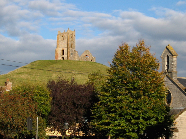
![]() This walk climbs this small hill overlooking the village of Burrowbridge in the Somerset Levels. On top of the hill there is the striking 18th century ruined church of St Michael's. It's a short, steep climb to the hill summit from the car park but there are lovely views over the Somerset Levels towards Glastonbury Tor and the Rivers Parrett and Tone. This circular walk starts at the Burrow Mump car park and climbs to the ruined church before heading along the river to Samways Farm. Here you head into the countryside along the Burrow Drove and Broad Drove tracks. You continue to Pathe and Stathe where you pick up a trail along the river which leads back to Burrowbridge. There's lovely views across Southlake Moor which can be flooded in winter. This attracts large numbers of wildfowl including pochard, teal and tufted duck. Look out for Otters and newts along the River Parret.
This walk climbs this small hill overlooking the village of Burrowbridge in the Somerset Levels. On top of the hill there is the striking 18th century ruined church of St Michael's. It's a short, steep climb to the hill summit from the car park but there are lovely views over the Somerset Levels towards Glastonbury Tor and the Rivers Parrett and Tone. This circular walk starts at the Burrow Mump car park and climbs to the ruined church before heading along the river to Samways Farm. Here you head into the countryside along the Burrow Drove and Broad Drove tracks. You continue to Pathe and Stathe where you pick up a trail along the river which leads back to Burrowbridge. There's lovely views across Southlake Moor which can be flooded in winter. This attracts large numbers of wildfowl including pochard, teal and tufted duck. Look out for Otters and newts along the River Parret.
The River Parret Trail runs through Burrowbridge so you can extend your walk by picking up this waterside, long distance trail. If you head south east you will come to Langport while walking north east will take you into Bridgwater.
Postcode
TA7 0RB - Please note: Postcode may be approximate for some rural locationsBurrow Mump Ordnance Survey Map  - view and print off detailed OS map
Burrow Mump Open Street Map  - view and print off detailed map
Burrow Mump OS Map  - Mobile GPS OS Map with Location tracking
Burrow Mump Open Street Map  - Mobile GPS Map with Location tracking
Pubs/Cafes
The King Alfred in Burrowbridge is a great place to go for some post walk refreshments. It's nestled under the shadow of Burrow Mump and the place where King Alfred famously burnt the cakes when he was hiding from the invading Danes, hence the pub’s name. It's a friendly place with great home cooked food. You can the find the pub next to the river at postcode TA7 0RB.
Further Information and Other Local Ideas
Head south east and you could pick up the Langport Walk. This will take you around the market town before following a riverside path to the historic ruins of Muchelney Abbey. The abbey is run by English Heritage and has a fascinating history having once been a wealthy Benedictine house and the second oldest religious foundation in Somerset. It's another worthy local piece of history to investigate in the area.
For cyclists Sustrans National Cycle Route 339 runs past the site on its way between Bridgwater and Langport.
For more walking ideas in the area see the Somerset Walks page.
Cycle Routes and Walking Routes Nearby
Photos
Burrow Mump. The ruined church of St Michael on the summit. An earth dragon is said to live below the hill.
Bridge over the River Tone, viewed from the East Deane Way which runs along the towpath.


