Compton Dundon and Combe Hill Wood
![]()
![]() This circular walk explores the area around the Somerset village of Compton Dundon.
This circular walk explores the area around the Somerset village of Compton Dundon.
On the way you'll visit The Hood Monument and Combe Hill Woods before a climb to Dundon Beacon where you can enjoy some fine views over the area.
The walk starts in the village and heads north to The Hood Monument. The hilltop monument is something of a local landmark and sits atop windmill hill. There's some fine views to Glastonbury Tor from this historic spot.
From here you head south east to Combe Hill Wood. Here you can enjoy miles of peaceful woodland trail through Great Breach Wood and Copley Wood. From the high points in the woods there are some lovely views over the surrounding countryside.
The route then heads west toward Dundon where you can climb to the Iron Age Hillfort at Dundon Beacon. The area is a nature reserve with some lovely flora and fauna to look out for.
Postcode
TA11 6PR - Please note: Postcode may be approximate for some rural locationsCombe Hill Wood Ordnance Survey Map  - view and print off detailed OS map
Combe Hill Wood Open Street Map  - view and print off detailed map
Combe Hill Wood OS Map  - Mobile GPS OS Map with Location tracking
Combe Hill Wood Open Street Map  - Mobile GPS Map with Location tracking
Walks near Compton Dundon
- Somerton - This attractive Somerset based town has a fine 17th century market square and some outstanding architecture to enjoy
- Lytes Cary - Visit this National Trust owned manor house and enjoy walks around the grounds and the surrounding countryside
- River Parret Trail - Follow the River Parrett from the source in Chedington in Dorset to the mouth in Bridgwater Bay, Somerset.
The route first heads to Langport passing Haselbury and the 16th century English Heritage owned Muchelney Abbey - Burrow Mump - This walk climbs this small hill overlooking the village of Burrowbridge in the Somerset Levels
- Glastonbury Canal - Follow the Glastonbury Canal through the Somerset Levels on this waterside walk through the Avalon Marshes
- Glastonbury Tor - This popular walk takes you from the ruins of Glastonbury Abbey to the summit of the iconic Glastonbury Tor
- Ham Wall - Ham Wall Nature Reserve is part of the Avalon Marshes in the beautiful Somerset Levels
- Shapwick Heath - Explore this lovely nature reserve in the Somerset's Levels
- Bridgewater Canal - This easy cycle ride takes you along a section of the Bridgewater Canal from Pennington Flash to Marshland Bridge, via Leigh
- Cheddar Gorge - This is a circular walk around the magnificent Cheddar Gorge in Somerset.
- Westhay Moor - This walk visits the Westhay Moor National Nature Reserve on the Somerset Levels.
- Street Somerset - This pretty Somerset based village is a great place from which to explore the nearby Polden Hills and Mendip Hills
Pubs/Cafes
Back in the village you can enjoy some post exercise rest and refreshment at The Castlebrook Inn. There pub has a nice garden area and there is also a large conservatory restaurant towards the rear. They serve good quality food and can be found at postcode TA11 6PR for your sat navs.
Dog Walking
The woodland trails on the route are ideal for dog walking. The Castlebrook Inn mentioned above is also dog friendly.
Further Information and Other Local Ideas
The woods are located just to the north of the noteworthy town of Somerton. You can enjoy some wonderful historic buildings, riverside walks along the River Cary and visit one of the local highlights at the National Trust's Lytes Cary manor.
To the north lies Street where you can enjoy walks along the Polden Way through the Polden Hills.
Photos
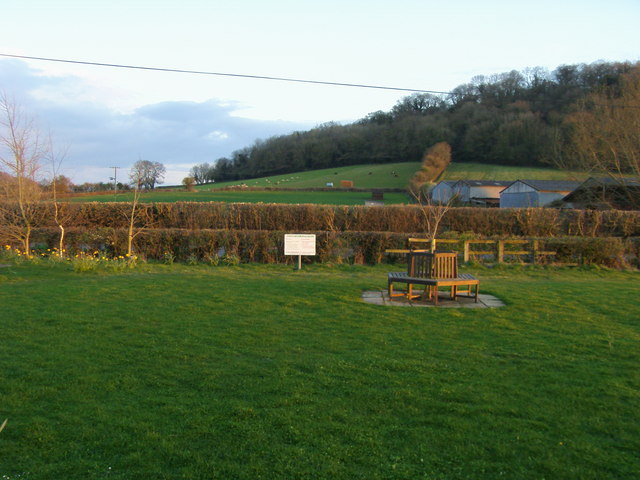
From Meadway Hall looking up to Dundon Hill. The hill fort at the top dates to 700 BC. An excavation in 1916 found pottery and flints here, but the fort has been damaged by quarrying.


