Caldy Hill
![]()
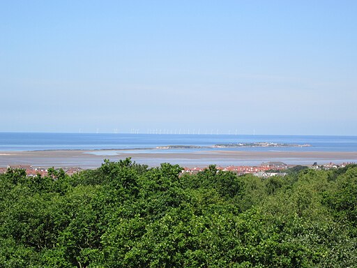
![]() Explore 250 acres of woodland and heathland on this lovely walk on the Wirral Peninsula. You can also climb the 260ft high Caldy Hill for fabulous views over the River Dee, Hilbre Island and the Irish Sea. On a clear day you can even see as far as Snowdonia and the Lake District.
Explore 250 acres of woodland and heathland on this lovely walk on the Wirral Peninsula. You can also climb the 260ft high Caldy Hill for fabulous views over the River Dee, Hilbre Island and the Irish Sea. On a clear day you can even see as far as Snowdonia and the Lake District.
It's a great place for flora and fauna with pretty heather, willdfowers, bracken, silver birch and oak trees.
Less than an a mile to the east is Royden Park and Thurstaston Common and Coast. It's a great place to extend your walk with woodlands, meadows, heathland and two meres where you will find an abundance of birdlife.
Just to the west you can pick up the Wirral Way and follow it to the nearby Wirral Country Park.
It's a great cycling and walking trail running on a disused railway line along the estuary of the River Dee.


