Carn Llidi
![]()
![]() This walk climbs to the hill fort and view point at Carn Llidi near St David's on the stunning Pembrokeshire coast.
This walk climbs to the hill fort and view point at Carn Llidi near St David's on the stunning Pembrokeshire coast.
The walk starts from the car park at Whitesands Bay (Porth Mawr) and follows paths east and then north to the hill summit which stands at a height of 181 metres. Here you'll find ancient burial chambers and splendid views to the coast at St David's Head and the nearby Ramsey Island. It's about a 1 mile walk to the summit from the car park with some concrete steps as you approach the summit.
After taking in the views the route descends on the same paths back to the car park.
Postcode
SA62 6PS - Please note: Postcode may be approximate for some rural locationsCarn Llidi Ordnance Survey Map  - view and print off detailed OS map
Carn Llidi Open Street Map  - view and print off detailed map
Carn Llidi OS Map  - Mobile GPS OS Map with Location tracking
Carn Llidi Open Street Map  - Mobile GPS Map with Location tracking
Further Information and Other Local Ideas
You can extend your walking in the area by picking up the Pembrokeshire Coast Path to visit St David's Head and the ancient Coetan Arthur Dolmen.
For more walking ideas in the area see the Pembrokeshire Coast Walks page.
Cycle Routes and Walking Routes Nearby
Photos
Concrete steps near the summit of Carn Llidi. During WWI a hydrophone station was built near the summit to detect enemy submarines in the western approaches. The same site was re-used throughout WWII, first as a radio station and observation point, then later as a radar station. The concrete and brick foundations of these defence sites remain and the concrete footpaths aid access to the summit.
Carn Llidi Summit overlooking Whitesands Bay , St David. The summit of Carn Llidi is 181 metres (594 ft) above sea level with commanding views east over Pembrokeshire.
The view to the west spans 180 degrees of the Irish Sea and western approaches making Carn Llidi a natural location for defensive surveillance during both world wars.
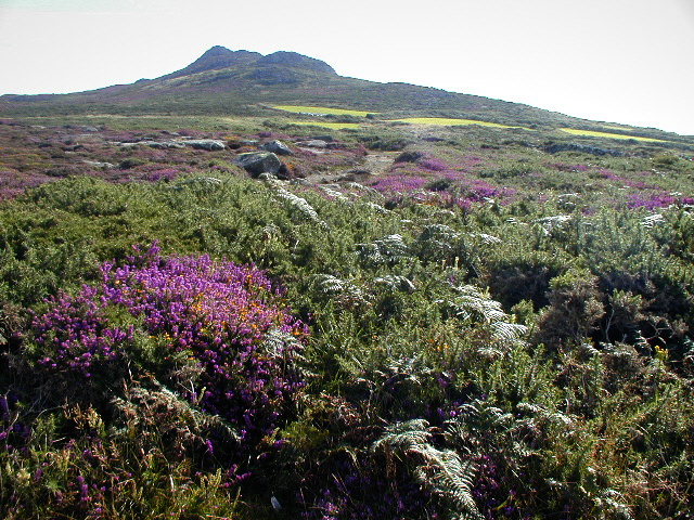
The slopes of Carn Llidi. A wide valley divides the Penmaen Dewi/St David's Head coastal strip from the flanks of the hill. The hill's rocky backbone dominates the area which is well-watered and relatively sheltered: there are numerous traces that the valley slopes were farmed and settled in both prehistoric and mediaeval times.


