Solva to St David's Coastal Walk
![]()
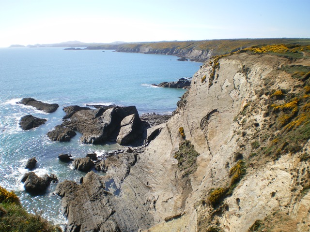
![]() A popular coastal walk from Solva to St David's along a section of the Pembrokeshire Coast Path. The walk is just over 6 miles, taking place on undulating paths with wonderful sea views along the way. There is some climbing along the cliff tops but it is generally a fairly easy route.
A popular coastal walk from Solva to St David's along a section of the Pembrokeshire Coast Path. The walk is just over 6 miles, taking place on undulating paths with wonderful sea views along the way. There is some climbing along the cliff tops but it is generally a fairly easy route.
The walk starts from the beautiful Solva Harbour and south along the River Solva to the coast. You head west passing the stunning natural sea arch at Gewni Island and the interesting rock formations at The Cradle. You continue past Trelerw to Caerfai Bay where you will find purple sandstone cliffs and a sandy beach which can be reached at low tide on some steep steps. There's also tremendous views to the islands of Skomer and Skokholm from the picnic area above the beach.
The next stage takes you to the St Non's Bay where you will find the ruins of St Non's Chapel, held by tradition to mark the birthplace of St David. The Grade II listed chapel is thought to be one of the oldest Christian buildings in Wales. Nearby you will find St Non's Cross and a holy well where visitors throw coins for luck.
The route continues past the lovely Porthclais with its delightful harbour. The old harbour wall, built by the Romans is still largely intact.
The walk then leaves the coast, following country lanes into St David's, where you finish at the cathedral. The city is noteworthy as the smallest in the UK and includes the medieval ruins of Bishops Palace next to the cathedral. The site dates back to the 6th century, although the building that stands today dates largely from the late 13th and 14th centuries.
To extend your walking in the area head to the wonderful St David's Head where you can enjoy views of Ramsey Island and Carn Llidi, a huge jagged tor, towering above the coast. You could also try the Solva to Newgale Walk. This section of the path passes two impressive headlands with great views out to Green Scar Island and Ramsey Island.
Solva to St Davids Coastal Walk Ordnance Survey Map  - view and print off detailed OS map
Solva to St Davids Coastal Walk Open Street Map  - view and print off detailed map
*New* - Walks and Cycle Routes Near Me Map - Waymarked Routes and Mountain Bike Trails>>
Solva to St Davids Coastal Walk OS Map  - Mobile GPS OS Map with Location tracking
Solva to St Davids Coastal Walk Open Street Map  - Mobile GPS Map with Location tracking
Pubs/Cafes
Head to the Harbour Inn in Solva for some refreshments. The friendly pub is in a great position overlooking the picturesque harbour. The pub has a good menu and some tables outside. It is also dog friendly. You can find it at 31 Main Street with a postcode of SA62 6UT.
The Cafe on the Quay is also beautifully located on Trinity Quay. You can sit outside on the balcony an enjoy wonderful views of the estuary with your lunch. You can find it at postcode SA62 6UQ.
Further Information and Other Local Ideas
Head north along the coast path and you could visit the quaint villages of Little Haven and Broad Haven. There's a lovely blue flag beach, natural arches and a fine beach front bar to visit here.
Just to the west of St David's there's the wonderful Treginnis Peninsula to explore. Here you can enjoy views towards Skomer Island and the oldest volcanic rocks in Wales, formed over 600 million years ago.


