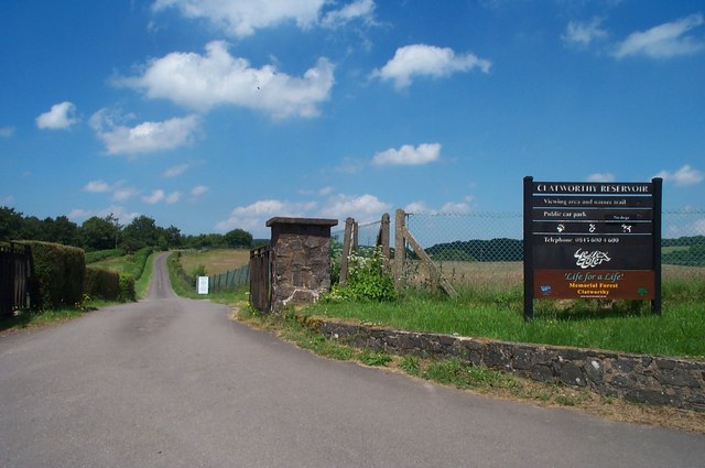
Clatworthy Reservoir
![]()
![]() Enjoy a walk around this pretty reservoir in the Brendon Hills on the edge of the Exmoor National Park. There's lovely grassy footpaths running alongside the water with splendid views of the surrounding hills, countryside and woodland. You can park at the car park at the eastern side of the reservoir near to the dam. Then pick up the trails around the perimeter of the water. It's about a 5 mile (8km) walk around the whole reservoir or you can try a shorter nature trail through Clatworthy Wood. Here you'll find beech, oaks, silver birch and rowan trees and some pretty streams. Look out for red deer, roe deer and badgers in this area and geese, grebes and swans on the water.
Enjoy a walk around this pretty reservoir in the Brendon Hills on the edge of the Exmoor National Park. There's lovely grassy footpaths running alongside the water with splendid views of the surrounding hills, countryside and woodland. You can park at the car park at the eastern side of the reservoir near to the dam. Then pick up the trails around the perimeter of the water. It's about a 5 mile (8km) walk around the whole reservoir or you can try a shorter nature trail through Clatworthy Wood. Here you'll find beech, oaks, silver birch and rowan trees and some pretty streams. Look out for red deer, roe deer and badgers in this area and geese, grebes and swans on the water.
Just to the south of the reservoir you can pick up the West Deane Way long distance trail near Wiveliscombe. Here you can extend your walk by following the trail south along the River Tone towards Ashbrittle and Tracebridge.
A few miles to the west you can enjoy more lakeside cycling and walking trails at the larger Wimbleball Lake.
Just to the north you can pick up the Samaritans Way South West and explore the Brendon Hills and Combe Sydenham Country Park.
Postcode
TA4 2EJ - Please note: Postcode may be approximate for some rural locationsClatworthy Reservoir Ordnance Survey Map  - view and print off detailed OS map
Clatworthy Reservoir Open Street Map  - view and print off detailed map
Clatworthy Reservoir OS Map  - Mobile GPS OS Map with Location tracking
Clatworthy Reservoir Open Street Map  - Mobile GPS Map with Location tracking
Pubs/Cafes
If you head a couple of miles south east of the reservoir you'll come to the pretty little village of Langley Marsh. Here you'll find the noteworthy Three Horseshoes. The historic country pub dates all the way back to the 17th century. It sits in a lovely spot at the foot of the Brendon Hills and has an attractive interior with cosy fires. There's also a good pub garden and a very good menu. The inn can be found at a postcode of TA4 2UL for your sat navs.
Further Information and Other Local Ideas
A few miles to the south west there's a great viewpoint at Haddon Hill. The hill lies just to the south of Wimbleball Lake providing great views over the water to Dartmoor beyond.
For more walking ideas in the area see the Exmoor Walks page.
Cycle Routes and Walking Routes Nearby
Photos
The reservoir seen from the ridge road between Parsonage Farm and Flint Cross, here defining the boundary between Clatworthy and Huish Champflower parishes. The reservoir was constructed between 1957 and 1959 and was officially opened in 1961. It has a capacity of 4499 million litres: by comparison nearby Wimbleball, constructed in the 1970s, can contain 21320 million litres


