Clayfield Copse
![]()
![]() This attractive area of woodland is located in Caversham, to the north of Reading.
This attractive area of woodland is located in Caversham, to the north of Reading.
The local nature reserve is a pleasant place for a stroll with woodland paths, a sculpture trail and wildflower meadows to enjoy. The site also includes Blackhouse Wood, just to the east.
Postcode
RG4 6RT - Please note: Postcode may be approximate for some rural locationsClayfield Copse Ordnance Survey Map  - view and print off detailed OS map
Clayfield Copse Open Street Map  - view and print off detailed map
Clayfield Copse OS Map  - Mobile GPS OS Map with Location tracking
Clayfield Copse Open Street Map  - Mobile GPS Map with Location tracking
Further Information and Other Local Ideas
To continue your walking head south and pick up the Thames Path on the Caversham Walk. You can also visit the splendid Caversham Court Gardens where there's more easy trails to try.
In Reading you can also pick up the Reading Canal Walk and the Reading Circular River Walk to explore the area further on foot.
For more walking ideas in the area see the Berkshire Walks page.
Cycle Routes and Walking Routes Nearby
Photos
Clayfield Copse. A piece of woodland enclosed within the Reading borough boundary and maintained by the local authority for recreation. Reading has many pockets of woodland even well within the urban area.
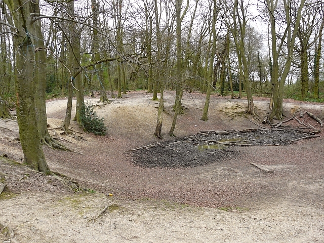
The Dip, Blackhouse Wood. Once part of the Caversham Park Estate, Blackhouse is ancient woodland with some notable tree specimens, e.g. wild pear and wild service tree. The depression here is thought to be the result of mineral extraction.
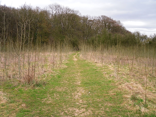
Field between Clayfield Copse and Blackhouse Wood. The field was in agricultural use until the mid 1990s. It is being allowed to regenerate into woodland, with some coppicing carried out. The Berkshire/Oxfordshire boundary runs between the field and the wood.


