Berkshire Walks

Use the filter to show walks of a certain type such as woods, reservoirs, hills, long distance, country parks, canals and rivers.
In the spring walkers flock to the beautiful bluebell woods in the Berkshire area. Click the 'Woodland' button below to see these.
Use the links to view full route information including elevation profiles, interactive maps and GPS downloads.
You can also view an overview map of all the routes in the using the Berkshire Walk Map>>
*New* - Walks and Cycle Routes Near Me Map - Waymarked Routes and Mountain Bike Trails>>
| Filter: |
| Route Name | Photo | Distance | Description |
| Basildon Park | 3.1 miles (5 km) | A walk around the beautiful Basildon Park near Reading. There are 4 different waymarked trails through the 400 acres of parkland and woodland that surround the 18th century mansion house. The walk also takes you through the beautiful garden with its maze, wildflower meadows and rose garden. The route also passes very close to Beale Park Wildlife Park and Gardens which are well worth a look. Here you'll find collections of small exotic animals, farm animals and birds, landscaped gardens and woodlands, and children's play areas. You will also pass very close to the River Thames so the walk can be continued along the river too. Heading east will take you towards the pretty village of Pangbourne where you can visit the delightful water meadows and enjoy a stroll along the River Pang. View Full Details>> | |
| Beeches Way | 15.5 miles (25 km) | Follow the Beeches Way through the Chilterns from the River Thames at Cookham to the Grand Union Canal at West Drayton. You start off at Cookham and head east to the wooded Burnham Beeches Nature Reserve. The reserve covers over 500 acres with a network of great woodland trails. There's also ponds, grassland, heathland with wildlife which includes Exmoor Ponies. The walk then passes through Fulmer before a lovely stretch through Black Park Country Park and Langley Park Country Park. The final stretch takes you around the lakes in Colne Valley Regional Park before finishing on the Grand Union Canal at West Drayton. View Full Details>> | |
| Bisham Woods | 1.9 miles (3 km) | These woods near Marlow have some nice walking trails to try. Bisham Woods actually consists of several woods including Quarry Wood, Fultness Wood and Inkydown Wood. The area covers nearly 400 acres and are considered 'the richest ancient woods in Berkshire'. There's lots to see with bluebells, beechwoods, ponds, woodland orchids and some climbs with great views over the Chilterns and Marlow. Other features in the wood include an ice house constructed in the 1760’s and Bisham Quarry which provided the stone for Windsor Castle. The circular walking route below takes you along various trails in the central and southern section of the woods but there are also bridleways running through Quarry Woods which are suitable for cyclists. Please stick to the marked bridleways if you are on your bike. Bisham Woods are thought to have been the original 'Wild Wood' in Kenneth Grahame's 'Wind in the Willows', which he wrote in the nearby village of Cookham Dean. The woods are located very close to the River Thames so it's easy to extend your walk. You could pick up the Thames Path and head east to Cliveden House. Here you'll find a fine Italianate mansion with lots of parkland and gardens to explore. View Full Details>> | |
| Blackwater Valley Footpath | 23 miles (37 km) | This is a nice easy waterside walk along the Blackwater River from Aldershot to Swallowfield. The walk starts at the delightful Rowhill Nature Reserve in Aldershot and heads along the river to Farnborough, passing Gold Valley Lakes and Willow Park on the way. From Farnborough you continue through Frimley Hatches Nature Reserve and Blackwater to the splendid Tri Lakes Country Park near Yately. The final section takes you on to Swallowfield via Eversley. View Full Details>> | |
| Bracknell Forest Ramblers Route | 26.1 miles (42 km) | This circular walk takes you on a tour of the woodland and countryside of Bracknell Forest in Berkshire. View Full Details>> | |
| Bucklebury Common | 3.1 miles (5 km) | This large area of common land in Berkshire covers 350 hectares (860 acres). It consists of heathland and broadleaved woodland of oak, ash and beech. There are miles of public footpaths and bridleways suitable for cycling. Other features include 12 ponds, several greens and a variety of flora and fauna. Keep your eyes peeled for a variety of woodland birds and the occasional deer as you make your way through the woods. You can start off from the car park which is located about half way between the villages of Upper Buckleberry and Chapel Row. The common is located just to the north of Thatcham so if you would like to continue your walking in the area you could head to the excellent Thatcham Discovery Centre. You could also head north to the village of Bucklebury and then continue to Stanford Dingley by picking up the riverside footpath along the River Pang. View Full Details>> | |
| California Country Park | 1.6 miles (2.5 km) | This country park is located near Wokingham in Berkshire and has two lovely short walks. The Longmoor Lake walk is about a mile while The Woodland Walk is about two miles. The paths are well laid out while there are also boardwalks passing above the bogland. View Full Details>> | |
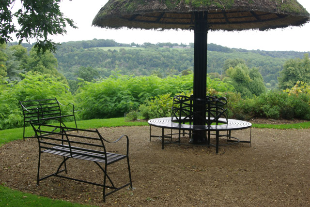
| Caversham Court Gardens | 0.6 miles (1 km) | Explore these beautiful award winning gardens on the banks of the River Thames on this short walk in the Caversham area of Reading. There are three lovely trails in park: Tree Trail - the park contains many fine specimen trees, some of which are over 100 years old. These include Lime, Yew and Magnolia. The Detective Trail - a historical walk for children. The Griffin's Trail - a family walk taking you to the pond, vinery, courtyard, font and riverbank. The gardens have a wide variety of plants and flowers including Wisteria, Lavender, Tulips, Nepeta and Roses. Caversham gardens are located just north of Reading town centre, over the Caversham Bridge. The Thames Path runs past the park so there is plenty of scope for continuing your walk along the river. For example if you head west you will soon come to the beautiful Mapledurham House with its 15th century watermill and lovely parkland. View Full Details>> | |
| Chiltern Way Berkshire Loop | 28 miles (45 km) | This walk runs from the outskirts of High Wycombe to Crowsley Park, near Henley on Thames. The route includes several long sections along the River Thames where you will pass a series of delightful riverside towns and villages. These include Cookham and then Henley-on-Thames, home to the famous annual regatta. View Full Details>> | |
| Cliveden House | 1.9 miles (3 km) | Explore the stunning gardens and woodlands surrounding this Italianate mansion near Maidenhead. The grounds include several beautifully laid out gardens. The Rose Garden with red, orange and yellow flowers, the oriental water garden with Chinese pagoda and the Long Garden with stunning floral displays and topiary. There are also miles of woodland paths with stunning views back to the gardens and over the surrounding Berkshire countryside. Look out for elephant, bear and tiger wood carvings as you go. The grounds also extend down to the River Thames so there is the opportunity for some waterside walking too. Other highlights include the recently restored maze, a number of exquisite temples, pavilions and follies, and the Fountain of Love located the end of the lime tree avenue which runs up to the house. The house itself is now a luxury hotel but tours are available for the general public. The house has been home to an earl, three countesses, two dukes, a Prince of Wales and the Viscounts Astor. During the 1960s, it became the setting for key events of the notorious Profumo Affair. The Thames Path and the Shakespeare's Way walking routes run past Cliveden. Both of these are good options if you would like to continue your walk. You could also head west to Bisham Woods where there are miles of good walking trails and mountain bike tracks to try. The Beeches Way runs past the northern edge of Cliveden. If you pick this up and head east you will soon come to the splendid Burnham Beeches Nature Reserve. The popular site covers over 500 acres with a network of woodland trails. There's also ponds, grassland, heathland with wildlife including Exmoor Ponies. View Full Details>> | |
| Combe Gibbet | 1.9 miles (3 km) | This walk climbs to the interesting structure of Combe Gibbet and continues on to Inkpen Hill. The gibbet was erected in 1676 for the purpose of gibbeting the bodies of George Broomham and Dorothy Newman. The gibbet was placed high on Gallows Down as a detterent to other criminals. It's now a popular tourist destination with great views and a number of footpaths to follow through the surrounding countryside. The hill is also a popular climb for cyclists with a number of bridleways to follow across Inkpen and Walbury Hill. This walk starts at the Inkpen Beacon car park and climbs to the gibbet along the Test Way long distance footpath. It's a good path which leads to the Inkpen long barrow and then up onto Inkpen Hill. From here there are wonderful views over the surrounding Berkshire countryside. The walk can be extended to visit the nearby Walbury Hill. At 297 m (974 ft) Walbury Hill is the highest point in Berkshire and South East England. At the summit you can enjoy more great views over the county and explore the Iron Age Hill fort of Walbury Camp. If you continue along the Test Way you can visit Combe Wood. You could also pick up the Wayfarer's Walk and head south east along a wonderful ridge top path to the nearby Pilot Hill, the highest hill in Hampshire. View Full Details>> | |
| Cookham River Circular Walk | 3.5 miles (5.7 km) | The little village of Cookham is situated in a particularly delightful spot by the River Thames. This area of the Thames Valley is thought to have inspired the 'Wind in the Willows' children stories, by the author Kenneth Grahame, who lived in nearby Cookham Deane. This circular walk takes you along a section of the river to Cock Marsh, before returning through the countryside to the village. There's lots of interesting flora and fauna to look out for, particularly around the wetland meadows of Cock Marsh where there are many breeding waders and specialist plants. On the climb to Winter Hill you can enjoy lots of wildflowers and wonderful views over the Thames Valley. You can start the walk from the National Trust's Cookham Moor car park. Then follow the riverside path north towards Bourne End. You then head into Cock Marsh where there is a moderate hill climb of just over 200ft. Here you can enjoy lovely views across the countryside of the marsh to the river and to the nearby Cliveden House. The route then descends past the Winter Hill golf course, returning to the village and the finish point back at the car park. To extend your walking in the area, head west along the Thames Path towards Marlow where you can visit Bisham Woods and Cookham Dean. View Full Details>> | |
| Dinton Pastures Country Park | 3.1 miles (5 km) | Enjoy 7 lakes, 2 rivers, 3 bird hides and several meadows in this terrific 335 acre park in Hurst. There are excellent facilities with a Rangers Office, cafe, picnic area and the Dinton Activity Centre where kayaking, canoeing, sailing, powerboating and climbing activities are available. The Museum of Berkshire Aviation and the headquarters of the British Entomological and Natural History Society are also located in the park. View Full Details>> | |
| Donnington Castle | 3.4 miles (5.5 km) | Enjoy a stroll around this historic castle before visiting the nearby Snelsmore Common on this circular walk in Newbury. The medieval castle is surrounded by attractive farmland and peaceful woodland, with nice footpaths to follow around the site. The castle dates from the 14th century and played a notable role in the First and Second Battle of Newbury in the Civil War during the 17th century. After exploring the grounds you can pick up a section of the Lambourn Valley Way to take you west to Bangor. There's nice views of the River Lambourn and the interesting Watermill Theatre to see here. The professional repertory theatre is housed in a 200 year old converted watermill by the river. At Bangor the route turns north to Snelsmore Common. There's miles of good footpaths to follow through the heathland and woodland on the common. Look out for wildlife including ponies, small deer and rabbits. After exploring the common the route turns south to return to the castle. View Full Details>> | |
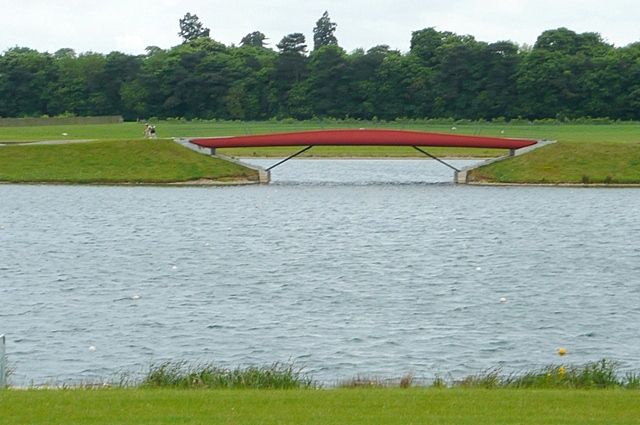
| Dorney Lake | 3.7 miles (6 km) | This purpose-built rowing lake in Buckinghamshire has a traffic free National Cycle Network trail running past it on one side and the Thames Path on the other. As such you can make a circular walking trail using these two trails or a linear ride from Eton Wick to Dorney Reach if you are on your bike. The lake was used as the rowing venue for the 2012 Olympics in London. It's a lovely area with the riverside path and views across the lake to enjoy. There's also 450 acres of parkland including an Arboretum and Nature Conservation area. Look out for water loving birdlife including the grey heron. You can park at the north western end of the lake just off Court Lane to start your walk. Alternatively you could catch the train to Windsor and then follow the Thames Path to the lake. It's about 1.5 mile walk passing Eton, Eton Wick and Dorney Common. A National Cycle Network Path also runs from the train station to the site. If you would like to extend your exercise then you could visit the nearby Windsor Great Park. The park has miles of cycling and walking trails with woodland, parkland and lakes to enjoy. You could also continue along the Thames Path to Maidenhead which is only a couple of miles to the north. The Jubilee River also runs past Dorney. This river has a great waterside cycling and walking trail running from Maidenhead to Eton. View Full Details>> | |
| Finchampstead Ridges | 2.2 miles (3.5 km) | This circular walk takes you through this peaceful common near Crowthorne. There are a number of delightful woodland trails, heather, bracken and two tranquil ponds to relax next to. From the high points on the ridges there are wonderful views over the River Blackwater Valley. The walk also visits Simon's Wood where there is a very large Heath Pond. You can start the walk from the National Trust car park here at a postcode of RG45 6AE for your sat navs. Also look out for a variety of wildlife including the Green Woodpecker in this peaceful area. You can easily extend your walk by heading to the nearby Tri Lakes Country Park, Horseshoe Lake or Yately Common Country Park for more lovely walking trails. View Full Details>> | |
| Goring | 11.2 miles (18 km) | This riverside village in South Oxfordshire is ideally located for walking with two National Trails passing through the area. Both The Ridgeway and the Thames Path head through the village and are a great way to explore the river and the surrounding countryside. The noteworthy village was named Oxfordshire's Village of the Year in 2009 and also has an interesting church with parts dating from the 13th century. This circular walk uses both waymarked trails to take you along both sides of the River Thames. You'll pass through two counties as in this area the river bisects Oxfordshire and Berkshire. Starting on the eastern side of the river at Goring Bridge, the route first heads north along the Ridgeway to South Stoke and North Stoke. At Mongewell you cross to the other side, although you could continue to nearby Wallingford if you prefer. On the western side of the river you pick up the Thames Path and follow it south. You'll pass the Berkshire settlements of Moulsford and Streatley, before crossing Goring Bridge to return to Goring. At Streatley you will pass the lovely riverside Swan Inn, which is a great place to sit outside and enjoy refreshments in the summer months. To continue your walking in the village you can pick up the The Swan's Way long distance trail. The shared cycling and walking trail starts in Goring and runs all the way to Salcey Forest. View Full Details>> | |
| Greenham Common | 4.3 miles (7 km) | Explore the Greenham and Cookham Commons on this circular walk near Newbury. Greenham Common is a former Royal Air Force station. Opened in 1942, it was used by both the Royal Air Force and United States Army Air Forces during the Second World War and the United States Air Force during the Cold War. Today this large green space is ideal for a long walk or cycle ride in peaceful surroundings. The expansive area of heathland is covered in heather and gorse and has nice wide footpaths to follow. There's also wildflower filled grasslands and wetland areas which attract dragonflies and birdlife. Look out for horses and ponies roaming the common too. This walk starts from the car park on Bury's Bank Road and takes you around the central area of the common. At the northern end of the common you will find Bowdown Woods Nature Reserve. Here you will find exceptionally rich woodland and a variety of wildlife including birds, reptiles, dragonflies and butterflies. To extend your walk from the common you could head north through Bowdown Woods to the lovely Thatcham Discovery Centre where there are splendid waterside footpaths to try. View Full Details>> | |
| Hungerford | 5.2 miles (8.4 km) | This market town in Berkshire is a fine place for walkers with easy river and canalside walking to enjoy. It's also close to the North Wessex Downs, an Area of Oustanding Natural Beauty with numerous options for walkers. View Full Details>> | |
| Jubilee River | 6.2 miles (10 km) | Follow the Jubilee River path from Maidenhead to Eton and Slough on this waterside walk or cycle on the border of Berkshire and Buckinghamshire. It's a delightful, peaceful trail with the gentle river surrounded by attractive woodland and countryside. The river path follows National Cycle Route 61 for most of the way. The route starts in Taplow and heads south past Taplow Lake. The 30 acre lake is popular with swimmers and wakeboarders. You continue through Dorney, passing Dorney Common and the 15th century Tudor manor house of Dorney Court. The route then heads east passing the pretty village of Eton Wick before finishing in the fields just north of Eton and Windsor. Here you can pick up the Thames Path to extend your walk. The river also passes Dorney Lake where there is a nice surfaced cycling and walking trail with views across the Olympic lake. View Full Details>> | |
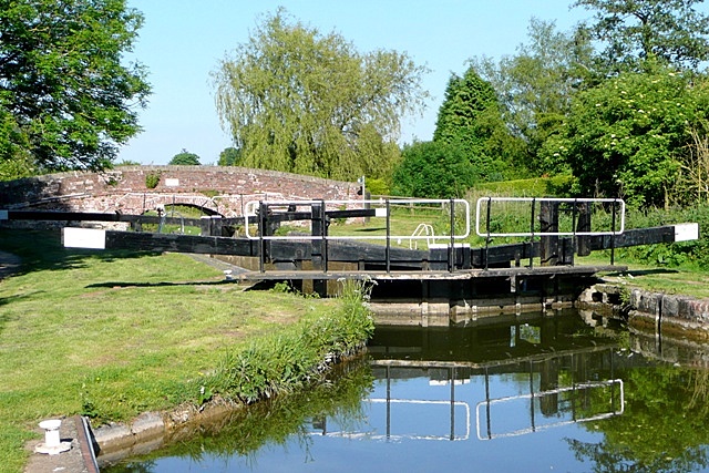
| Kennet and Avon Canal Walk | 75.8 miles (122 km) | A splendid waterside walk from the Thames at Reading, through Thatcham, Newbury, Hungerford, Great Bedwyn, Pewsey, Devizes, Bradford on Avon to Bath. Most of the walk follows the towpath making for an easy, relaxing walk. The route of the Kennet & Avon Canal takes you through some of the nation's best loved landscapes, including West Berkshire - an Area of Outstanding Natural Beauty - and the southern tip of the rolling Cotswolds. Highlights include the delightful Thatcham Discovery Centre, Caen Hill Locks (video below), Avoncliff Aqueduct, Claverton Pumping Station, numerous pretty canalside villages and the historic city of Bath. View Full Details>> | |
| Lambourn Valley Way | 21.7 miles (35 km) | Travel from Oxfordshire into Berkshire along the Lambourn Valley Way and enjoy woodland, parkland and a series of quaint towns and villages. The walk starts at the Bronze age fort at Uffington Castle and the distinctive prehistoric Uffington White Horse hill figure. From here you head south across the Lambourn Downs before following the River Lambourn through Lambourn, Boxford and Speen before a lovely stretch along the Kennet and Avon Canal takes you into Newbury. View Full Details>> | |
| Maidenhead Boundary Walk | 13 miles (21 km) | This circular walk takes you around the old boundary of Maidenhead. It runs for about 13 miles visiting the boundary stones, the River Thames and Maidenhead Thicket. The walk is an annual event allowing walkers to raise money through sponsorship for their favourite charities whilst enjoying a very interesting walk through some beautiful parts of the Berkshire countryside. It's a nice one do to though as a day walk at anytime of year in smaller groups. View Full Details>> | |
| Maidenhead Thicket | 1.6 miles (2.5 km) | Enjoy a short walk through the pretty Maidenhead Thicket located on the western outskirts of the town. There are miles of woodland walking trails with snowdrops, common spotted orchids and other wildflowers to see. You'll also visit the earth-banks and ditches of Robin Hood’s Arbour, a Scheduled Ancient Monument. The glade was used by outlaws who used the woods as a hideaway. The area attracts a variety of wildlife including butterflies, dragonflies and wetland birds. View Full Details>> | |
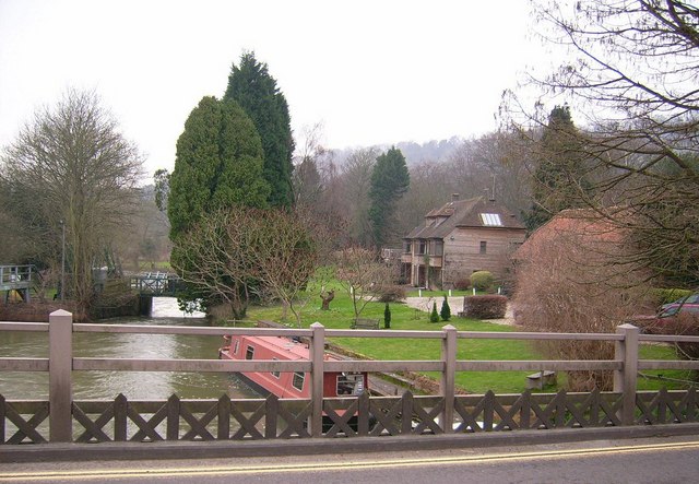
| Marlow to Hurley River Walk | 2.2 miles (3.6 km) | This easy riverside walk takes you from Marlow to Hurley along the Thames Path. The route runs for a distance of just over 2 miles on a flat waymarked path. As such it's perfect for a pleasant afternoon stroll. The walk starts on Marlow Bridge and heads east past the delightful Higginson Park which is worth a small detour. The riverside park is a popular local attraction with its pretty gardens and maze. The path continues to Temple Lock and Temple Lock Island. It's a noteworthy and scenic spot on the river, having first built by the Thames Navigation Commissioners in 1773. Shortly after passing the lock you come to Hurley Lock, another significant and picturesque lock on the Thames. Here the river splits into a number of channels with several weirs between wooded islands. Just to the south of the lock you can stroll into the small village of Hurley. You'll pass the historic remains of Hurley Priory, a former Benedictine priory which sits on the banks of the river. The long narrow nave of the priory church survives and is used as the Hurley parish church. It has mainly Norman windows and doorways. Also of note here is the Olde Bell Inn which dates from 1135. It is claimed to be the oldest hotel in the UK, and one of the oldest hotels in the world. The hotel is said to contain a secret tunnel leading to the village priory, which was used by John Lovelace, who was involved in the Glorious Revolution to overthrow King James II in the 17th century. The hotel was also used as a meeting point for Winston Churchill and Dwight D. Eisenhower during World War II. It's well worth exploring the whole site as other features include a kitchen garden, wildflower garden and a 16th century Tithe Barn. The inn is located close to Pinewood Studios and over the years, has seen a number of movie-star guests, including Mae West, Greta Garbo, Cary Grant, Errol Flynn, Elizabeth Taylor and Richard Burton. After exploring Hurley you can return to Marlow the same way or turn it into a circular walk by heading north from Temple lock into the countryside. You could then pick up Lower Pound Lane and follow it back to Marlow, via Higginson Park. View Full Details>> | |
| Newbury | 3.7 miles (6 km) | The delightful Berkshire town of Newbury is a great place for waterside walks along the rivers, canal and lakes you can find in the area. This short, easy stroll takes you along the Kennet and Avon Canal to the nearby Thatcham Discovery Centre. It's a lovely stretch of the canal with lots of wildlife to look out for in the nature reserve at the end of the walk. View Full Details>> | |
| Newbury to Kintbury and Hungerford Canal Walk | 8.7 miles (14 km) | Enjoy an easy stroll along the Kennet and Avon Canal from Newbury to Hungerford via the lovely village of Kintbury. It's a beautiful section of the canal with several pretty locks, old stone bridges and views of the River Kennet which runs alongside the canal. There's lots of wildlife to see too with kingfishers, mute swans, coots, moorhens and herons visitors to the area. At the end of the walk you can catch a train directly back to Newbury. View Full Details>> | |
| Pangbourne Circular Walk | 2.5 miles (4 km) | This nice 3 mile circular walk around the Berkshire village of Pangbourne includes waterside stretches along the River Thames and the River Pang. Start the walk from Panbourne train station and then head east along the Thames Path to Pangbourne Meadow. It's a delightful spot which is great for picnics and also hosts the annual Village fete in June. After passing along the pretty meadow the route turns south, following a footpath along the Sul Brook towards Sulham Woods. You can take a short detour south and visit the attractive woods which contain a series of waymarked trails. This walk heads west to meet up with the River Pang where you can follow a path along the river back to the village. To extend your walking in the area you could continue east along the Thames towards Purley on Thames and visit Mapledurham House. The estate is a lovely place for a stroll and includes a 15th century watermill. Around here you can also pick up the long distance Chiltern Way which runs through the area. If you head west along the path it will take you towards Basildon Park. Here you will find 4 different waymarked trails taking you through 400 acres of parkland and woodland. View Full Details>> | |
| Pilot Hill | 2.2 miles (3.5 km) | Climb to the highest point in Hampshire on this walk on the Berkshire/Hampshire border. The walk starts from the Inkpen Beacon car park about 2 miles north west of the hill. From here you pick up the Wayfarer's Walk and follow it past Walbury Hill and the pretty West Woodhay Down. At 297 m (974 ft) Walbury Hill is the highest point in Berkshire and South East England. At the summit you can enjoy more great views over the county and explore the Iron Age Hill fort of Walbury Camp. The route continues to Pilot Hill where you pick up the Brenda Parker Way to take you to the Hampshire village of Faccombe. View Full Details>> | |
| Reading Circular River Walk | 2.2 miles (3.5 km) | This circular walk takes in a number of waterways including the River Thames, the River Kennet and the Kennet and Avon Canal. You'll also visit the pretty Forbury Gardens, Reading Abbey and the historically significant Holy Brook. The walk starts near the train station on Reading Bridge, with views of Caversham on the opposite side of the river. You then follow the Thames path east, passing King's Meadow Park and the large Tesco. After about a mile you come to the River Kennet where you turn south west towards Blake's Lock. Next to the lock is the Riverside Museum which tells the story of Reading's two rivers. Exhibits include a gypsy caravan, a medieval mill wheel, turbine machinery, and seasonal art exhibits. Shortly after you come to Highbridge Wharf where you cross the river and turn north to the Holy Brook. The brook is a channel of the River Kennet parts of which are thought to have been created in mediaeval times by the monks of Reading Abbey to supply water mills and fish ponds. The brook takes you towards the ruins of Reading Abbey, founded by Henry I in 1121. You'll also pass the ruined former watermill of Abbey Mill on this section of the walk. The route then meanders into the attractive Forbury Gardens. Here you will find pretty flower beds, an attractive fountain and the noteworthy Maiwand Lion. The statue was erected in 1886 to commemorate the loss of 286 soldiers at the Battle of Maiwand in Afghanistan in 1880. Soon after the walk finishes back at Reading Bridge, near the train station. It's easy to extend your riverside walking in the area by picking up the long distance Thames Path or the Kennet and Avon Canal Walk. Heading west along the Thames will take you to the attractive Mapledurham House and the town of Pangbourne. View Full Details>> | |
| Reading to Henley | 9.9 miles (16 km) | Enjoy an easy riverside walk along the Thames Path on this walk from Reading to Henley-on-Thames via Sonning. The route runs for just over 9 miles so the walk should take about 3-4 hours. At the end of the walk you can catch a train or bus back to Reading. It's a lovely section of the river with pretty locks, little islands and great views of the surrounding countryside. The walk starts on Caversham Bridge in the centre of Reading. From here you head east along the riverside path to Sonning, passing the Caversham Lakes. These include the Redgrave-Pinsent Rowing Lake named after the Olympic rowers Sir Steve Redgrave and Sir Matthew Pinsent. The GB rowing squad and the Oxford University boat race team train on the lake. The route continues to the village of Sonning which is a particularly pretty area. Here you'll pass Sonning Lock and Sonning Bridge. The photogenic arch bridge was completed in 1775, to replace an earlier wooden bridge. The next stage takes you towards Shiplake where there's another lock, a series of little islands in the river and views over to the historic settlement of Wargrave on the opposite side of the water. View Full Details>> | |
| River Pang | 3.7 miles (6 km) | Enjoy an easy stroll along the River Pang and through Sulham Woods on this circular walk in Berkshire. The walk starts in Pangbourne and heads south along the river towards Tidmarsh. You can continue along the river towards Bradfield and Stranford Dingley but this route heads into Sulham Wood where there are some nice woodland trails. To extend your walk you can pick up the Thames Path and head along the river to Mapledurham House. Also nearby is the lovely Basildon Park where you will find 400 acres of parkland and woodland surrounding an 18th century mansion house. View Full Details>> | |
| Sandhurst | 1.2 miles (2 km) | This Berkshire based town is in an ideal spot for exploring the expansive Bracknell Forest and the River Blackwater Valley. View Full Details>> | |
| Slough | 10.6 miles (17 km) | This Berkshire based town is located in the Thames Valley near Reading and Windsor. View Full Details>> | |
| Snelsmore Common Country Park | 4 miles (6.5 km) | This circular walk takes you around the peaceful Snelsmore Common Country Park in Newbury and on into the surrounding countryside along public footpaths. View Full Details>> | |
| Streatley | 9.9 miles (16 km) | A circular walk from Streatley, climbing onto the Ridgeway Hills to the west of the town before looping round across Cholsey Downs and returning via the River Thames. There's fine views over the Chiltern Hills, a visit to an ancient Roman Temple and a nice easy riverside stretch to finish. Much of the route takes place on country lanes or bridle paths so could be completed on a cycle as well. The route starts in the village where you can pick up The Ridgeway National Trail. Follow the waymarked footpath north west and it will take you up to Thurle Down. Head west along the path and it leads to Warren Farm where you can turn north to Dean's Bottom and Lowbury Hill. The hill is notable as the site of a former Roman temple. After passing the temple the route turns north east along the Fair Mile which is a former Racehorse Gallops. Follow the trail east across Cholsey Downs and you can then descend to the riverside village of Moulsford. The final section then picks up a nice footpath along the River Thames to take you back into Streatley. Back in the village you can enjoy refreshments at the riverside Swan Inn. It's a great place to sit outside and enjoy river views and refreshments in the summer months. View Full Details>> | |
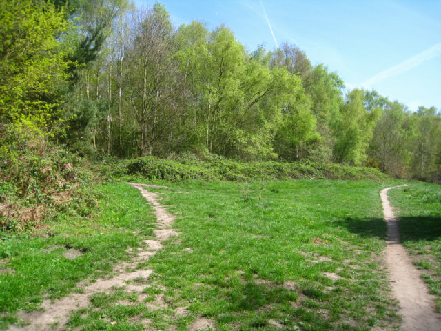
| Sulham Woods | 3.1 miles (5 km) | Follow a series of waymarked trails in this woodland area near Tidmarsh. There's lots of different trails to try with a mix of open countryside and woodland to enjoy. The site includes Broadleaved, mixed and yew woodland with lots of bluebells in the spring months. You can start your walk from Sulham village or from nearby Tidmarsh. There is a car park on Sulham Hill Road just to the east of the village. The Thames Path runs just to the north of Sulham. You can pick this up to extend your walking in the area. Just to the east you can pick up a waterside path running north along the River Pang to Pangbourne. View Full Details>> | |
| Swinley Forest | 6.8 miles (11 km) | This forest in Bracknell has miles of good walking trails and some good mtb trails as well. This circular route starts at the look out centre just to the south of Bracknell. From here you can follow trails heading south toward Bagshott Heath on the edge of Camberley. More trails then lead north past Rapley Lake and the Mill Pond before returning to the car park. View Full Details>> | |
| Test Way | 45.4 miles (73 km) | Travel through the Test Valley on this 45 mile walk through Hampshire and Berkshire. The route starts Eling Tide Mile near Totton heading north towards the Lower Test Nature Reserve and Romsey along the river. Here the river runs parallel to the old Andover Canal which you can explore on the Romsey Canal Walk. The route continues through Kimbridge and then onto the impressive National Trust owned Mottisfont Abbey. This 13th century Augustinian priory is surrounded by glorious grounds and is a major highlight on the trail. In this area you will also pick up the path along the old Sprat And Winkle Line railway which closed in 1964. This section is also suitable for cyclists. The path continues through Stockbridge, Wherwell and the pretty village of St Mary Bourne with its delightful thatched houses. This section also passes Harewood Forest and Danebury Hill Fort near Stockbridge. It's worth taking a a short detour to climb the hill and enjoy some splendid views over the Test Valley. The final section is a gradual climb through Hurtsbourne Tarrant and Linkenholt towards Inkpen Beacon and Walbury Hill in Berkshire where the trail finishes. View Full Details>> | |
| Thatcham Discovery Centre | 1.2 miles (2 km) | This delightful nature reserve in Thatcham is the perfect place for an easy waterside stroll in Berkshire. There are well laid out footpaths taking you to several lakes, reedbeds, along the Kennet and Avon Canal and to the Thatcham Community Orchard. There are very good facilities with a car park, bird hides, picnic area, a lakeside cafe and an excellent visitor centre with interactive wildlife and natural history displays. The reserve is a great place for wildlife. Look out for birds including fieldfare and redwing. The wildflowers attract various butterflies such as garden tiger, butterbur, waved black, holly blue, and gatekeeper. The reserve is also accessible by public transport. You could follow the canal from Thatcham train station which is located just a mile to the east. To extend your walk you could head south of the reserve to Bowdown Woods and Greenham Common. At Bowdown Woods Nature Reserve you will find exceptionally rich woodland and a variety of wildlife including birds, reptiles, dragonflies and butterflies. Greenham Common is covered in heather and gorse and has nice wide footpaths to follow. There's also wildflower filled grasslands and wetland areas which attract dragonflies and birdlife. The woods and common are located just half a mile south of Thatcham Discovery Centre. Just to the north east there's miles of trails in the expansive Bucklebury Common. View Full Details>> | |
| The Chase Nature Reserve | 1.6 miles (2.5 km) | This National Trust owned nature reserve has 143 acres of woodland to explore on a number of footpaths. It is located near to the villages of Woolton Hill and Enborne Row on the Hampshire/Berkshire border. The area consists of broadleaf and coniferous woodland with streams and lots of interesting flora and fauna to look out for. The snowdrops in early spring are particularly lovely. There is a car park just off station road which gives direct access to the trails. It's easy to extend your walking in the area by heading into the adjacent Penwood forest. You can also visit the real Downton Abbey and climb to the viewpoint on Beacon Hill at Highclere Castle just to the south of the reserve. Walbury Hill and Pilot Hill, the highest points in Berkshire and Hampshire respectivley, are also close by. View Full Details>> | |
| The Long Walk Windsor Castle | 8.7 miles (14 km) | This route in Windsor Great Park takes you along the famous 'Long Walk' to Windsor Castle. The path was laid out by King Charles II and the planting of its trees completed by William of Orange in the 1680s. You can walk the length of the tree lined path which runs from the castle to Snow Hill at a distance of 2.65 miles (4.26 km). Along the way you can look out for the resident Red Deer which are often seen in the area. The walk starts in the Savill Garden car park and takes you to Cumberland Lodge where you pick up the Three Castles Walk. Follow the long distance trail up to Snow Hill and the Copper Horse statue which marks the start of the Long Walk. The statue is of George III on horseback, and is said to represent the king as an emperor in the Roman tradition. From the elevated position of the hill there is a splendid view down the Long Walk to the castle. The path then descends to the Prince of Wales Pond and the Rush Pond before passing Doubles Gate and the Long Walk gate. Shortly after you come to the castle which is a royal residence founded by William the Conqueror in the 11th century. The castle is open to the public all year round and includes nice footpaths around the pretty gardens. View Full Details>> | |
| Three Downs Link | 101.9 miles (164 km) | This is a walking and cycling path following bridleways through Hampshire, Berkshire, Wiltshire and Oxfordshire. The trail runs from Exton, in Hampshire, to Dean Hill, near Hungerford. You will pass through open chalk downland, along rivers and canals and through some pretty villages.
The route passes through or near Basingstoke, New Arlesford, Malborough, Winchester, Newbury and Hungerford. It uses the South Downs Way National Trail for part of the route and also links with the Ridgeway National Trail. View Full Details>> | |
| Tri Lakes Country Park | 5 miles (8 km) | Also known as the Yately Lakes this lovely country park near Sandhurst has some nice waterside trails to try. The park has numerous pretty lakes, an animal park, an indoor play area and an excellent lakeside cafe. Sandhurst railway station is right next to the park so you can easily come by train. The route also visits the adjacent Horseshoe Lake and the Moor Green Lakes Nature Reserve where there are excellent bird watching opportunities. The Three Castles Path, the Blackwater Valley Footpath and the Wokingham Way all run past the park so you could pick up any of these trails to continue your walk. Yately Common Country Park is also nearby. View Full Details>> | |
| Valley Gardens | 3.4 miles (5.5 km) | Explore these stunning, colourful gardens located in Windsor Great Park. View Full Details>> | |
| Virginia Water Lake | 4.3 miles (7 km) | Enjoy a waterside walk around the beautiful Virginia Water in Windsor. The lake is located within the wonderful Windsor Great Park and is surrounded by woodland and gardens. A well defined walking path runs around the lake taking you to a number of interesting sites. You'll pass the 18th century ornamental cascade and the Leptis Magna Ruins - a Roman style temple built from columns and lintels brought from the ancient city of Leptis Magna in the early 19th Century. There is also a striking 100-foot high Totem Pole and the Virginia Water Pavilion built from wood from Windsor Great Forest. Right next to the lake are the stunning Valley Gardens. Here you'll find 250 acres of landscaped gardens and woodlands to explore using a series of well defined walking trails. You could also head further into Windsor Great Park to extend your walk. View Full Details>> | |
| Walbury Hill | 0.9 miles (1.5 km) | This walk takes you to the highest point in Berkshire at Walbury Hill near Hungerford. The hill summit stands at 297 m (974 ft) and proffers wonderful views over the surrounding Berkshire countryside. At the summit you will also find the Iron Age Hill fort of Walbury Camp. The hill is also a popular climb for cyclists with a number of bridleways to follow across Inkpen and Walbury Hill. The walk starts from the Inkpen Beacon car park and follows the Wayfarer's Walk to the hill. The car park is located about half a mile from the hill so it is a short climb. The Test Way long distance footpath also passes the hill so it's easy to extend this walk and climb to Combe Gibbet, Inkpen Beacon and Combe Wood. You could then return through Combe and turn it into a longer circular walk. You could also pick up the Wayfarer's Walk and head south east along a wonderful ridge top path to the nearby Pilot Hill, the highest hill in Hampshire. View Full Details>> | |
| Wayfarer's Walk | 70.8 miles (114 km) | Starting at the town of Emsworth on Chichester Harbour, follow this fabulous 70 mile walk through the heart of Hampshire and on into Berkshire. You will pass through the pretty Hampshire towns and villages of Cheriton, Droxford, Hambledon and New Arlesford while also experiencing the beautiful landscape and wildlife in this special county. The path is easy to follow as it is waymarked by metal and plastic disks attached to wooden and metal posts. Highlights on the route in include the National Trust owned Hinton Ampner stately home with its wonderful gardens and Watership Down - the delightful setting for Richard Adams' 1972 novel. The route passes the wonderful 5000 acre estate surrounding Highclere Castle in Hampshire. The house is famous as the location of period drama 'Downton Abbey' and includes the excellent viewpoint at Beacon Hill. There are also some lovely waterside stretches to enjoy at Cheriton along the River Itchen and along the River Arle at New Arlesford. The walk finishes at Walbury Hill, the highest point in Berkshire and the South East of England. View Full Details>> | |
| Wellington Country Park | 3.4 miles (5.5 km) | This 350 acre park is very popular with walkers with four splendid nature trails to follow. View Full Details>> | |
| Windsor Great Park | 7.6 miles (12.2 km) | A circular cycle or walk around the beautiful Windsor Great Park in Surrey. The park includes 5,000 acres of parkland, which includes a Deer Park, lakes, avenues, gardens, woodland and open grassland. National Cycle Network route 4 runs right through the park while the Three Castles Walk runs along the Long Walk Avenue where there are fabulous views of Windsor Castle. Cyclists please note that cycles are not permitted on the Long Walk. If you'd like to continue your exercise you could head to Virginia Water Lake. This large man made lake is located in the southern end of the park. It has a delightful walking trail running around its perimeter. Also of interest are the beautiful Valley Gardens. Located next to the lake they consist of 250 acres of landscaped gardens and woodlands and a series of well defined walking trails. You can also enjoy a walk along the Thames Path from Windsor to Dorney Lake. The lake has a nice surfaced cycling and walking trail to try. The Jubilee River also runs past Dorney. The river has a great waterside cycling and walking trail running from Maidenhead to Eton. Also of interest is our Windsor Circular Walk which will take you to Eton Wick and the famous Eton College. View Full Details>> | |
| Windsor River Walk | 6.1 miles (9.8 km) | Enjoy a riverside stroll along the Thames Path in Windsor and Eton on this lovely waterside walk in Berkshire. The circular walk visits Eton Wick, Eton Great Common, Eton College and Datchet. There's weirs, old bridges, lots of boats and splendid views of Windsor Castle, Eton College and the Berkshire countryside to enjoy. View Full Details>> | |
| Wokingham Way | 55.3 miles (89 km) | This long circular walk follows the Wokingham Borough unitary boundary visiting Reading, Bracknell and Henley-on-Thames. The walk takes you through Wokingham's most delightful areas including : the expansive Bracknell Forest, Tri Lakes Country Park and Wellington Country Park. View Full Details>> | |
| Wraysbury | 3.5 miles (5.6 km) | This pretty Berkshire village is located close to the River Thames near Windsor. View Full Details>> | |
| Yattendon | 5 miles (8 km) | A circular walk from Yattendon visiting the woodland to the north of the village and nearby Ashampstead. The pretty little Berkshire village is located about 7 miles north of Newbury. View Full Details>> |