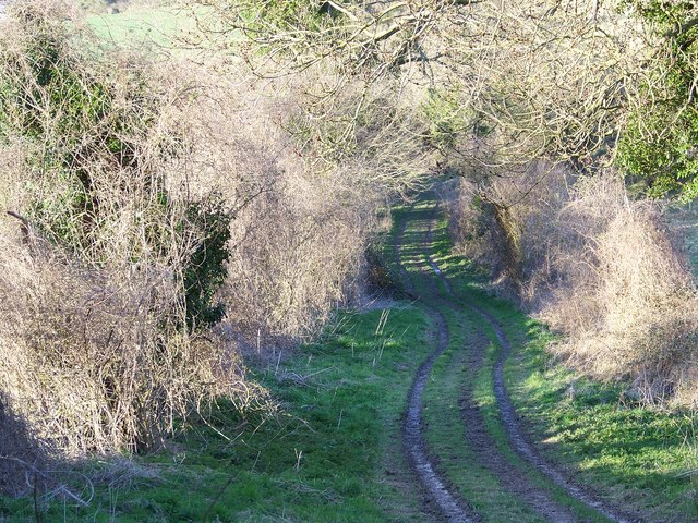
Coombe Bissett Down
![]()
![]() Enjoy a short walk around this pretty nature reserve near Salisbury. The reserve is located just a few miles south west of Sailsbury and has nice walking tracks to try. The area is a chalk downland valley with a variety of plants to enjoy such as delicate harebells, bee orchid, devil's-bit scabious and the burnt orchid. It's great for wildlife too with butterflies including Adonis blue, chalkhill blue and dingy skipper and birds including Yellowhammer, goldfinch, and skylarks. The reserve includes a mixture of grassland and woodland.
Enjoy a short walk around this pretty nature reserve near Salisbury. The reserve is located just a few miles south west of Sailsbury and has nice walking tracks to try. The area is a chalk downland valley with a variety of plants to enjoy such as delicate harebells, bee orchid, devil's-bit scabious and the burnt orchid. It's great for wildlife too with butterflies including Adonis blue, chalkhill blue and dingy skipper and birds including Yellowhammer, goldfinch, and skylarks. The reserve includes a mixture of grassland and woodland.
There are some slopes in the reserve so some climbing is required. You are rewarded with splendid views over the surrounding countryside of the Cranborne Chase AONB.
You can also enjoy a walk around the pretty little village of Coombe Bissett. There is a nice pub called the Fox and Goose, a church dating from the 12th century and lovely thatched cottages. The River Ebble also runs through the village.
Postcode
SP5 4LE - Please note: Postcode may be approximate for some rural locationsCoombe Bissett Down Ordnance Survey Map  - view and print off detailed OS map
Coombe Bissett Down Open Street Map  - view and print off detailed map
Coombe Bissett Down OS Map  - Mobile GPS OS Map with Location tracking
Coombe Bissett Down Open Street Map  - Mobile GPS Map with Location tracking
Further Information and Other Local Ideas
Just to the north you can pick up the Avon Valley Path and head into Salisbury to visit the famous cathedral. Here you can pick up the Salisbury Circular Walk to further explore the area.
Just a few miles south east of the city you can enjoy a climb to Pepperbox Hill. The National Trust owned area includes a distinctive 17th century and some fine views over the Wiltshire countryside to the city. Near here there's also Figsbury Ring. The Iron Age hill fort is another National Trust owned site with good footpaths around the ramparts and more tremendous views.
Just west is Broad Chalke where there's a Norman church, pretty watercress beds and views of the River Ebble which meanders through the picturesque village. Just to the west of Broad Chalke is the neighbouring village of Ebbesbourne Wake where you will find two lovely old pubs, a 14th century church and the walk to Prescombe Down.
For more walking ideas in the area see the Wiltshire Walks and Cranborne Chase Walks pages.
Cycle Routes and Walking Routes Nearby
Photos
Donkey Field in the village. The field is named after two donkeys, Jack and Jane, owned by the Widow Rideout, the village carrier, who operated the Coombe Bissett Express to Salisbury in the mid 19th century.


