Craig Cerrig-Gleisiad a Fan Frynych
![]()
![]() Enjoy a walk through this spectacular glacial National Nature Reserve and climb to the summit of Fan Frynych on this challenging walk in the Brecon Beacons. The reserve can be easily accessed from a lay-by on the A470 from which the walk starts. Soon you will be exploring this wonderful natural amphitheatre with imposing craggy cliffs created during the Ice Age, 20000 years ago. The reserve contains rare arctic-alpine plants such as purple saxifrage and mossy saxifrage. There is also an abundance of wildlife to look out for including Peregrine falcons, merlin, red kite and a variety of butterflies. The area also contains woodland, streams and an Iron Age Hillfort. From the 629 m (2,064 ft) summit of Fan Frynych there are splendid views over the national park.
Enjoy a walk through this spectacular glacial National Nature Reserve and climb to the summit of Fan Frynych on this challenging walk in the Brecon Beacons. The reserve can be easily accessed from a lay-by on the A470 from which the walk starts. Soon you will be exploring this wonderful natural amphitheatre with imposing craggy cliffs created during the Ice Age, 20000 years ago. The reserve contains rare arctic-alpine plants such as purple saxifrage and mossy saxifrage. There is also an abundance of wildlife to look out for including Peregrine falcons, merlin, red kite and a variety of butterflies. The area also contains woodland, streams and an Iron Age Hillfort. From the 629 m (2,064 ft) summit of Fan Frynych there are splendid views over the national park.
The Brecon Beacons Way also passes the reserve so you could pick this up to continue your walk.
Postcode
LD3 8NL - Please note: Postcode may be approximate for some rural locationsCraig Cerrig-Gleisiad a Fan Frynych Ordnance Survey Map  - view and print off detailed OS map
Craig Cerrig-Gleisiad a Fan Frynych Open Street Map  - view and print off detailed map
Craig Cerrig-Gleisiad a Fan Frynych OS Map  - Mobile GPS OS Map with Location tracking
Craig Cerrig-Gleisiad a Fan Frynych Open Street Map  - Mobile GPS Map with Location tracking
Cycle Routes and Walking Routes Nearby
Photos

The summit trig point on Fan Frynych with the Brecon Beacons in the distance.

Craig Cerrig-gleisiad from the cwm below Fan Frynych

Craig Cerrig Gleisiad. A National Nature Reserve, home to a rich variety of arctic-alpine flora.

Pool above Craig Cerrig Gleisiad. There are two pools marked in this square. This is the southernmost of them, visible as you walk the path along the rim of Craig Cerrig Gleisiad. This pool is larger and more open than the north one allowing birds to swoop low along it in search of insects.

Glyn Tarell From the Path up Craig Cerrig-gleisiad

A view up the Nant Cwm-du. The watercourse drops here over slabs of Old Red Sandstone.

Old workings on Fan Frynych
The Beacons from Fan Frynych. Pen y Fan Horseshoe Walk and Corn Du viewed from Fan Frynych across the Tarell valley.
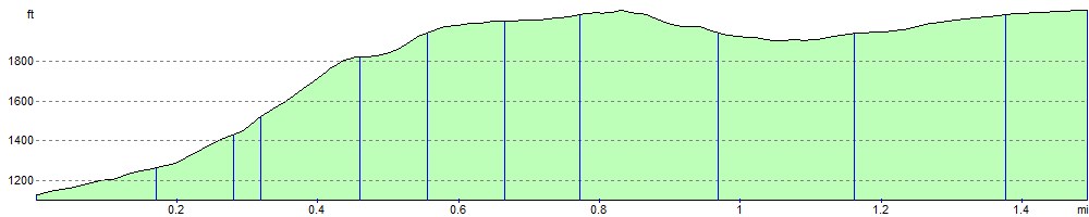
Elevation Profile