Pen y Fan Horseshoe Walk
![]()
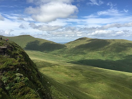
![]() This fantastic horseshoe ridge walk visits Pen Y Fan, Corn Du and the Cribyn in the Brecon Beacons National Park. It's a challenging hike but you will be rewarded with some simply stunning views over the surrounding peaks and reservoirs.
This fantastic horseshoe ridge walk visits Pen Y Fan, Corn Du and the Cribyn in the Brecon Beacons National Park. It's a challenging hike but you will be rewarded with some simply stunning views over the surrounding peaks and reservoirs.
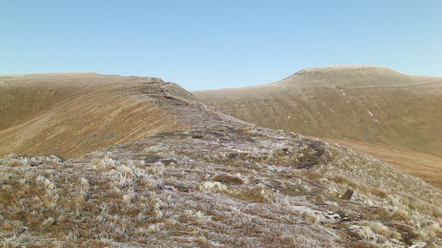
The walk starts from the car park in Taf Fechan Forest and heads north to the beautiful Lower Neuadd Reservoir. You then climb west onto the Craig Fan Ddu ridge and head north with fantastic views toward Pen y Fan and Corn Du.
The route climbs to the summit of Corn Du at 873 m (2,864 ft). Here you will find a well structured Bronze Age cairn and views to the Black Mountain range and Fforest Fawr.
You continue a short distance to the 886 m (2,907 ft) summit of Pen Y Fan which is the highest peak in south Wales. There's more panoramic views here to the Bristol Channel, Carmarthen Bay, Swansea Bay, the Gower Peninsula, the Black Mountains, the Cambrian Mountains, Exmoor and the Clee Hills in South Shropshire can be seen.
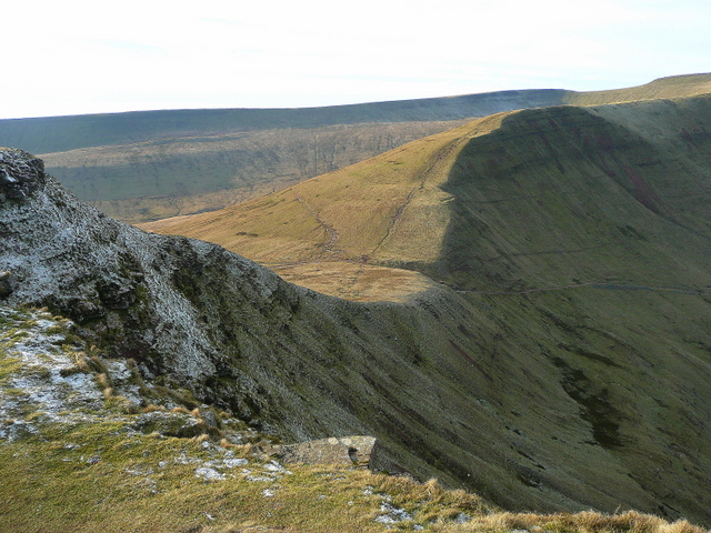
After taking in the views the route descends along Craig Cwm Sere to the Cribyn, standing at a height of 795 m (2,608 ft). The impressive views include Mynydd Epynt, the town of Brecon and the Cambrian mountains beyond. Look out for mountain birds including peregrine falcons, common buzzards and the red kite in this area.
You continue the descent along Craig Cwm Cynwyn toward Bwlch Y Fan and Fan-y-Big. The final section descends past Tor Glas and the Upper and Lower Neuadd Reservoirs to the car park.
To continue your walking in the area you can try our shorter alternative route to Pen Y Fan. It starts from the Pont ar Daf car park to the west of the mountain and is not quite as challenging.
Also nearby is the climb to Fan Y Big and the Cribyn which starts from the lovely Blaen y Glyn Waterfalls.
Pen y Fan Horseshoe Walk Ordnance Survey Map  - view and print off detailed OS map
Pen y Fan Horseshoe Walk Open Street Map  - view and print off detailed map
Pen y Fan Horseshoe Walk OS Map  - Mobile GPS OS Map with Location tracking
Pen y Fan Horseshoe Walk Open Street Map  - Mobile GPS Map with Location tracking
Further Information and Other Local Ideas
Head north from the mountain car park and you can visit another highlight of the area at Llyn Cwm Llwch. It's a beautiful place and considered the best preserved glacial lake in South Wales.
For more walking ideas in the area see the Brecon Beacons Walks page.
Cycle Routes and Walking Routes Nearby
Photos
Lower Neuadd Reservoir. Merthyr Tydfil Corporation constructed Lower Neuadd Reservoir in 1884. To facilitate its construction, a temporary railway line was constructed from Torpantau halt on the Brecon & Merthyr Junction railway. The top water level at 1413ft. In the background is Craig Fan Ddu.
Corn Du and Pen y Fan. The nearest peak, Corn Du, can be bypassed by taking the right hand path directly to Pen y Fan.
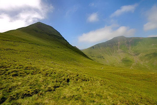
Corn Du and Pen y Fan from Bwlch Duwynt. Corn Du on the left and Pen y Fan on the right. Once you have reached one summit, it is an easy task to walk down and up again to the other one. These are the two highest peaks in the Brecon Beacons. Pen y Fan means the top peak, a fitting name since it is the highest point in South Wales.


