Darley Dale
![]()
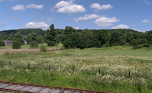
![]() Enjoy a walk through the pretty Darley Dales on this waterside route in the lovely Derbyshire Dales. The walk runs along the River Derwent from Darley Bridge to the village of Rowsley, a few miles to the north. It follows the waymarked Derwent Valley Heritage Way which also runs along the heritage Peak Railway. You'll pass the train stations at Darley and Rowsley where you should see some classic old steam trains. The route finishes at the village of Rowsley where the River Wye flows into the River Derwent. It is notable as being on the border of the Peak District National Park which runs through the village west of the River Wye and immediately to the north of Chatsworth Road. After exploring the village the route returns the same way, though you could return part of the way on the Peak Railway. Back in Darley Dale you could explore Whitworth Park where there's ten acres of landscaped grounds with pathways along tree-lined avenues and a small lake.
Enjoy a walk through the pretty Darley Dales on this waterside route in the lovely Derbyshire Dales. The walk runs along the River Derwent from Darley Bridge to the village of Rowsley, a few miles to the north. It follows the waymarked Derwent Valley Heritage Way which also runs along the heritage Peak Railway. You'll pass the train stations at Darley and Rowsley where you should see some classic old steam trains. The route finishes at the village of Rowsley where the River Wye flows into the River Derwent. It is notable as being on the border of the Peak District National Park which runs through the village west of the River Wye and immediately to the north of Chatsworth Road. After exploring the village the route returns the same way, though you could return part of the way on the Peak Railway. Back in Darley Dale you could explore Whitworth Park where there's ten acres of landscaped grounds with pathways along tree-lined avenues and a small lake.
Darley Dale is located very close to the popular town of Matlock. You could follow the river trails south to visit the town. Also nearby is the walk across Stanton Moor to the interesting Bronze Age Nine Ladies Stone Circle.
The circular Birchover Walk starts from the nearby village. It visits the moor and stone circle before heading to Darley Bridge. The popular Robin Hood's Stride can also be visited near the village. The splendid rock formation is one of the highlights of the area. There's also the Bronze Age Nine Stones Close Stone Circle just north of the rocks.
Darley Dale Ordnance Survey Map  - view and print off detailed OS map
Darley Dale Open Street Map  - view and print off detailed map
Darley Dale OS Map  - Mobile GPS OS Map with Location tracking
Darley Dale Open Street Map  - Mobile GPS Map with Location tracking
Further Information and Other Local Ideas
The circular Rowsley Walk starts from the nearby village and visits Bakewell, Chatsworth Park and the 11th century Haddon Hall.
Rowsley is home to the modern Peak Shopping Village where there's a good range of stores and plenty of eateries for refreshment. In this area you can also visit the neighbouring village of Beeley where you can explore the expansive Beeley Moor and visit the village's excellent 18th century coaching inn. Just to the north east of the moor there's the fascinating Hob Hurst's House. Here you will find an ancient Bronze Age burial mound and fine views from Harland Edge.
Head a few miles south west and you could pick up the circular Brassington Walk and visit Middleton Top and the expansive Carsington Water.
For more walking ideas in the area see the Peak District Walks and White Peak Walks pages.


