Darwen Tower Circular Walk
![]()
![]() This circular walk takes you up Darwen Hill to Jubilee Tower from Tockholes in Lancashire. The short climb to the tower gives great views over the surrounding moorland and reservoirs. The Bowland Fells and the mountains of Ingleborough and Whernside make a wonderful backdrop. On a clear day you can also see North Yorkshire, Morecambe Bay, Blackpool Tower, the Lake District and the Isle of Man.
This circular walk takes you up Darwen Hill to Jubilee Tower from Tockholes in Lancashire. The short climb to the tower gives great views over the surrounding moorland and reservoirs. The Bowland Fells and the mountains of Ingleborough and Whernside make a wonderful backdrop. On a clear day you can also see North Yorkshire, Morecambe Bay, Blackpool Tower, the Lake District and the Isle of Man.
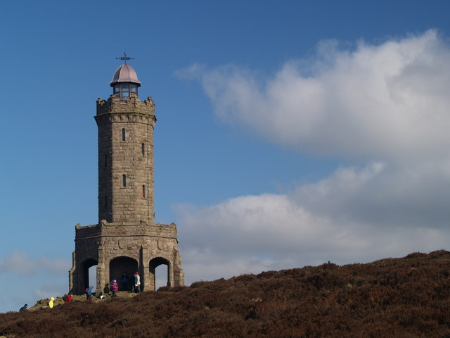
The walk starts from the car park at Tockholes and follows good footpaths to the hill summit and the tower. You can then climb the 85 feet high tower on the stone spiral staircase inside. The tower was built in the late 19th century to commemorate Queen Victoria's Diamond Jubilee.
The route descends along the Witton Weavers Way, passing the attractive Sunnyhurst Hey and Earnsdale Reservoirs before returning to the car park. At Earnsdale reservoir you will find the pretty Sunnyhurst Woods. You could extend the walk by exploring the 85 acres of woodland with its streams and wide variety of birdlife.
There's also nice footpaths around Roddlesworth Reservoir and the adjacent Rake Brook Reservoir.
Darwen Tower Ordnance Survey Map  - view and print off detailed OS map
Darwen Tower Open Street Map  - view and print off detailed map
*New* - Walks and Cycle Routes Near Me Map - Waymarked Routes and Mountain Bike Trails>>
Darwen Tower OS Map  - Mobile GPS OS Map with Location tracking
Darwen Tower Open Street Map  - Mobile GPS Map with Location tracking
Pubs/Cafes
The Royal Arms is the ideal place for some post walk refreshments. The pub was originally built in 1860 as two cottages to house weavers that worked the local Hollinshead Mill. Shortly after they were knocked together to make an Ale house for the thirsty weavers after their long shifts. Inside it retains much of its old world charm with original stone walls, real fires, flagged and wooden floors. In the warmer months you can relax outside in the garden area. The pub has a good menu and fine selection of ales too. You can find them near to the visitor centre at the start/end of the route.
Also at the start of the walk there's a nice cafe in the Roddlesworth Information Centre. They do delicious home made pies and have a unique bird watching facility in the cafe. You can view the birds through one way glass with regular visitors such as greater spotted woodpeckers, nuthatches and chaffinches to see. The centre also has a wealth of information on the area with a set of handy leaflets on walks around the area.
Dog Walking
The woods and moors are ideal for fit dogs and the Royal Arms pub is also dog friendly.
Further Information and Other Local Ideas
The tower is often approached from the nearby town of Darwen. One nice option is to start in Bold Venture Park where there are some nice trails to start the walk. The tower is not too far from the western end of the park.
The Blackburn Walk visits the tower from the train station of the nearby town. It follows the Leeds and Liverpool Canal and the Witton Weavers Way to the tower before heading to Sunnyhurst Woods and Darwen train station.
A few miles north west of the tower you'll find a historical highlight of the area at Hoghton Tower. The fortified manor house dates from the 16th century and takes its name from the de Hoghton family, its historical owners since at least the 12th century. It's open to the public on certain days and includes lovely grounds and gardens to explore. You can follow the Witton Weavers Way north west for a few miles to reach the castle. There are more excellent views to enjoy from the elevated position of the house.
Just to the west there's the climb to Great Hill. It's a quiet and remote spot of the moors, rising to a height of 383 metres at the high point.
For more walking ideas in the area see the Lancashire Walks and the West Pennine Moors Walks pages.
Cycle Routes and Walking Routes Nearby
Photos
Darwen or Jubilee tower. The tower, built to celebrate Queen Victoria's diamond jubilee. The first sod was laid in 1897 and the official opening was 1898. From the top viewing platform can be seen the peaks of the Yorkshire dales, the lakeland and Welsh mountains, and west to the Irish sea.
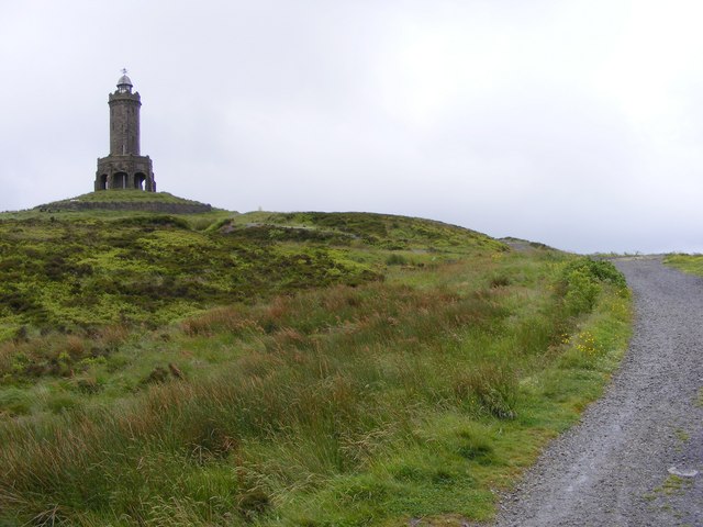
Darwen Moor. The wooded valley of Stepback Brook cuts the moor in two. Darwen Tower (in the next square) can be seen in the distance.
The moors around the area offer rich opportunities for wildlife spotting. Red Grouse can be seen throughout the year, adding a splash of colour to the rugged landscape. In the rough pasture, you might also encounter Curlew and Meadow Pipit, which are often found in these habitats.
Peregrine Falcons are sometimes seen soaring high above, showcasing their impressive flight skills. In spring, keep an eye on the drystone walls for Wheatear, which are known to nest in these stone structures. These walls also provide habitat for various small creatures, including mice, weasels, and the Common Lizard. The diverse wildlife adds to the natural charm and appeal of the moorland environment.
Royal Arms, Tockholes. The 19th century pub is located near the car park at the start/finish of the walk.


