Denstone Railway Walk

 This route uses a section of the Churnet Valley Railway Path and the Staffordshire Way to create a circular walk around the Staffordshire based village. On the way you'll pass Alton Towers, the peaceful woods at Dimmingsdale and enjoy views of the River Churnet.
The walk starts at Denstone Hall and follows the old railway line north along the river towards Crumpwood Weir. The trail continues west past the Alton Towers Theme Park before passing Mather's Wood and arriving at Oakamoor.
The trail then heads south to Dimmingsdale where there are some nice woodland trails and a series of picturesque ponds. Continue south east and you will pass through the village of Alton before picking up Saltersford Lane and following it back towards Denstone.
Postcode
ST14 5HF - Please note: Postcode may be approximate for some rural locationsDenstone Ordnance Survey Map  - view and print off detailed OS map
Denstone Open Street Map  - view and print off detailed map
Denstone OS Map  - Mobile GPS OS Map with Location tracking
Denstone Open Street Map  - Mobile GPS Map with Location tracking
Pubs/Cafes
Denton Hall at the start has an award winning cafe where you can enjoy refreshments after your walk. They have outdoor seating with views over the Staffordshire countryside. Inside there's a cosy log burner on colder days.
On the walk The Alton Bridge Hotel is a nice place to stop for refreshments. There's a lovely garden area next to the river where you can sit out and relax on finer days. You can find them at postcode ST10 4BX for your sat navs.
Dog Walking
The railway path, the woodland and country trails are ideal for dog walking. The Alton Bridge Hotel mentioned above is also dog friendly.
Further Information and Other Local Ideas
For an alternative walk in the valley try the Churnet Valley Walk which runs from Froghall to Cheddleton where you will find the Churnet Valley Railway centre. There's lots of information on the railway and an interesting museum here.
If you follow the Staffordshire Way south from the village you can visit the Rocester Roman Fort and the town of Uttoxeter. Heading north east will take you to the weir at Norbury and the village of Ellastone. Here you'll find a 16th century church, the site of a 12th century ruined abbey and fine old inn dating from the 1850s.
Just a couple of miles south west of Denstone you will find the remains of the 12th century Croxden Abbey. There are nice trails to follow around the substantial abbey ruins with information boards detailing the history of the site. It's an interesting area and run by English Heritage with no charge for your visit.
For more walking ideas in the area see the Staffordshire Walks page.
Cycle Routes and Walking Routes Nearby
Photos
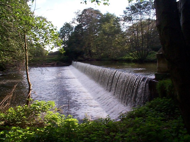
Crumpwood Weir was built in the early 1800's to take the Uttoxeter Canal across the River Churnet. Boats dropped through Carrington's lock to join the river before being pulled across the top of the weir and back into the canal via a flood lock on the other side. The Uttoxeter Canal opened in 1811 but was never profitable. It was closed in 1849, when much of its route was filled in to accommodate North Staffordshire Railway.
Oakamoor to Denstone Greenway in the Snow. The former trackbed of the North Staffordshire Railway is now classed as a "greenway" between Denstone and Oakamoor and is open to walkers. The "ditch" to the right is a remnant of the Uttoxeter Canal, closed in 1849 and partly filled-in to make way for the railway.


