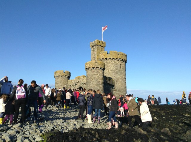
Douglas Coastal Walk and the Tower of Refuge
 This walk takes you along the coastal path in Douglas with fine views out to the historic castle on St Mary's Isle in Douglas Bay.
The tower was constructed to provide shelter to mariners wrecked around the ofter trecherous waters of St Mary's Isle. It is possible to walk out to the Tower of Refuge at low tides at certain times of the year although there is the risk of being stranded as the tide comes in. The best way are the organised walks by the local council with more details on the more information website link. See the video below to get an idea of the walk.
This walk starts at the pier and takes you along the promenade, passing the pretty Douglas Promenade gardens and Douglas beach on the way. The route is also known as the promenade cycleway so suitable for cyclists too.
The route uses part of the Raad ny Foillan - Isle of Man Coastal Path which takes you around the whole island on foot. You could extend your walk by following the path north to visit Groudle Glen. One of the Manx National Glens this area includes the popular Groudle Glen Railway, a delightful miniature railway run by local enthusiasts.
Please click here for more information
Douglas Open Street Map  - view and print off detailed map
Douglas Open Street Map  - Mobile GPS Map with Location tracking
Walks near Douglas
- Raad ny Foillan - Isle of Man Coastal Path - Follow the Isle of Man Coast path along the beautiful Manx coast and enjoy some stunning coastal scenery
- Dhoon Glen - This walk visits a delightful wooden glen on the east coast of the Isle of Man, a few miles south of Ramsey.
- Snaefell - Climb to the peak of the highest mountain on the Isle of Man on this short climb from the Bungalow station
- Groudle Glen - This walk visits Groudle Glen just north of Douglas on the Isle of Man.
- Glen Maye - This pretty glen on the Isle of Man is perfect for a peaceful stroll in beautiful surroundings


