Dow Crag and Seathwaite Tarn Walk
![]()
![]() A challenging circular walk in the Western Lakes which visits the pretty Seathwaite Tarn and the fine viewpoint at Dow Crag.
A challenging circular walk in the Western Lakes which visits the pretty Seathwaite Tarn and the fine viewpoint at Dow Crag.
The walk starts from the little village of Seathwaite in the Duddon Valley area of the South Lakeland District. Park at the car park in the village and start by heading north east up to the Walna Scar Road. The path then climbs to Walna Scar, Brown Pike, Blind Tarn and Buck Pike before coming to Dow Crag. The summit stands at a height of 778 m (2,552 ft) with great views of the Scafells, Skiddaw and the Helvellyn range. You are also just above the lovely Goat's Tarn and Blind Tarn which are very photogenic.
After taking in the views you then descend to Seathwaite Tarn where there's a nice path along the western side of the water. The path then continues the descent to pretty Tarn Beck, which you follow back into Seathwaite.
This walk is located very close to the Old Man of Coniston where you can extend your exercise. It lies just to the east of the Dow Crag summit and can be reached by following paths past Goat's Water from Goat's Hawse. See our Circular Walk around Coniston for more details. The 7 mile hike visits the Old Man summit before heading to Dow Crag, Buck Pike, Brown Pike and Walna Scar.
Just to the west is the lovely climb to Harter Fell where there are more great views over the Duddon Valley and woodland trails through the adjacent Dunnerdale Forest.
Dow Crag and Seathwaite Tarn Ordnance Survey Map  - view and print off detailed OS map
Dow Crag and Seathwaite Tarn Open Street Map  - view and print off detailed map
Dow Crag and Seathwaite Tarn OS Map  - Mobile GPS OS Map with Location tracking
Dow Crag and Seathwaite Tarn Open Street Map  - Mobile GPS Map with Location tracking
Pubs/Cafes
The 16th century Newfield Inn is located at the start of the route in Seathwaite village. The cosy interior includes a log burner to warm you up on colder days. Outside there's a nice garden area where you can watch the birds at the bird feeders and enjoy views of the surrounding fells. They do really nice food and have a good selection of Cumbrian beers. The pub is dog friendly and also provides accommodation if you need to stay over. You can find the pub at postcode LA20 6ED.
Further Information and Other Local Ideas
The tarn is located just to the west of the River Duddon in the Duddon Valley. You can try our riverside circular walk here and also try some of the peaceful woodland trails in the adjacent Dunderdale Forest. The car park at the forest also makes an alternative starting point for the route.
For more walking ideas in the area see the Lake District Walks page.
Cycle Routes and Walking Routes Nearby
Photos
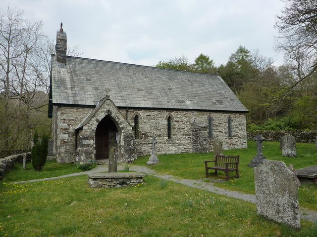
Holy Trinity Church, Seathwaite. The church is recorded in the National Heritage List for England as a designated Grade II listed building. The 19th century church was built on the site of an earlier church. For 67 years the curate of that church had been Robert Walker, who was made famous by the poet William Wordsworth. Wordsworth called him "Wonderful Walker", and made reference to him in his Duddon Sonnets and in the poem The Excursion.
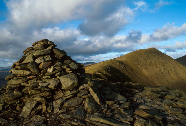
Stone shelter and Walna Scar Track. Walna Scar is the highest of Wainwright's The Outlying Fells of Lakeland. Geologically, Walna Scar contains a rich seam of distinctively striped slate which was quarried until the early 20th century. The quarry can still be seen today on the slopes overlooking the Duddon Valley.
Bottom end of Coniston Water from Dow Crag. The name Dow Crag originally applied specifically to the eastern face which looks down upon the tarn of Goat's Water. From the summit the view south and west to the coast is excellent, but much of Lakeland is blotted out by the flanks of the Coniston range. The Scafells are far enough west to put in an appearance and Skiddaw and the Helvellyn range can be seen through Fairfield and Levers Hawse.
Seathwaite Tarn. The dam is almost 400 yards (366 m) long and is concrete cored with slate buttresses, the resulting depth of the tarn being around 80 feet (24 m). The lake is located to the south of Grey Friar Fell and to the west of Brim Fell (on the ridge between The Old Man of Coniston and Swirl How) and north east of the village of Seathwaite on the east of the Duddon Valley.


