Dungloe River Walk
![]() This circular walk explores the area around the town of in County Donegal.
This circular walk explores the area around the town of in County Donegal.
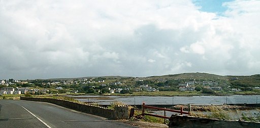
On the way you'll enjoy riverside paths along the Dungloe River and pass close to Long Lough at the eastern end. The eastern section runs along Dungloe Lough and Cope Mountain. There's lovely views across the water to the countryside and hills in the distance. There's also a delightful fairy village with woodland trails and sculptures.
Dungloe River Walk Open Street Map  - view and print off detailed map
Ireland Walking Map - View All the Routes in the Country>>
*New* - Walks and Cycle Routes Near Me Map - Waymarked Routes and Mountain Bike Trails>>
Dungloe River Walk Open Street Map  - Mobile GPS Map with Location tracking
Further Information and Other Local Ideas
To the north east you could try the Muckish Railway Walk near Falcarragh. This trail takes you along the old Letterkenny to Burtonport railway line in the Derryveagh Mountains. Near here you can also pick up the Donegal Boardwalk and enjoy a fine coastal walk along the lovely Sheephaven Bay. Near here there's more nice waterside paths along Lough Salt. You can also climb to Loughsalt mountain for some fine views over the lake and surrounding area.
Also north east is the wonderful Poison Glen in Dunlewey. The glen includes some beautiful scenery with a pretty stream, an old arched footbridge, spectacular mountain views and some splendid flora and fauna to see. The glen is also close to the stunning Glenveagh National Park where you could pick up the Glenveagh Bridle Path. The shared cycling and walking path will take you through the glen to the historic Glenveagh Castle where you can explore the beautiful gardens and learn about the castle's fascinating history.
To the north there's Bloody Foreland where there are fine cliff top trails and views of nearby islands such as Tory Island.
In nearby Burtonport you can catch the ferry to Arranmore Island where there are some lovely, peaceful walking trails and lots of wildlife to see.


