Dyfi Forest Walks and Mtb
![]()
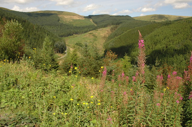
![]() This expansive forest is located in the Dyfi Valley area of the Snowdonia National Park.
This expansive forest is located in the Dyfi Valley area of the Snowdonia National Park.
There's miles of good mountain biking and walking trails to explore the area. In the forest there are wonderful views of the beautiful Afon Angell valley to enjoy as well. There's also lots of interesting flora and fauna with fungi, butterflies and a variety of woodland birds to see.
Part of this loop uses a section of the Dyfi Valley Way which runs through the forest. You could extend your exercise by following it to nearby Dinas Mawddwy or Machynlleth. The towering Cadair Idris lies to the west.
See the video below for an example of the mtb trails in the forest.
Postcode
SY20 9QP - Please note: Postcode may be approximate for some rural locationsDyfi Forest Ordnance Survey Map  - view and print off detailed OS map
Dyfi Forest Open Street Map  - view and print off detailed map
Dyfi Forest OS Map  - Mobile GPS OS Map with Location tracking
Dyfi Forest Open Street Map  - Mobile GPS Map with Location tracking
Pubs/Cafes
Just to the south west there's the pleasant riverside village of Corris to visit. The village includes the heritage Corris Railway and pleasant walks through the River Dulas Valley. At the nearby Aberllefenni Quarry you can explore one of the oldest working slate quarries in Wales while enjoying some fine views over the area from the high points.
It's also a good place for refreshments with the noteworthy Slater’s Arms pub. The inn is named after the historical primary trade of the townsfolk of Corris. The Grade II listed pub has a charming old interior with traditional features such as slate flooring and a decorative mantelshelf above a large inglenook fireplace.
They serve good quaity food and also provide accommodation if you would like to stay in the area. You can find them on Bridge Street at postcode SY20 9SP for your sat navs. The pub is also dog friendly.


