Epsom Downs Circular Walk
![]()
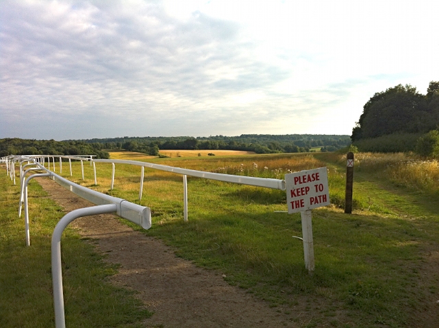
![]() This circular walk takes you around Epsom Downs racecourse in Surrey. The downs consist of attractive chalk downland, grassland and woodland. You'll also enjoy wonderful views across the famous racecourse which hosts the Epsom Derby and the Oaks.
This circular walk takes you around Epsom Downs racecourse in Surrey. The downs consist of attractive chalk downland, grassland and woodland. You'll also enjoy wonderful views across the famous racecourse which hosts the Epsom Derby and the Oaks.
You can start your walk from the Tattenham Corner car park at the northern end of the downs. Tattenham Corner train station is also very close to the start of the walk so you can easily visit by public transport. The footpath then passes through the course, heading across Walton Downs towards Walton on the Hill. The route then skirts the edge of Banstead Heath before returning to the car park via Tadworth Farm.
The area is great for wildlife spotting. Look out for Skylarks and various butterflies including the rare Chalk Hill Blue.
The walk can be extended by further exploring Banstead Heath which is criss crossed with miles of footpaths.
There's lots of good options if you'd like to extend your walking in the area. A couple of miles to the north west you'll find Epsom Common and Ashtead Common National Nature Reserve. Both of these large open spaces have nice walking trails to follow. The Thames Down Link passes through Ashtead Park just to the west of the downs.
National Cycle Network Route 22 crosses part of the downs so you can bring your bike too.
You can explore large sections of the racecourse using the google street view link below.
Postcode
KT18 5LQ - Please note: Postcode may be approximate for some rural locationsEpsom Downs Ordnance Survey Map  - view and print off detailed OS map
Epsom Downs Open Street Map  - view and print off detailed map
Epsom Downs OS Map  - Mobile GPS OS Map with Location tracking
Epsom Downs Open Street Map  - Mobile GPS Map with Location tracking
Explore the Area with Google Street View 
Pubs/Cafes
The Tattenham Corner pub is located at the start/end of the route and a good place for some post walk refreshments. They do good food and have a large garden area with views of Epsom Downs. It's a nice place to relax on warmer days. You can find it at a postcode of KT18 5NY.
Dog Walking
The downs are a great place for a dog walk and you'll probably see plenty of other owners with their pets on your visit. You are advised to please keep them on leads in the morning when the horses exercise on the downs.
Further Information and Other Local Ideas
The circular Tadworth Walk starts from the train station in the nearby town. It visits the Downs and Banstead Heath to the south.
Cycle Routes and Walking Routes Nearby
Photos
Tattenham Corner public house, opposite Epsom Downs race course and near Tattenham Corner station. The pub is located close to the start and end point of the walk. The downs includes chalk grassland and woodland habitats, supporting a diverse range of plants and animals. The area is home to rare plant species such as round-headed rampion, bastard-toadflax, and chalk hill eyebright. In spring and summer, wildflowers like buttercups and daisies adorn the open downs, while the wooded areas of The Warren feature bluebells and ferns.
View of the downs in the summer of 2009. A very pleasant place to walk, and the surrounding race course is not all intrusive or restrictive.
The downs provide breeding and feeding grounds for various bird species, including skylarks, great tits, and green woodpeckers. Butterflies such as the small blue and chalkhill blue are also present, both associated with chalk grassland habitats. The combination of these ecosystems creates a rich environment supporting a wide array of plant and animal life.
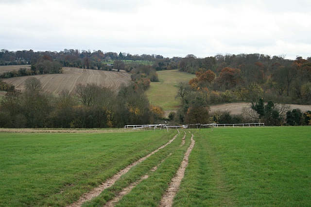
Finishing straight, Epsom Downs Looking down the finishing straight from the Old London Road crossing of the racecourse, just off Tattenham Corner Road (B290). The crossing is closed on racedays, and to vehicles at night.


