Falmer to Lewes Walk
![]()
![]() This small East Sussex based village is located between Brigthe campus of Brighton & Hove Albion's Falmer Stadium. It's a pretty place with a noteworthy large gravel pond and a pretty green which is ideal for picnics in the summer months. Next to the pond is the historic parish church which dates back to the 17th century.
This small East Sussex based village is located between Brigthe campus of Brighton & Hove Albion's Falmer Stadium. It's a pretty place with a noteworthy large gravel pond and a pretty green which is ideal for picnics in the summer months. Next to the pond is the historic parish church which dates back to the 17th century.
This walk from the village takes you to Lewes using footpaths and bridleways across the South Downs.
Starting in Falmer you head north east to Waterpit Hill and Balmer Down where there's the 170 metre high Balmer Huff hill and the site of the ancient medieval village of Balmer.
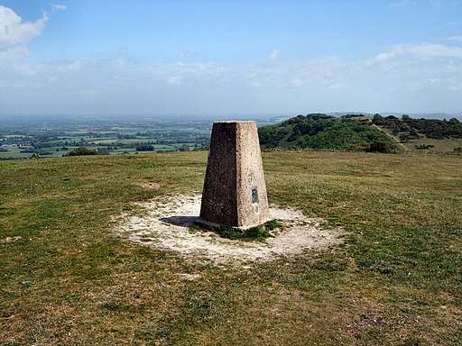
The route then picks up a section of The South Downs Way National Trail to take you up to Blackcap and Mount Harry. Blackcap includes a splendid ridge top trail with tremendous views over the Weald, burial mounds, battle grounds and ancient trackways. It's great for flora and fauna too with butterflies fluttering around the many pretty wildflowers. You can also explore the woodland areas in Ashcombe bottom here.
From Mount Harry you continue east to the village of Offham. Here you can pick up a lovely riverside path along the River Ouse which will take you south to Lewes. Here you can visit the historic 11th century castle and enjoy walks along the Sussex Ouse Valley Way.
Postcode
BN1 9PD - Please note: Postcode may be approximate for some rural locationsFalmer Ordnance Survey Map  - view and print off detailed OS map
Falmer Open Street Map  - view and print off detailed map
*New* - Walks and Cycle Routes Near Me Map - Waymarked Routes and Mountain Bike Trails>>
Falmer OS Map  - Mobile GPS OS Map with Location tracking
Falmer Open Street Map  - Mobile GPS Map with Location tracking
Walks near Falmer
- Stanmer Country Park - Enjoy beautiful woodland walks and extensive open lands in this country park in Brighton
- Lewes - This circular walk around the county town of East Sussex includes riverside paths, lovely views of the South Downs and a visit to Lewes Castle
- Barcombe Mills - This delightful area of East Sussex has riverside trails, a small reservoir and lovely countryside views
- Sussex Ouse Valley Way - This splendid waterside walk follows the River Ouse from its source near Lower Beeding to the coast at Seaford Bay.
The walk starts near Horsham at the village of Lower Beeding and passes through Slaugham, Handcross and Staplefield - Mount Caburn - This walk visits the delightful Mount Caburn Nature Reserve in the South Downs
- Firle Beacon - This circular walk takes you to the splendid Firle Beacon in the South Downs
- The South Downs Way - This beautiful 100 mile long trail runs from Winchester to the coastal town of Eastbourne
- Lewes to Alfriston - A lovely walk from Lewes to Alfriston, first following the River Ouse before picking up the South Downs Way
- Glynde to Lewes Walk - This popular circular walk on the South Downs takes you from the village of Glynde to the town of Lewes
- Rottingdean - This attractive coastal village is located in the city of Brighton in East Sussex
- Iford - A circular walk from the Sussex village of Iford, visiting the River Great Ouse and the neighbouring villages of Southease and Rodmell.
The village sits just a couple of miles south of Lewes on slopes of the South Downs in the valley of the River Ouse - Seaford - This East Sussex based town is a great place for cliff top coastal walking
- Castle Hill Nature Reserve - This circular walk visits the Castle Hill National Nature Reserve on the eastern outskirts of Brighton in the South Downs National Park
- Castle Hill Nature Reserve - This circular walk visits the Castle Hill National Nature Reserve on the eastern outskirts of Brighton in the South Downs National Park
Pubs/Cafes
The Swan Inn is a nice place in Falmer for refreshments. The pub is over 100 years old with the are adorned with antique adverts and pictures of the village in days past. They serve good quality food and can be found at postcode BN1 9PD for your sat navs. The pub is dog friendly.
Further Information and Other Local Ideas
Just to the west of Falmer there's Stanmer Country Park to explore. Here you'll find an 18th century Palladian building surrounded by a country estate with woodland trails and fine views.
Photos
Path near Blackcap. This whole area is steeped in history with many interesting features including burial mounds, battle grounds and ancient trackways. It is reputed that Simon de Montfort marched his army along this way in 1264 to fight King Henry III's men in the Battle of Lewes.


