Frieth Walks
![]()
![]() This Buckinghamshire based village has some nice walks into the surrounding countryside of the Chiltern Hills.
This Buckinghamshire based village has some nice walks into the surrounding countryside of the Chiltern Hills.
The village lies just to the east of the pretty neighbouring villages of Turville and Fingest where you can pick up the waymarked Chiltern Way and visit the famous Chitty Chitty Bang Bang Windmill.
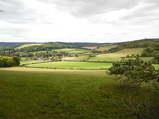
This walk from the village follows footpaths west through woodland to visit the two settlements. On the way there's some peaceful woodland in Mousells Wood and fine views of the surrounding countryside.
Postcode
RG9 6PY - Please note: Postcode may be approximate for some rural locationsFrieth Ordnance Survey Map  - view and print off detailed OS map
Frieth Open Street Map  - view and print off detailed map
Frieth OS Map  - Mobile GPS OS Map with Location tracking
Frieth Open Street Map  - Mobile GPS Map with Location tracking
Walks near Frieth
- Turville - This circular walk explores the countryside surrounding the Chilterns village of Turville
- Fingest - This pretty little Buckinghamshire village is located in the Chilterns near Henley on Thames
- Chitty Chitty Bang Bang Windmill - This short circular walk visits Cobstone Windmill in Turville, Buckinghamshire
- Ibstone - This Buckinghamshire based village is located in a pleasant rural spot in the Chiltern Hills, on the border with Oxfordshire
- Greys Court - This walk explores the area around the National Trust's Greys Court in Henley-on-Thames, Oxfordshire.
- Henley via Stonor Circular Walk - A circular walk from Henley visiting Stonor, Middle Assendon and the National Trust's Greys Court
- Henley-on-Thames - The popular market town of Henley-on-Thames has a number of excellent waymarked trails to try
- Thames Path - Starting at the Source of the Thames at Thames Head in Gloucestershire, follow the iconic river through beautiful countryside and historic towns to the city of London.
- Lane End - This Buckinghamshire village is located just west of High Wycombe in the Chiltern Hills.
Pubs/Cafes
The Prince Albert is a friendly village pub serving good food and ales. There is a cosy fire indoors and a nice secluded garden outside. They provide car parking and are also dog friendly.
Photos
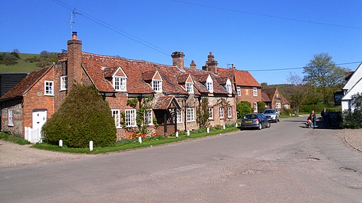
The Hambleden Valley near Frieth The view from the edge of Mousells Wood with Adams's Wood descending towards Goddards.


