Garforth Walks
![]()
![]() This Leeds based town is located to the east of the city. There's some nice country trails, a canal, a major nature reserve and several parks to explore nearby.
This Leeds based town is located to the east of the city. There's some nice country trails, a canal, a major nature reserve and several parks to explore nearby.
This walk from the town takes you to the Aire and Calder Navigation Canal and RSPB St Aidan's to the south of the town. On the way there's some nice farmland scenery, visits to some of the local villages and lots of wildlife to see at the nature reserve.
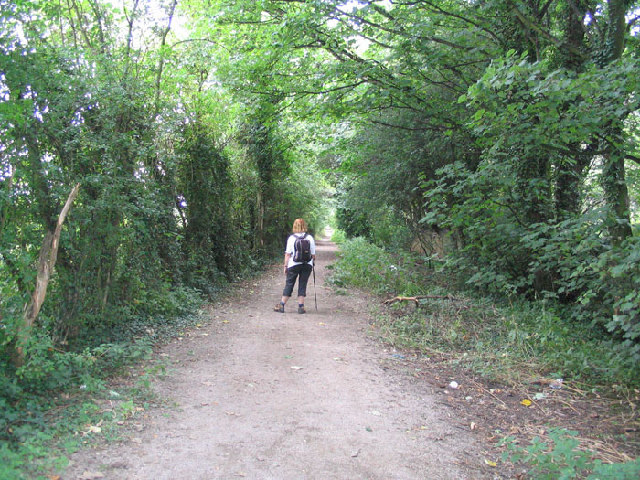
The walk starts at Garforth Train Station where you can pick up the Leeds Country Way. Follow the waymarked trail south and it will take you through the town and out into the countryside. At Brecks Wood you turn west before turning south to the villages of Swillington and Little Preston. You'll then pass a series of lakes at Swillington Park before arriving at the Aire and Calder Navigation Canal by Swillington Bridge. You can then follow the pleasant canal path south east to Fleet Bridge where there is a lock and marina. The trail crosses the canal to enter St Aidan's, a large RSPB nature park with excellent birdwatching opportunities and attractive wetland areas. Follow the footpaths through the site and you can pick up the Leeds Country Way again around Little Preston. The route then retraces its steps back to Garforth train station.
Garforth Ordnance Survey Map  - view and print off detailed OS map
Garforth Open Street Map  - view and print off detailed map
Garforth OS Map  - Mobile GPS OS Map with Location tracking
Garforth Open Street Map  - Mobile GPS Map with Location tracking
Pubs/Cafes
Back in the town the Gaping Goose is a good choice for some post walk refreshments. It's a friendly place with a good selection of real ales and an outdoor seating area. You can find them at 41 Selby Rd with a postcode of LS25 1LR for your sat navs.
Dog Walking
The walk is a nice one to do with your dog. Please keep them on leads or under close control in St Aidan's because of the wildlife. In the reserve you will find a dog parking area, a dog bowl and a recreation area. The Gaping Goose pub mentioned above is very dog friendly and may provide a biscuit if your friend is lucky!
Further Information and Other Local Ideas
To continue your walking around Garforth head west to visit Temple Newsam Country Park. There's 1500 acres of parkland to explore with a series of woodland trails, pretty ponds, landscaped gardens and the Dunstan Hills. The expansive estate surrounds a fine Tudor-Jacobean house with hundreds of years of history.
A few miles to the north east you'll find Aberford and the Lotherton Hall Estate. The estate of this Edwardian house includes a deer park and a bird garden with 200 magnificent species including flamingos and snowy owls. Just north of the village you can pick up the Hazlewood Castle Walk and visit the nearby country estate. Here you'll find expansive bluebell woods and a mountain bike trail located to the west of the 18th century mansion which is now run as a hotel. Parlington Woods on the historic Parlington Hall Estate can be visited near here as well.
Head north along the Leeds Country Way and it will take you to Barwick-in-Elmet and Thorner. Here you could visit Bramham Park where there are hundreds of acres of parkland, gardens, woodland and countryside to explore. The landscaped park surrounds the historic 18th century Bramham House which is a Grade I listed building.
You can also head into Leeds and try the Leeds Canal Walk and explore the Leeds and Liverpool Canal. This visits the wildlife rich Rodley Nature Reserve and the historic Kirkstall Abbey before heading to Shipley.
Cycle Routes and Walking Routes Nearby
Photos
St Aidan's RSPB reserve. A view looking south over St Aidan's RSPB Nature Reserve in Allerton Bywater between Leeds and Castleford. Previously and opencast coal mine now allowed to flood and form a wetlands reserve. Look out for kestrels and short eared owls in the reserve.
View over the River Aire to the wetlands beyond


